|
Maine Cruise 2004
Week 4 (Continued)
|
Week
1 | Week 2 | Week 3
| Week 4 |
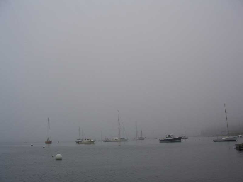
Thursday, August 19, 2004
Tenants Harbor |
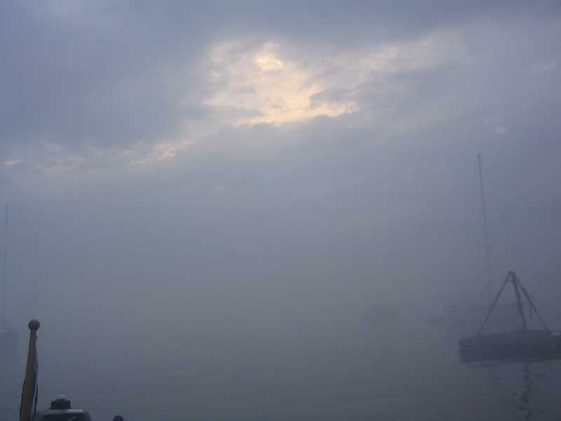
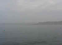
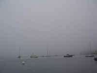 It
was very foggy again this morning, but by 1000 I thought it looked
hopeful enough to take off the sailcover and prepare the boat for what I
thought would be an imminent departure. The fog had other ideas,
though, and it simply refused to clear out; with an ample view from our
mooring to the waters beyond the mouth of the harbor, it was sadly
evident that the fog remained very thick offshore, thick enough that we
decided it was not worth heading into. It
was very foggy again this morning, but by 1000 I thought it looked
hopeful enough to take off the sailcover and prepare the boat for what I
thought would be an imminent departure. The fog had other ideas,
though, and it simply refused to clear out; with an ample view from our
mooring to the waters beyond the mouth of the harbor, it was sadly
evident that the fog remained very thick offshore, thick enough that we
decided it was not worth heading into. |
We spent an enjoyable hour or so in the morning watching the escapades of the young kids in
the St. George sailing program, who were sailing
their fleet of Hunter 90 dinghies right next to our mooring. Most
of the kids were just having fun and playing around, hardly paying any
attention to sailing, but one kid seemed to be more serious, giving one
of the instructors--who was out in his own dinghy to play
interference--a run for his money.
 Disappointed
to be staying, since we were ready to make some good progress home, we
consoled ourselves by going ashore for lunch at Cod End, where we
ordered chowder and a mixed seafood platter. I have to say we were
somewhat disappointed in the meal, and it was expensive, especially for
what it was. Nonetheless, we enjoyed the diversion and, sated, we
returned to the boat for the afternoon. Every mooring in the place
was filled by mod-afternoon, as boat after boat came in, apparently
seeking refuge. Disappointed
to be staying, since we were ready to make some good progress home, we
consoled ourselves by going ashore for lunch at Cod End, where we
ordered chowder and a mixed seafood platter. I have to say we were
somewhat disappointed in the meal, and it was expensive, especially for
what it was. Nonetheless, we enjoyed the diversion and, sated, we
returned to the boat for the afternoon. Every mooring in the place
was filled by mod-afternoon, as boat after boat came in, apparently
seeking refuge.
|
At around 1500, the fog finally seemed to clear out beyond the head of
the harbor, but by this point it was too late in the day to consider
going anywhere of benefit. Besides, NOAA was predicting
thunderstorms with the passage of a cold front, so in port we
stayed. We hoped for a good day Friday, as we intended, weather
permitting, to make the 52-mile push back to our mooring in
Falmouth--especially since Saturday's forecast was lousy, with unsettled
weather, rain, and southwest winds in the 20s.
Obviously, the thought of returning home
was bittersweet, at best, but the weather of the last few days, which
left me feeling frequently on edge and irritated, was enough to make
even me ready to be back. That will surely be short-lived, but,
while I wasn't looking forward to the end of a wonderful cruise, I was
ready to stop worrying about the weather and just be home.
NOTABLE
LOBSTER BOAT NAMES SEEN THIS TRIP:
Yankee's [sic] Suck
A Salt Weapon
Chasing Tail |
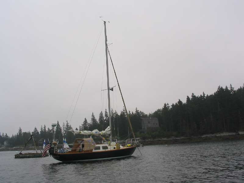
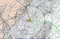
Friday, August 20, 2004
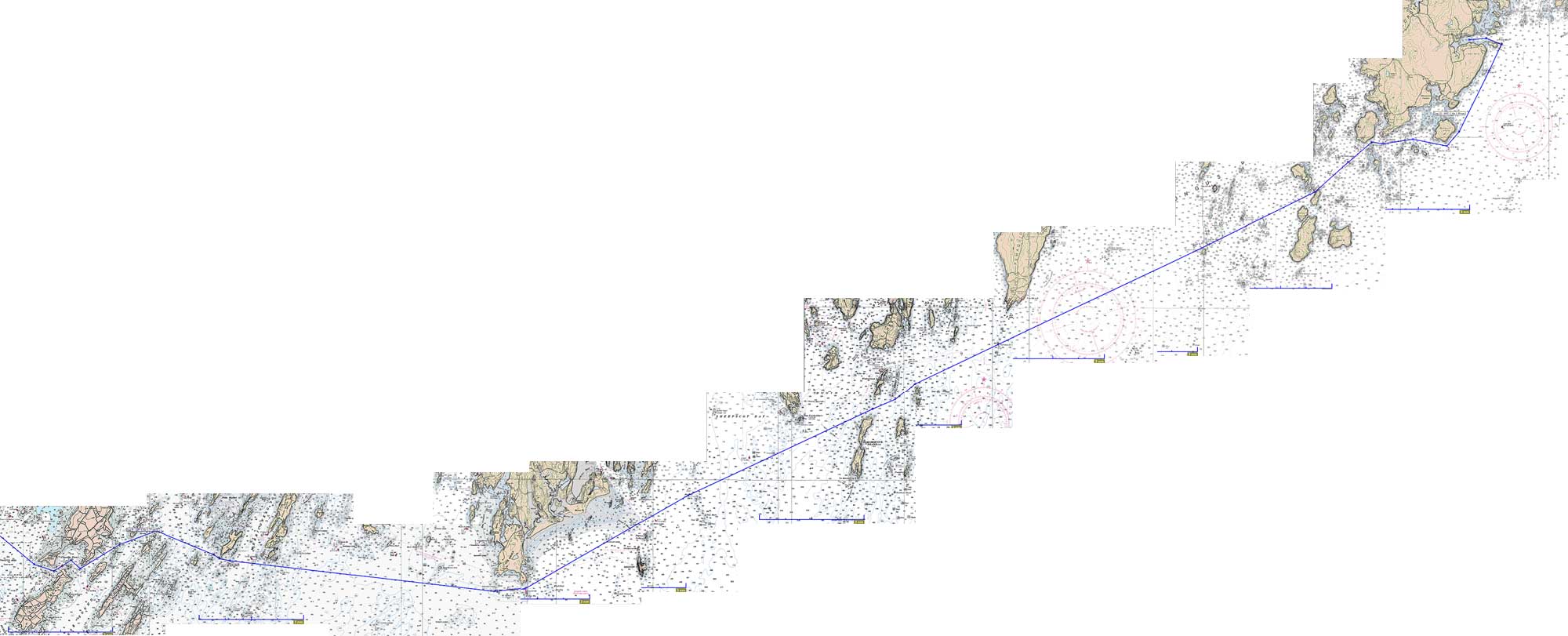
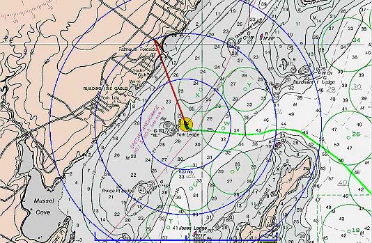
Tenants Harbor - Falmouth/PYC/Home Base (51.9NM Plotted) |
|

Route Chart
|
 Hoping
for an early start on a passage that would take us, at the shortest,
over 10 hours to complete, I got up at 0445 to check the weather.
Unfortunately, the fog had settled in once again, dropping once the
nagging wind that had blown much of the night died at a little after
midnight. I decided that the fog was still to thick into which to
depart; my benchmark was to see Southern Island, at the entrance of the
harbor, before leaving. Now, I could barely even see boats moored
nearby, though the fog seemed to be only at near sea level, leaving
fog-free skies above. I returned to bed to rest a while longer,
but eventually got up for good at 0545. Hoping
for an early start on a passage that would take us, at the shortest,
over 10 hours to complete, I got up at 0445 to check the weather.
Unfortunately, the fog had settled in once again, dropping once the
nagging wind that had blown much of the night died at a little after
midnight. I decided that the fog was still to thick into which to
depart; my benchmark was to see Southern Island, at the entrance of the
harbor, before leaving. Now, I could barely even see boats moored
nearby, though the fog seemed to be only at near sea level, leaving
fog-free skies above. I returned to bed to rest a while longer,
but eventually got up for good at 0545. |
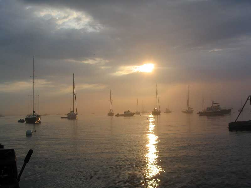
 I
made coffee and drank two large cups while I watched the fog. It
looked hopeful: the inner harbor had mostly cleared by 0630, and
it looked like the thickest fog might retreat or dissipate.
Finally, at about 0700 it looked like it was on its way, so we readied
the boat for departure and dropped the mooring at 0715. There was
no wind, the skies were visible overhead (always a good sign; if the fog
obscures the sky as well it is less likely to be moving out), and the
sun was breaking through the 6/8 overcast. I
made coffee and drank two large cups while I watched the fog. It
looked hopeful: the inner harbor had mostly cleared by 0630, and
it looked like the thickest fog might retreat or dissipate.
Finally, at about 0700 it looked like it was on its way, so we readied
the boat for departure and dropped the mooring at 0715. There was
no wind, the skies were visible overhead (always a good sign; if the fog
obscures the sky as well it is less likely to be moving out), and the
sun was breaking through the 6/8 overcast. |
| This was a drudgery
passage with little of interest on the way. To that end, I will
simply restate my ongoing ship's log that I kept on scratch paper in the
cockpit during the long day.
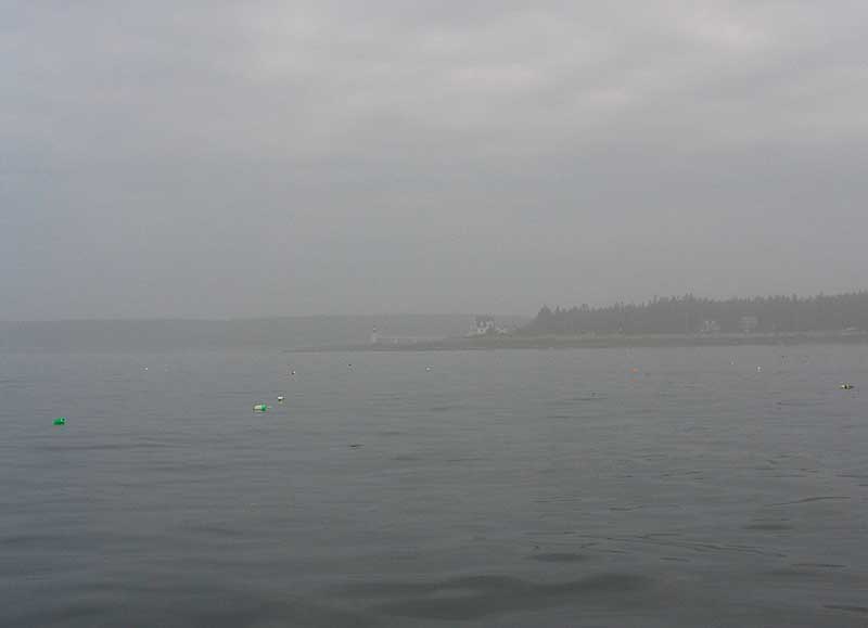
0715: Depart Tenants Harbor.
Leftover southwest swell on the nose outside harbor. Powering at
about 5 knots over ground. Visibility about .25 mile outside
lighthouse, but rapidly improved to 1-3NM, where it remained for most of
the day. Since we departed with visible fog, I had hooked up my
laptop with the Cap'n Voyager to the GPS, and had the radar on as
well. I was unworried about limited visibility as far as
navigation went, and with the rapidly improving visibility had few
worries about local boat traffic.
0740: Abeam Hart's Ledge to
starboard
0814: C/C @ R"2",
Mosquito Island |
 0836:
Abeam N"6", Marshall Ledge 0836:
Abeam N"6", Marshall Ledge
0907: Abeam N"12", Davis
Straight
0950: Abeam N"14",
Eastern Egg Rock
1115: Abeam "PL",
Pemaquid Ledge |
| 1156:
Hypocrites
1226: Abeam Cuckolds Lighthouse
1248: Abeam R"2SR",
Sheepscot River, .25nm Stb. Making 5 knots over ground with
slight adverse tide.
1328: Abeam G"1",
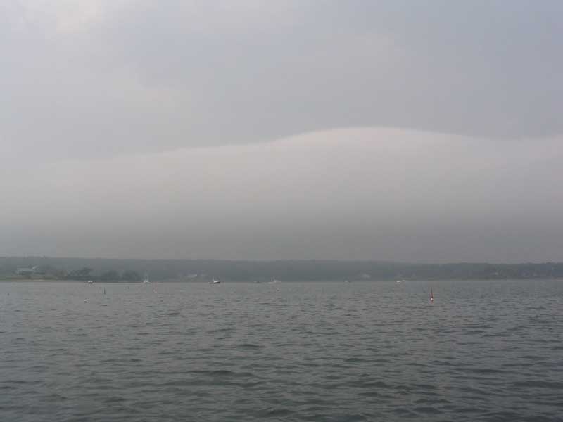
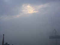
Kennebec River, Making 5.6 knots over ground with favorable tide.
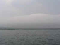
1330-1415: Thick, wet fog descended
with almost no warning shortly after passing G"1". For a
time, the fog was the thickest I had ever seen, reducing visibility to
dangerous levels (i.e. none). Reduced speed to just over 4 knots. Since
this particular channel is relatively narrow, and highly traveled by
boats passing on the traditional routes both east and west along the
coast, there were quite a few boats around which were suddenly only
visible on radar, amongst pathetically wailing air horns. Tense
and scary, especially when the sun would disappear behind the numerous
clouds overhead, lending a dark gray appearance to the
fog. Absolutely no visibility to speak of.
Fortunately, after about 30 minutes of this the fog lightened some, improving
visibility to at least 1/8 mile, which seemed expansive after what we
had just experienced. With this slight improvement, the visibility
quickly improved until we could presently see Fuller Rock, 0.6nm ahead,
and continued to improve as we passed Fuller Rock and Cape Small.
1420: Abeam Fuller Rock
1431: Abeam R:2BH", Bald Head
Ledge. Making 5.7 knots over ground with favorable
tide.
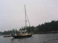
1435: Passed Triton #587 Valkyrie,
owned by Ron Smith, on reciprocal course. We diverted for a brief
chat, during which he indicated they had moved to East Boothbay, and
that he was bringing the boat up there to her new mooring.
1600: Little Mark Island.
Making 4 knots with strong adverse tide. |
 1600-1700:
Managed to dodge several thunderstorms in the area, by virtue of our
sinuous course through the islands. Light rain showers, but
nothing menacing despite nearby thunder and lightning. Adverse
tide through many of the final miles of the trip, culminating with a
trip record of 3.5 knots over ground passing through Chandler Cove. 1600-1700:
Managed to dodge several thunderstorms in the area, by virtue of our
sinuous course through the islands. Light rain showers, but
nothing menacing despite nearby thunder and lightning. Adverse
tide through many of the final miles of the trip, culminating with a
trip record of 3.5 knots over ground passing through Chandler Cove.
1745: Secured to our mooring at PYC.
Hot, muggy, and dead calm.
|
|
|
| We spent 30-45
minutes putting the boat away, and packing a few things to take
home. I planned to return in a day or two to unload much of the
unneeded cruising gear and give the boat a much-deserved post-cruise
washdown.
While I was happy that our long, boring
motor home was over, I can't say I felt particularly glad to be back in
Falmouth. It's just worlds apart from the waters we had left only
that morning. We hailed the launch and rode in to the busy yacht
club, where the juniors were having their end-of-season potluck
celebration, and where my sister was kindly waiting to give us a ride
home.
Final cruise thoughts, ruminations, and
observations to follow in due course.
|
|