|
Maine Cruise 2004
Week 3
|
Week
1 | Week 2 | Week 3
| Week 4 |
Sunday, August 8, 2004
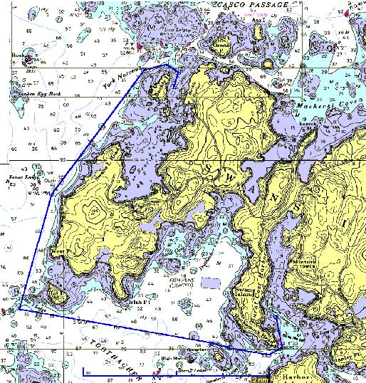
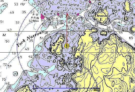
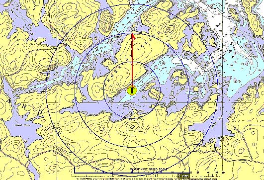
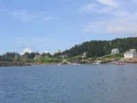
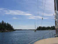
Burnt Coat Harbor - Buckle Island (6.72NM Plotted) |
|
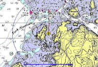
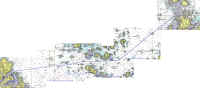
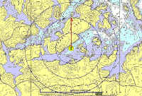
Route
Chart
|
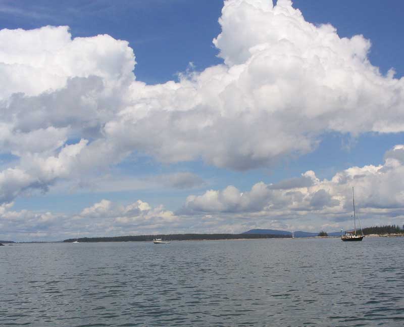
 With a short day
planned, we relaxed on the mooring until about 1100. Once again,
the weather was gorgeous and perfect. Today, I hoped to take
advantage of some wind later in the day and sail up to Buckle Island
Harbor, so we waited around. By 1100, it seemed that the breeze
was beginning to fill in, so we departed. Sadly, outside the
harbor, the sea was glassy with no wind--rats. With a short day
planned, we relaxed on the mooring until about 1100. Once again,
the weather was gorgeous and perfect. Today, I hoped to take
advantage of some wind later in the day and sail up to Buckle Island
Harbor, so we waited around. By 1100, it seemed that the breeze
was beginning to fill in, so we departed. Sadly, outside the
harbor, the sea was glassy with no wind--rats. |
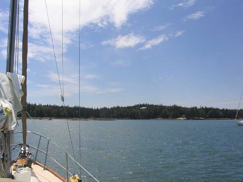
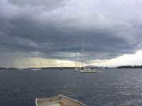
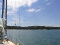
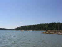
 We were the first boat into Buckle Harbor, save for a small powerboat
that was there for the afternoon only. We picked a good anchoring
spot near the head of the harbor, dropping the anchor in 7' of water at
low tide; the anchor was on the bottom before I knew it, and before the
chain was all in the water we had sufficient scope out for the low tide
depth. (I let out about 70' total to allow for the expected
high tide depths of, I figured, 18'). The water was quite clear,
though I wasn't able to find the anchor a half hour or so later when I
rowed around.
We were the first boat into Buckle Harbor, save for a small powerboat
that was there for the afternoon only. We picked a good anchoring
spot near the head of the harbor, dropping the anchor in 7' of water at
low tide; the anchor was on the bottom before I knew it, and before the
chain was all in the water we had sufficient scope out for the low tide
depth. (I let out about 70' total to allow for the expected
high tide depths of, I figured, 18'). The water was quite clear,
though I wasn't able to find the anchor a half hour or so later when I
rowed around. |
|
|
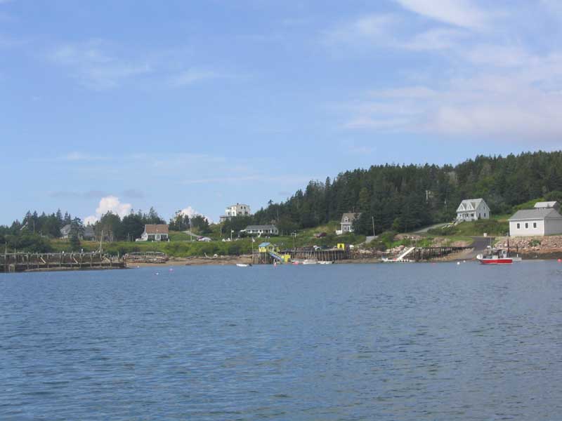
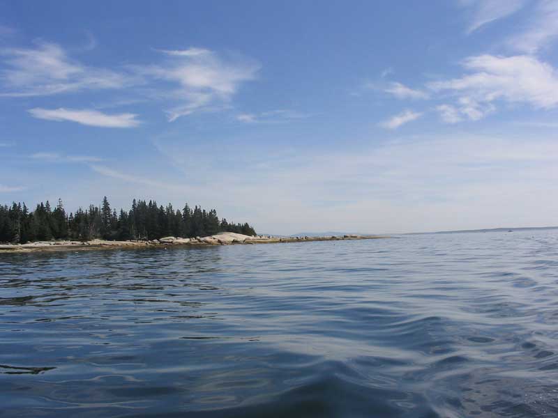
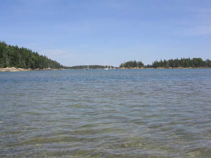
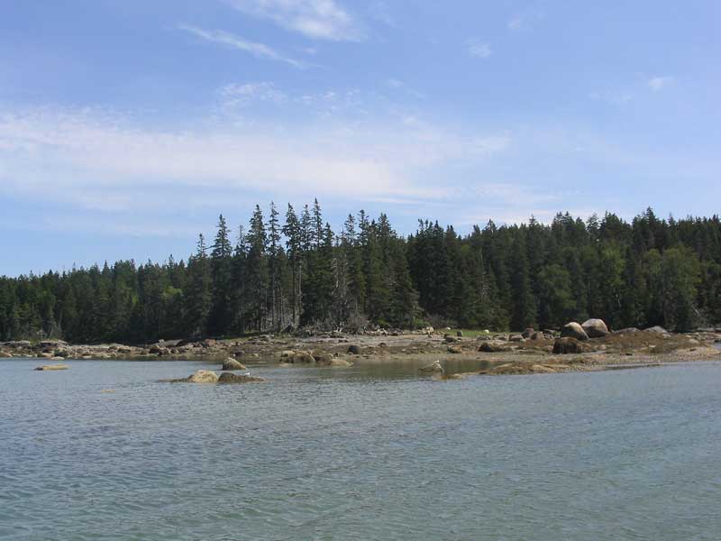
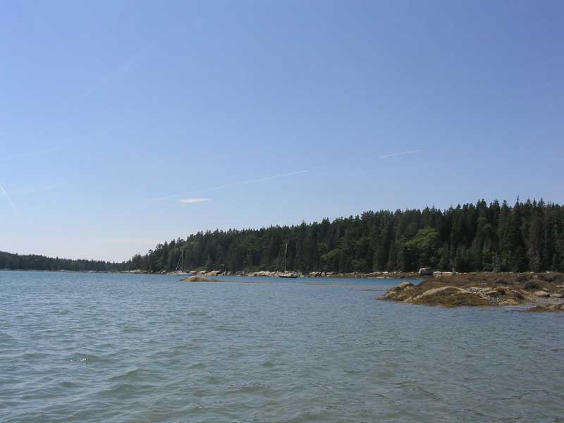
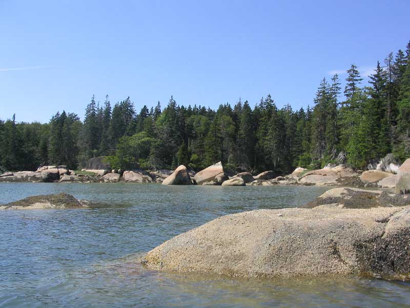
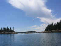
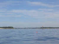
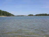
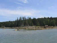
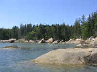
 Buckle Harbor is
such a cool place, especially at low tide. The head of the harbor
is filled with granite outcroppings and tidal islands. Very
pretty. Throughout the afternoon, a number of other sailboats
filtered in, gradually filling the harbor with 12 boats. Late in
the afternoon, the promised wind finally began to blow, eventually
gusting as high as 20 knots a few times. Buckle Harbor is
such a cool place, especially at low tide. The head of the harbor
is filled with granite outcroppings and tidal islands. Very
pretty. Throughout the afternoon, a number of other sailboats
filtered in, gradually filling the harbor with 12 boats. Late in
the afternoon, the promised wind finally began to blow, eventually
gusting as high as 20 knots a few times. |
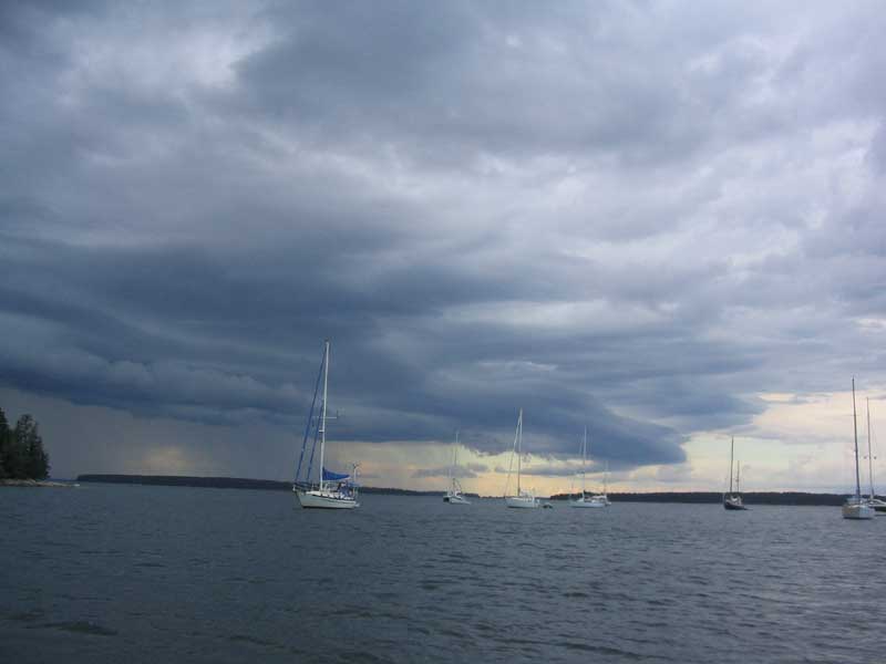
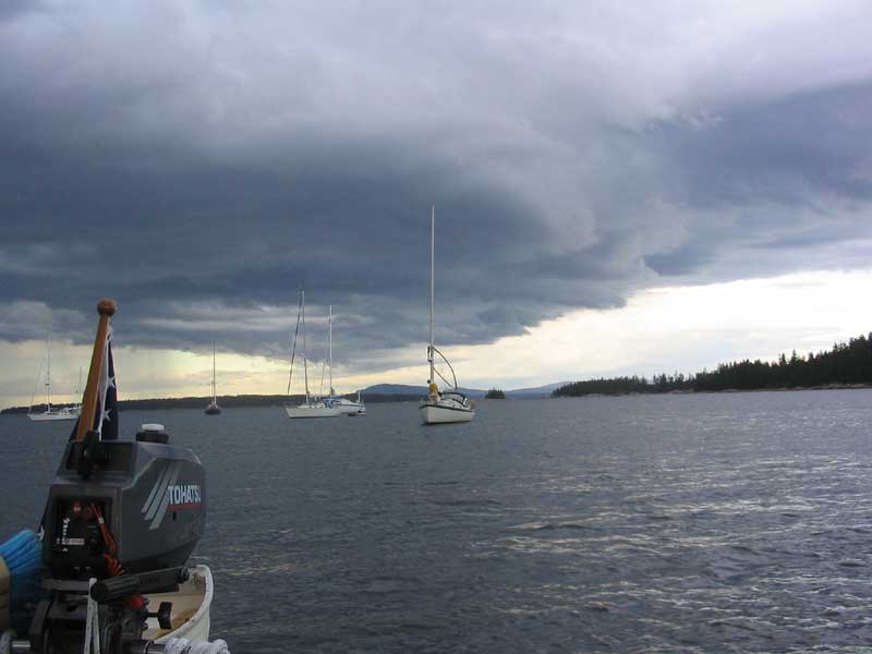
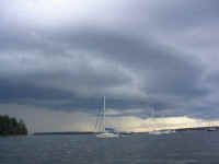
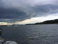
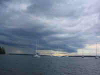 Near cocktail time, the sky to the west darkened; NOAA had mentioned the
possibility of thunderstorms, but it hadn't seemed the sort of day I
might have expected any severe weather. It was soon clear, though,
that there was a major squall line passing through. What was less
clear was where it would end up in relation to us. Given the
appearance of the clouds I could see, and the NOAA warnings on the
radio, I let out another 30' of scope, and prepared for anything that
might happen by stowing the awning and cockpit table, and getting my
foulies ready--just in case.
Near cocktail time, the sky to the west darkened; NOAA had mentioned the
possibility of thunderstorms, but it hadn't seemed the sort of day I
might have expected any severe weather. It was soon clear, though,
that there was a major squall line passing through. What was less
clear was where it would end up in relation to us. Given the
appearance of the clouds I could see, and the NOAA warnings on the
radio, I let out another 30' of scope, and prepared for anything that
might happen by stowing the awning and cockpit table, and getting my
foulies ready--just in case. |
|
|
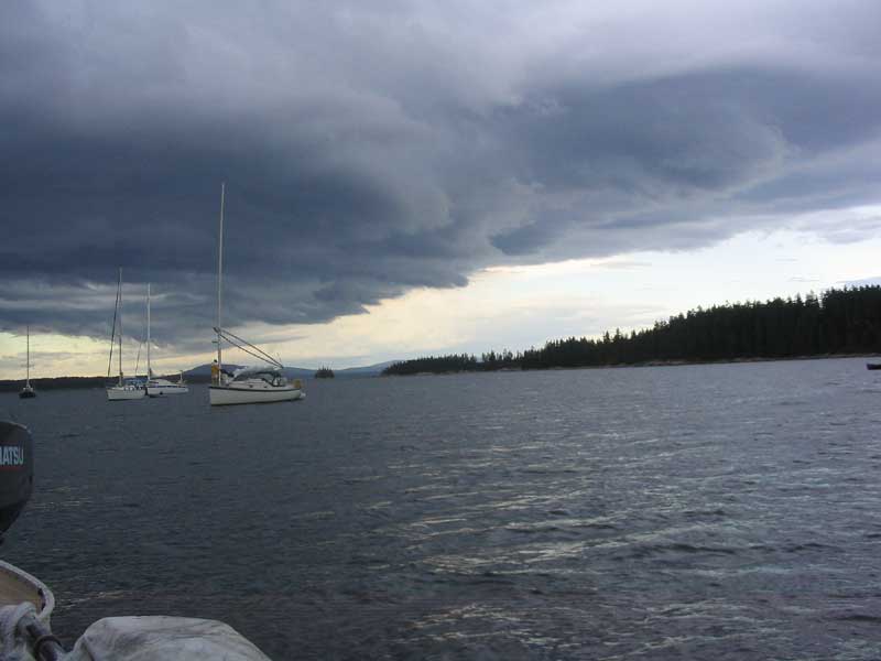
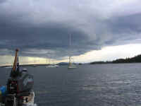 We were fortunate in that the worst of the squall line, whatever it may
have contained, passed us by safely to the north; but we were very much
immediately on the edge, and there were some relatively minor gusts for
a time during the squall's passage. One of the boats in the
anchorage--which had done a poor anchoring job to begin with, in my
estimation--dragged about 200' before fetching up again, quite near
another anchored boat. I felt helpless at first watching them
drag, as I saw no signs of life on the boat and wasn't sure they
knew--but there was nothing I could do. Eventually, the owner came
up on deck, and I relaxed. I was surprised they weren't watching
the events unfold anyway, like I and nearly everyone else in the harbor
seemed to be; I was on edge the whole time, hoping for the best but
prepared for the worst the storm might throw at us.
We were fortunate in that the worst of the squall line, whatever it may
have contained, passed us by safely to the north; but we were very much
immediately on the edge, and there were some relatively minor gusts for
a time during the squall's passage. One of the boats in the
anchorage--which had done a poor anchoring job to begin with, in my
estimation--dragged about 200' before fetching up again, quite near
another anchored boat. I felt helpless at first watching them
drag, as I saw no signs of life on the boat and wasn't sure they
knew--but there was nothing I could do. Eventually, the owner came
up on deck, and I relaxed. I was surprised they weren't watching
the events unfold anyway, like I and nearly everyone else in the harbor
seemed to be; I was on edge the whole time, hoping for the best but
prepared for the worst the storm might throw at us. |
|
|
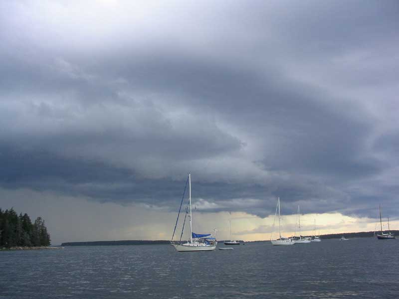
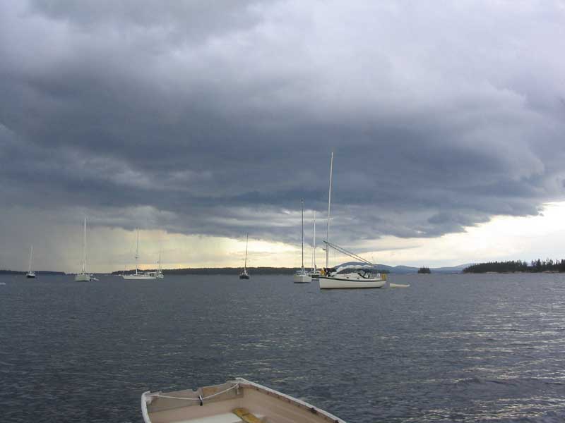
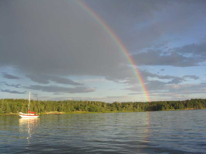
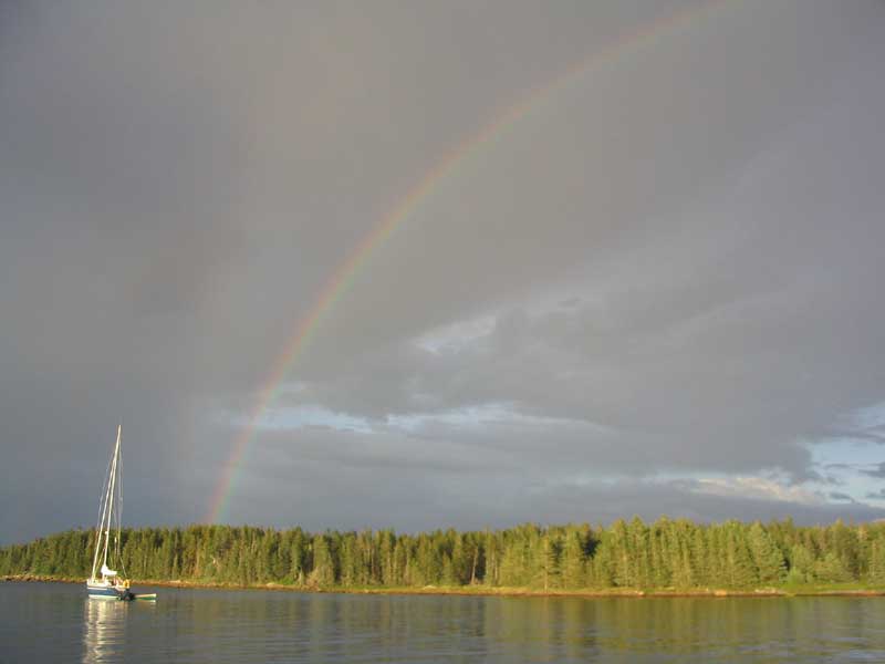
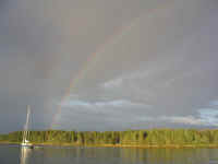
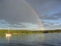 In the end, we had some frightening looking clouds, some 25-knot gusts,
and a minor wind oscillation, with some rain falling after the worst of
the clouds has passed. As the back side of the squall finally
passed, revealing sunshine again, an excellent, perfect, full rainbow
appeared--to the extent that we could see both ends of the rainbow
"hitting" the ground on nearby Swan's Island. We had
never seen anything quite like it. The pictures surely don't do it
justice.
In the end, we had some frightening looking clouds, some 25-knot gusts,
and a minor wind oscillation, with some rain falling after the worst of
the clouds has passed. As the back side of the squall finally
passed, revealing sunshine again, an excellent, perfect, full rainbow
appeared--to the extent that we could see both ends of the rainbow
"hitting" the ground on nearby Swan's Island. We had
never seen anything quite like it. The pictures surely don't do it
justice. |
 Later,
the sky cleared, and when I went on deck for my final walk-around a
little after 2100, the stars were amazing, with no moon yet to wash them
out. I don't think I've ever seen the Milky Way as distinct as it
was. Too bad pictures couldn't capture the incredibleness of
it...one simply cannot see stars such as this anywhere near
civilization. Later,
the sky cleared, and when I went on deck for my final walk-around a
little after 2100, the stars were amazing, with no moon yet to wash them
out. I don't think I've ever seen the Milky Way as distinct as it
was. Too bad pictures couldn't capture the incredibleness of
it...one simply cannot see stars such as this anywhere near
civilization. |
Monday, August 9, 2004
Buckle Island - Hells Half Acre/Bold-Camp-Devil Islands
Buckle Island |
Dear Mr. Nice NOAA Man,
My name is Timmy, and I am 37 years
old. Part of my summer project is listening to your weather
forecasts on the radio. I listen every day while I am on my boat
sailing on the coast of Maine. I like hearing the cool
synthesized voices, especially when they make a pronunciation
mistake. It's funny.
I have noticed that your forecasts seem to
be, um, (how should I say this), lacking in the most remote vestiges
of accuracy. Today, f'r'instance, I listened to your forecast
man and he said that the winds would be west 5-10 knots in the
morning, and becoming 10-15 knots from the southwest in the afternoon.
Mister, maybe you can tell me why we had
southwest winds of 20-25 knots when we left our harbor this
morning. I bet you were playing a joke on all of us--you guys
are really funny! Ha ha. Or maybe the forecast was in
code, and I lost my secret decoder ring. That might be it too.
My wife, whose name is Heidi, really liked it
when the winds got really strong. We had so much fun that
we thought it would be wicked fun if we went back to our same harbor
so that we might be able to have as much fun tomorrow as today!!
It was extra funny because the place we were going was right in the
wind, so we got to sail back and forth trying to get there.
Wheee
Because I have been listening to your funny
man on the radio all summer, I have noticed that today was not the
first time that he made a joke about the weather. He must be a
comedian, because he makes jokes every day almost. I would like
to meet him because he is so funny.
Anyway, Mister NOAA, I hope you will write me
back and tell me all about your forecasts, and how the funny man makes
all these jokes all the time. A grown-up told me once that the
weather coming out of the radio was supposed to help people like me,
who are on their boats on the water. But how do these funny
jokes help people on the water like me?
Sincerely,
Timmy Lackey
|
| It could have
been September: the morning was crisp and cool, and the sky was an
incredibly dark shade of blue. By 0800, some wind had already
begun blowing, counter to the forecast (but what else is new).
Around 0915 or so, I rowed to the head of the harbor to sort of see what
was going on out in Jericho Bay; it looked OK, so we decided to head out
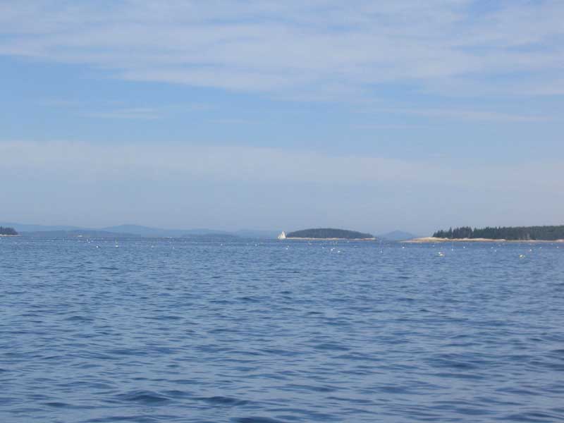
for our planned destination of Hells Half Acre/Bold-Camp-Devil Islands, across
Jericho Bay in the archipelago known collectively as Merchants
Row. The distance: a whopping 6.3 miles.
After weighing anchor, we motored out of
Buckle Harbor before raising the main, as I wanted to see what the wind
was like outside of the protected harbor. I decided to raise the
main with one reef, and soon we were enjoying a pleasant--if seemingly
underpowered--sail across beautiful, lobster pot-infested, Jericho
Bay. I had just voiced the thought that I might shake out the reef
when the wind began to blow in earnest. Shortly, I was glad for
the reefed sail, and we pounded along in a growing sea for a while
through several tacks, as our destination was (natch) precisely upwind.
After a half hour of this, with the wind
showing all signs of staying steady and even increasing into the 20s,
Heidi decided we should head back: we hadn't really made all that
much progress towards our goal, given the tacks involved and the
constant slaloming around the buoys and toggles, which were very hard to
see amongst the whitecaps. I readily agreed, since there was no
particular reason we had to be anywhere. We turned around, and
soon enough we were back in Buckle Harbor and heading for the same
anchoring spot we had left an hour or so before. We sailed about
3-4 miles total, round trip, I would guess.
During the afternoon, the wind picked up
even further, hurling unpleasant gusts through the anchorage.
During one brief time I had BoatTV on, I saw 28 knots. Gross.
(BoatTV, for anyone who might have missed the reference earlier, is our
name for our windspeed indicator.) I let out extra scope
because of the ferocity of the wind, even in this protected anchorage.
 Late in the afternoon, the wind began to
abate, finally. I went out and rowed around the rocky head of the
harbor while the tide was about half full. The harbor ended up
with even more boats than the night before: 14. The evening
turned out to be gorgeous--warm, light breeze, and perfect vistas.
So it wasn't all bad after all! The wind died before sunset, and
it was calm and, once again, incredibly starry overnight. Late in the afternoon, the wind began to
abate, finally. I went out and rowed around the rocky head of the
harbor while the tide was about half full. The harbor ended up
with even more boats than the night before: 14. The evening
turned out to be gorgeous--warm, light breeze, and perfect vistas.
So it wasn't all bad after all! The wind died before sunset, and
it was calm and, once again, incredibly starry overnight.
|
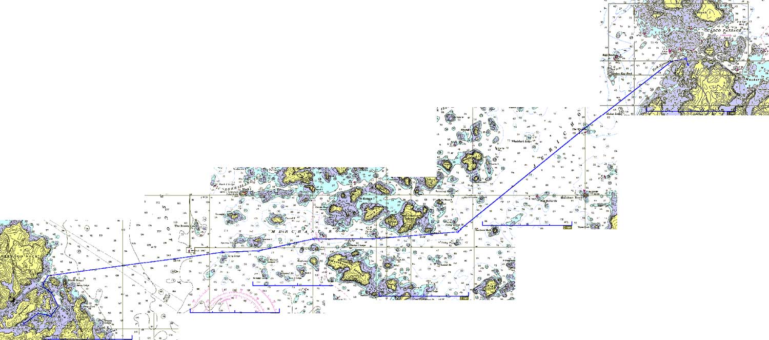
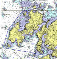
Tuesday, August 10, 2004
Buckle Island - Seal Bay Vinalhaven (17.7 NM Plotted) |
|
Route Chart
|
 Overnight, the
weather forecast deteriorated, and when I listened first thing in the
morning, NOAA was calling for significant winds for late in the day,
overnight, and into the next couple days. As a result, we decided
to modify our destination; we had been planning on spending a few days
amongst the islands of Merchants Row, but none of the coves offer the
sort of protection I would want for the forecast 25-knot winds. We
decided instead to go a bit further and head for either Winter Harbor or
nearby Seal Bay on Vinalhaven. We had been to Winter Harbor during
our 2002 cruise, and liked it immensely. Either Winter Harbor or
Seal Bay offered good protection from the south and southwest, and no
exposure to seas or annoying swell (as some of the Merchant Row islands
might). Overnight, the
weather forecast deteriorated, and when I listened first thing in the
morning, NOAA was calling for significant winds for late in the day,
overnight, and into the next couple days. As a result, we decided
to modify our destination; we had been planning on spending a few days
amongst the islands of Merchants Row, but none of the coves offer the
sort of protection I would want for the forecast 25-knot winds. We
decided instead to go a bit further and head for either Winter Harbor or
nearby Seal Bay on Vinalhaven. We had been to Winter Harbor during
our 2002 cruise, and liked it immensely. Either Winter Harbor or
Seal Bay offered good protection from the south and southwest, and no
exposure to seas or annoying swell (as some of the Merchant Row islands
might). |
 We departed at about 0845 and enjoyed a
fair tide down Jericho Bay, which was, this morning, flat calm and
windless--quite a change from yesterday. The wind remained calm as
we headed down the bay to the eastern side of the channel technically
known as Merchant Row, though in general nomenclature all the islands
around pick up this name as well. We departed at about 0845 and enjoyed a
fair tide down Jericho Bay, which was, this morning, flat calm and
windless--quite a change from yesterday. The wind remained calm as
we headed down the bay to the eastern side of the channel technically
known as Merchant Row, though in general nomenclature all the islands
around pick up this name as well. |
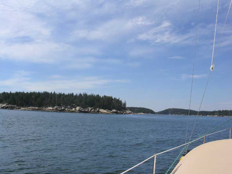
 On the western end of the
channel, a pleasant southwesterly breeze picked up, and we were soon
sailing under full sail in 12-16 knots--lovely. As we sailed
across the 4-5 mile width of Isle au Haut bay, the wind picked up a bit,
then would slacken a bit, but we had 12-18 knots pretty much the whole
way, and enjoyed boatspeeds of nearly 6 knots over ground. The
apparent wind direction was a close to beam reach--perfect conditions,
really. I made an appeal to the wind gods to let them know that
this was how it should be...we'll see if it makes any difference. (It
didn't) On the western end of the
channel, a pleasant southwesterly breeze picked up, and we were soon
sailing under full sail in 12-16 knots--lovely. As we sailed
across the 4-5 mile width of Isle au Haut bay, the wind picked up a bit,
then would slacken a bit, but we had 12-18 knots pretty much the whole
way, and enjoyed boatspeeds of nearly 6 knots over ground. The
apparent wind direction was a close to beam reach--perfect conditions,
really. I made an appeal to the wind gods to let them know that
this was how it should be...we'll see if it makes any difference. (It
didn't) |
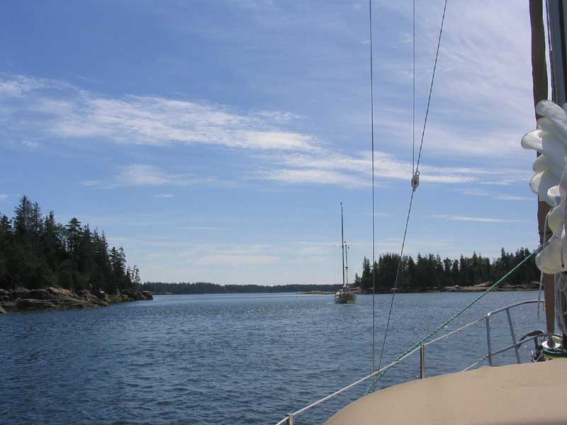
 Arriving at the entrance to Winter
Harbor, we decided to head for Seal Bay. Unfortunately, at this
moment several other boats converged (seemingly from nowhere), and as we
proceeded into the narrow entrance to the bay, following a wooden yawl,
we found ourselves amidst a parade of these boats, all of whom seemed to
be flying the burgee of some unknown Massachusetts yacht club. It
felt funny being in this train of boats, and we wished to distance
ourselves, but there was little to do but follow along as we trudged
slowly along the winding channel into the most logical anchoring zone in
the large, but rock-strewn and tidal, bay. Arriving at the entrance to Winter
Harbor, we decided to head for Seal Bay. Unfortunately, at this
moment several other boats converged (seemingly from nowhere), and as we
proceeded into the narrow entrance to the bay, following a wooden yawl,
we found ourselves amidst a parade of these boats, all of whom seemed to
be flying the burgee of some unknown Massachusetts yacht club. It
felt funny being in this train of boats, and we wished to distance
ourselves, but there was little to do but follow along as we trudged
slowly along the winding channel into the most logical anchoring zone in
the large, but rock-strewn and tidal, bay. |
 Finally, the lead boat seemed to slow and
ponder dropping anchor, which was great as far as I was concerned
because they were in an area further out than I planned to go. I
throttled up a bit and passed, then continued on to the spot I hoped to
anchor, further in. There was a Cape Dory 28 on a mooring in
almost exactly the spot I had earmarked on the chart, but we dropped
anchor just outboard of her in about 11' of water near low tide. Finally, the lead boat seemed to slow and
ponder dropping anchor, which was great as far as I was concerned
because they were in an area further out than I planned to go. I
throttled up a bit and passed, then continued on to the spot I hoped to
anchor, further in. There was a Cape Dory 28 on a mooring in
almost exactly the spot I had earmarked on the chart, but we dropped
anchor just outboard of her in about 11' of water near low tide. |
|
|
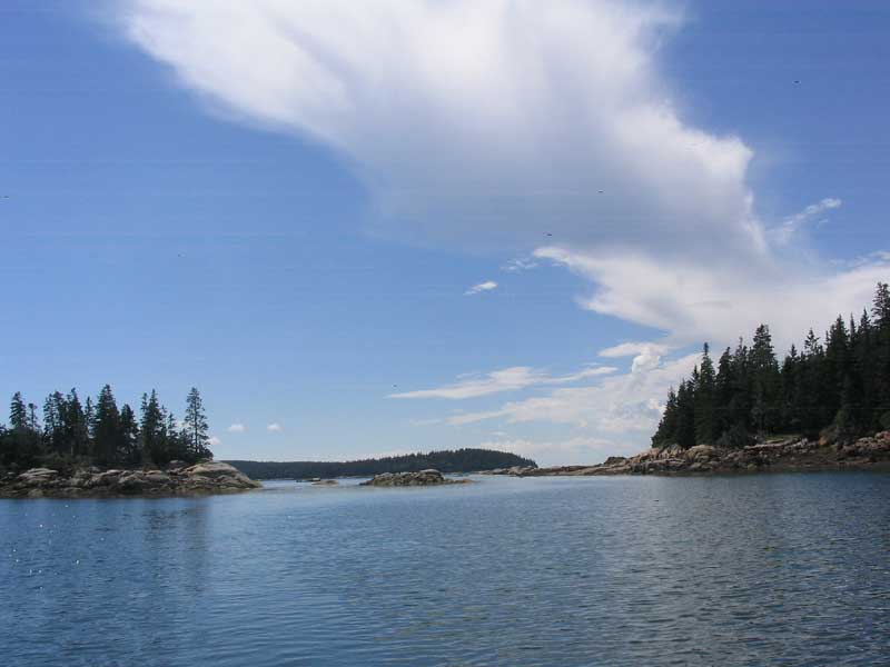
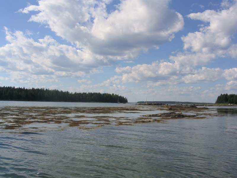
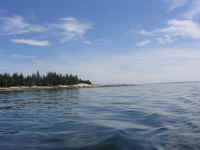
 What a beautiful and special place!
Only a couple houses were visible in the distance, and the seascape was
an incredible mixture of small islands, granite outcroppings, and gently
sloping mud basins. There was so much to explore, given the
breadth of the bay as well as nearby Winter Harbor and its vast
tributaries (which, during the 2002 cruise were sadly under-explored and
led to our eventual purchase of an outboard motor for the dinghy) that
we decided immediately to stay at least through Wednesday, all depending
on the weather, of course. What a beautiful and special place!
Only a couple houses were visible in the distance, and the seascape was
an incredible mixture of small islands, granite outcroppings, and gently
sloping mud basins. There was so much to explore, given the
breadth of the bay as well as nearby Winter Harbor and its vast
tributaries (which, during the 2002 cruise were sadly under-explored and
led to our eventual purchase of an outboard motor for the dinghy) that
we decided immediately to stay at least through Wednesday, all depending
on the weather, of course. |
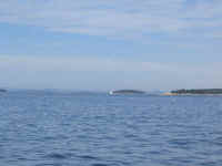
 During the afternoon, boats continued to
stream in; for some reason, I had been under the impression that Seal
Bay might be a sort of secret place that was too far off the beaten
path, but apparently not. Most of hte boats stayed in the broader
basin outboard of us, apparently part of the club cruise. A couple
boats ventured in further, close to our spot. During the afternoon, boats continued to
stream in; for some reason, I had been under the impression that Seal
Bay might be a sort of secret place that was too far off the beaten
path, but apparently not. Most of hte boats stayed in the broader
basin outboard of us, apparently part of the club cruise. A couple
boats ventured in further, close to our spot. |
 At sundown, we had a surprise from a
neighboring boat. We had been watching the owners, and they seemed
to be mischievously up to something in their cockpit, but we couldn't
tell what. Suddenly, we knew, as their small cannon fired the
sundown shot for colors! Would there be another shot in the
morning at 0800? (There wasn't.) At sundown, we had a surprise from a
neighboring boat. We had been watching the owners, and they seemed
to be mischievously up to something in their cockpit, but we couldn't
tell what. Suddenly, we knew, as their small cannon fired the
sundown shot for colors! Would there be another shot in the
morning at 0800? (There wasn't.) |
|
|
Wednesday, August 11, 2004
Seal Bay Vinalhaven |
 Unpleasant
weather: the nagging, gusty, irritating southwest wind that had
blown nearly all night continued, and even intensified this
morning. The day featured a clogged, moisture-ridden atmosphere,
clammy conditions, and low overcast and haze. During the morning,
the winds frequently gusted to 25 knots and higher. Amazingly,
despite relatively gusty winds overnight (though they did diminish for a
time), I slept quite well. Unpleasant
weather: the nagging, gusty, irritating southwest wind that had
blown nearly all night continued, and even intensified this
morning. The day featured a clogged, moisture-ridden atmosphere,
clammy conditions, and low overcast and haze. During the morning,
the winds frequently gusted to 25 knots and higher. Amazingly,
despite relatively gusty winds overnight (though they did diminish for a
time), I slept quite well.
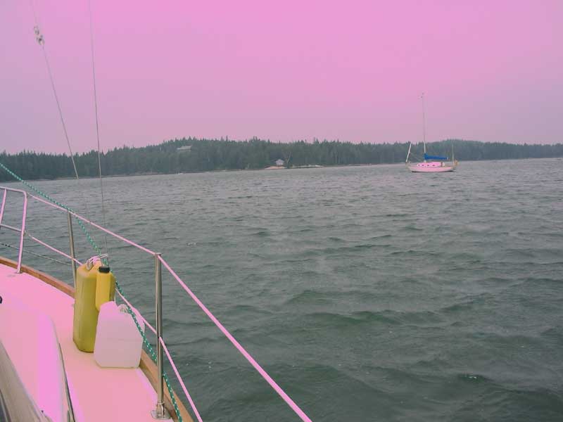
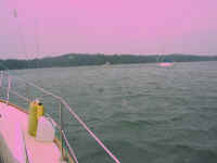
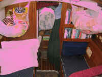
(Note: sorry for the weird pink
coloring in today's photos. It is because of a camera flaw.)
|
About 1000, most of the other boats that had
anchored overnight departed. I didn't envy them--it was just that
kind of indefinable nasty sort of day, somehow, even if any single
condition, taken by itself, wasn't truly so horrible. At least to
begin, anyway. |
 After
a late brunch, enjoyed in the cockpit during a sunnier, warm, less-windy
period, I turned to several maintenance chores. First, I added
water to the water tank, emptying four of the deck jugs into the fill
pipe. Next, I tackled the galley sink again, which was still not
draining properly; in fact, it was barely draining at all. At
first, I still suspected a clog in the drain hose, so, after emptying
the locker beneath the galley countertop and bailing out the gross sink,
I removed the hose, only to find barely any material inside. Thinking
that a kink I had noticed in the hose was at fault, I crawled under the
vee berth cushions to access a forward storage locker for another length
of hose to replace it. Unfortunately, when I replaced the hose and
tried the drain again, it still didn't drain at all. Clearly,
something else was at fault. After
a late brunch, enjoyed in the cockpit during a sunnier, warm, less-windy
period, I turned to several maintenance chores. First, I added
water to the water tank, emptying four of the deck jugs into the fill
pipe. Next, I tackled the galley sink again, which was still not
draining properly; in fact, it was barely draining at all. At
first, I still suspected a clog in the drain hose, so, after emptying
the locker beneath the galley countertop and bailing out the gross sink,
I removed the hose, only to find barely any material inside. Thinking
that a kink I had noticed in the hose was at fault, I crawled under the
vee berth cushions to access a forward storage locker for another length
of hose to replace it. Unfortunately, when I replaced the hose and
tried the drain again, it still didn't drain at all. Clearly,
something else was at fault.
It was obvious that I had to open up the
sump chamber, which I did, enjoying the tight access in the confined
space (though it wasn't truly that bad). I won't go into great
detail, and I took no photos, but the large horizontal strainer inside
the sump appeared to have worked as intended by filling up completely
with an appetizing mixture of coffee grounds, food bits, grease, and
other stuff. The entire 8" long cylinder was virtually
packed. After cleaning it out, the performance of the sink was
much improved, needless to say.
Finally, I looked into a problem I had
been experiencing with my wind instruments. In addition to a
sticky anemometer (which pretty much takes care of itself when the wind
picks up), the apparent wind direction display was not working
properly. The vane at the masthead was pointing in the right
direction, but the display was constantly wrong, and would only show the
wind on the port side--and even then, the angle was always wrong.
I dug out my instruction book and found a way to calibrate the display,
so I changed it so it seemed more accurate. Time will tell.
There's another process called linearization that I might have to
perform later, but this involves a requirement for direct access to the
masthead unit, so if this is necessary, it will wait till fall, when I
can connect the masthead unit directly to the display once the mast is
unstepped. |
During the afternoon, the wind gusted ridiculously, near 30 knots during
the times I flipped on the power to the display. The boat
constantly sidled back and forth, tacking before the wind from one side
to another, and eventually it grated on me. "OK, wind,"
I said, "I get the point!" Then, I made the mistake of
listening to NOAA, and heard perhaps the most depressing forecast I have
ever heard, with forecasts of winds in the 20-30 knot range right
through the weekend, except for those times it would be foggy. Of
course, the forecast had changed significantly over the past 24 hours,
and there was little reason to believe it might not change significantly
over the next 24, so I tried not to despair. Too much,
anyway The wind was too strong all day to really leave the boat
for any exploring or dinghying.
Meanwhile, we were slowly running out of
fresh food and ice. There was enough ice remaining for a
couple more days, but we had already started in on some of the canned
and packaged goods, as there was not much in the way of real food
left. Fortunately, the boat was well-stocked with soups, canned
food, pasta, etc., so even if we were stuck for days we'd be OK.
Still, we looked forward to provisioning, soon. Unless the weather
interfered...
Please click here to
continue.--->
|
|