|
Maine Cruise 2004
Week 1
|
Week
1 | Week 2 | Week 3
| Week 4 |
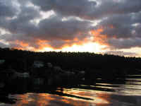
Friday, July 23, 2004
I had hoped to be able to leave today, though as the foggy week wore on
it became more and more plain that I would not be able to because of the
weather. Nonetheless, on Thursday I had knocked off my final
pre-departure list--all those details that one must take care of before
disappearing off the face of the earth for four weeks.
This year, I had decided to
bring the boat partway down the coast in advance by myself, with Heidi
to join up with me about a week later. I looked forward to the
extra time aboard, but as it was my first extended cruising period
without Heidi, I intended to make smart decisions and allow plenty of
extra time in my schedule to account for what seemed--this year, at
least--to be the inevitable bad weather, or fog.
With more fog, I decided
early in the day to stay home. This did not make me happy, and
rarely have I lived through a more unproductive and loose-endy
day. I survived, however, and after a spell started looking ahead
to Saturday, when there was some improvement forecast in the weather. |
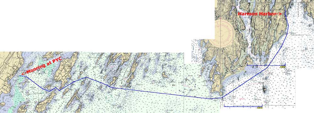
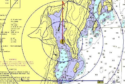
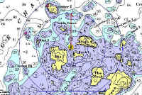
Saturday, July 24, 2005
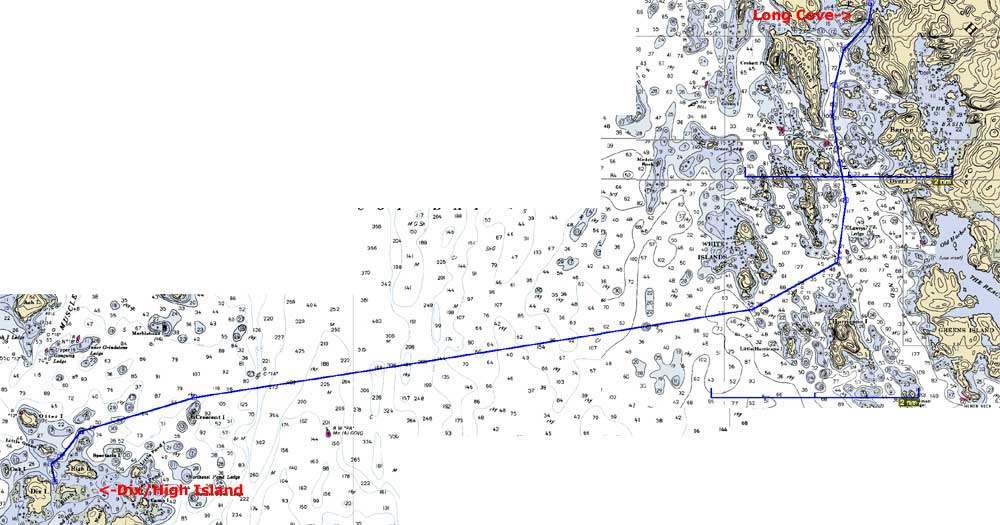
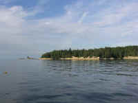
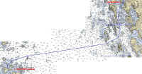
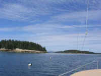
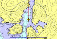
Falmouth (PYC) - Harmon Harbor (26.2NM Plotted) |
|
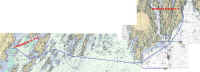
Route Chart
|
|
The day dawned gray and showery, but the air was different:
clearer, cleaner. With even better weather forecast for Sunday, I
had planned Saturday as a sort of "jumping off" day--a day to
get aboard and try to get somewhere to make Sunday's eventual journey a
bit shorter and easier. As before, I wanted to get the boat east
to Penobscot Bay as quickly as possible, after which time I could slow
down and start gunkholing. The mileage was substantial and, as I
was going it alone, I was a little concerned--perhaps apprehensive is a
better word--about the longness of the days, and the logistics of being
the sole person aboard to do all tasks with no relief.
Anyway, Heidi left early in
the day for a family reunion, with my plans a bit uncertain except that
I intended to be on the boat that day. By about 0900, the weather
was improving, and I decided to head to the boat. Armed with two
bags full of perishable goods (most of which had been stored in my
freezer to prolong both their lives and that of the ice), I was aboard
by 1000 and, after stowing the gear, was ready to go.
 Friends Heather and Nathan
were in a similar situation and had also decided to depart this
day. Since we had similar goals for the onset of the cruise, I
decided to see if our plans correlated for the day; they did, in that we
both wanted to try and get somewhere, if only to reduce the trip for the
next day. Friends Heather and Nathan
were in a similar situation and had also decided to depart this
day. Since we had similar goals for the onset of the cruise, I
decided to see if our plans correlated for the day; they did, in that we
both wanted to try and get somewhere, if only to reduce the trip for the
next day.
|
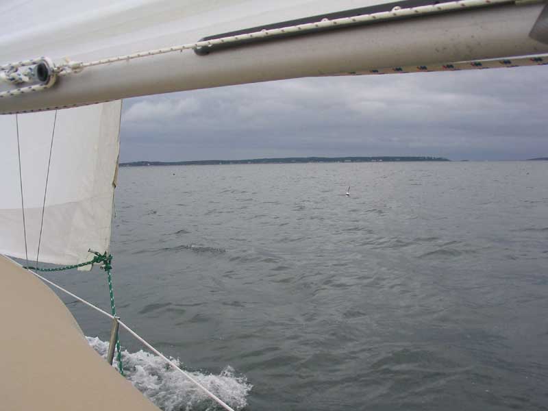
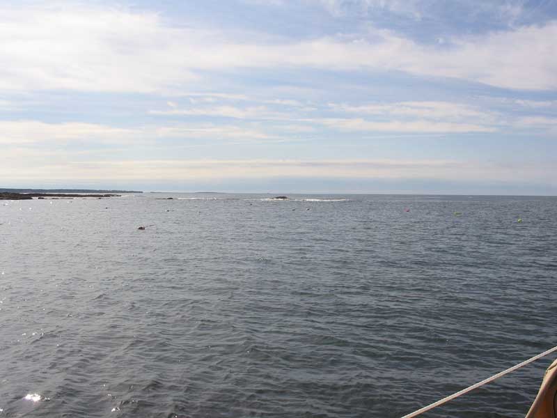
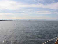
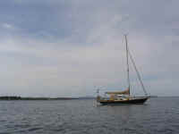
 Shortly after 1100, we
departed the anchorage more or less in tandem. The skies were
gray, and the back side of the front that had plagued us for days was
clearly visible offshore, but the day showed promise. A brisk 18
knot northerly breeze picked up outside the anchorage and Clapboard
Island, so we sailed to Chandler Cove, where the wind direction made it
impossible to sail and we were forced to motor. I took the
opportunity to tuck a reef in the main, as I didn't want to be faced
with the chore if the winds were to be as strong later in the day's
trip. Shortly after 1100, we
departed the anchorage more or less in tandem. The skies were
gray, and the back side of the front that had plagued us for days was
clearly visible offshore, but the day showed promise. A brisk 18
knot northerly breeze picked up outside the anchorage and Clapboard
Island, so we sailed to Chandler Cove, where the wind direction made it
impossible to sail and we were forced to motor. I took the
opportunity to tuck a reef in the main, as I didn't want to be faced
with the chore if the winds were to be as strong later in the day's
trip.
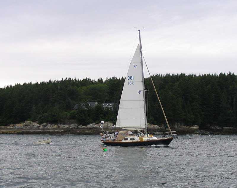
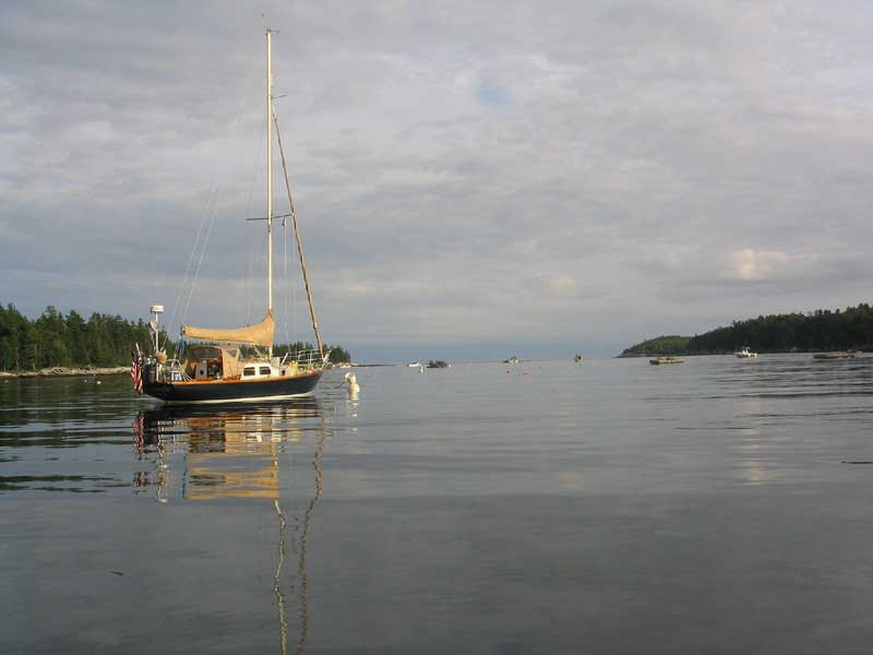
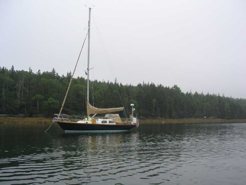
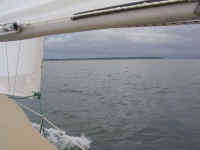
(Underway photo courtesy of Dasein)
|
|
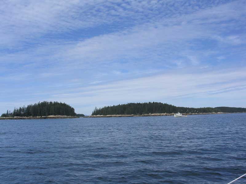
 After motoring past Stave Island, the course eased enough to allow another attempt at sailing,
which worked well till Little Mark Island, where our speed dropped too
low. Again went the engine, only to return to sailing a bit later
on when the breeze picked up again off Jaquish Island. This was
short lived, though, and before we were halfway across the bay we were
under power again--and remained so for the rest of the trip. After motoring past Stave Island, the course eased enough to allow another attempt at sailing,
which worked well till Little Mark Island, where our speed dropped too
low. Again went the engine, only to return to sailing a bit later
on when the breeze picked up again off Jaquish Island. This was
short lived, though, and before we were halfway across the bay we were
under power again--and remained so for the rest of the trip.
|
|

|
|
 Earlier, we had decided to
head past Cape Small into the mouth of the Sheepscot River, to Harmon
Harbor--just seaward of Five Islands. It looked interesting and
cozy. After a mind-numbing several hours of droning under power, I
reached the entrance to the harbor first and rounded up to drop the
main. Almost immediately, swarms of mosquitoes descended upon me;
bear in mind I was still offshore at this point, at least 1/2 mile from
the narrow harbor entrance and a further half mile from the inner
harbor. I thought this did not bode well for the night, but so be
it. Earlier, we had decided to
head past Cape Small into the mouth of the Sheepscot River, to Harmon
Harbor--just seaward of Five Islands. It looked interesting and
cozy. After a mind-numbing several hours of droning under power, I
reached the entrance to the harbor first and rounded up to drop the
main. Almost immediately, swarms of mosquitoes descended upon me;
bear in mind I was still offshore at this point, at least 1/2 mile from
the narrow harbor entrance and a further half mile from the inner
harbor. I thought this did not bode well for the night, but so be
it.
|
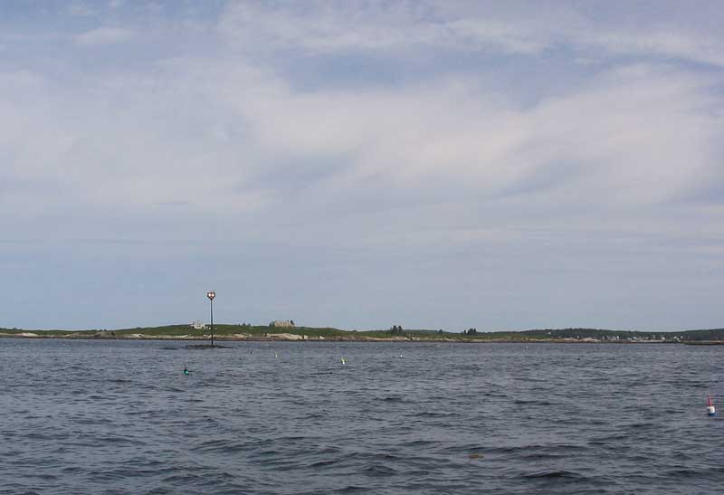
 The harbor entrance was very
narrow and flanked by reefs, the starboard of which was hidden under the
high tide; it was only visible when the swells reared up and rushed
across, not quite breaking but impressive nonetheless. My first
impression was that the swells looked like a tidal bore sweeping through
the harbor. Inside the harbor, we were just circling to anchor
when two separate people--one in a boat, one from shore--made a point of
hailing us to offer moorings for the night. How nice! We accepted
and soon were settled. Fortunately, the mosquitoes turned out not
to be as bad as feared outside the harbor! The harbor entrance was very
narrow and flanked by reefs, the starboard of which was hidden under the
high tide; it was only visible when the swells reared up and rushed
across, not quite breaking but impressive nonetheless. My first
impression was that the swells looked like a tidal bore sweeping through
the harbor. Inside the harbor, we were just circling to anchor
when two separate people--one in a boat, one from shore--made a point of
hailing us to offer moorings for the night. How nice! We accepted
and soon were settled. Fortunately, the mosquitoes turned out not
to be as bad as feared outside the harbor!
|
|
|
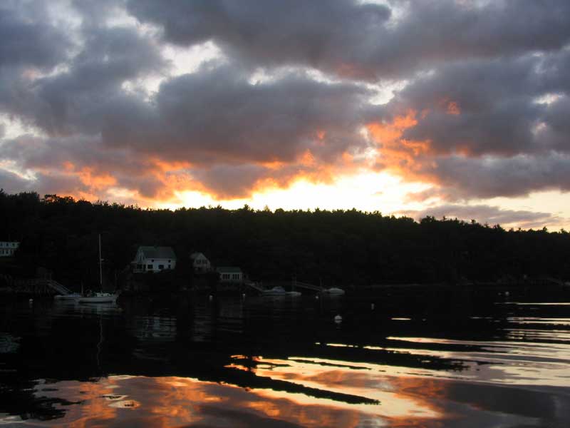
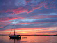
 Later that night, the house
on the point belonging to the person who offered the moorings had a
fireworks display that was quite good, actually. It seemed to be
celebratory of the start of a great cruise. The night was clear
and cool, with a half moon. Later that night, the house
on the point belonging to the person who offered the moorings had a
fireworks display that was quite good, actually. It seemed to be
celebratory of the start of a great cruise. The night was clear
and cool, with a half moon. |
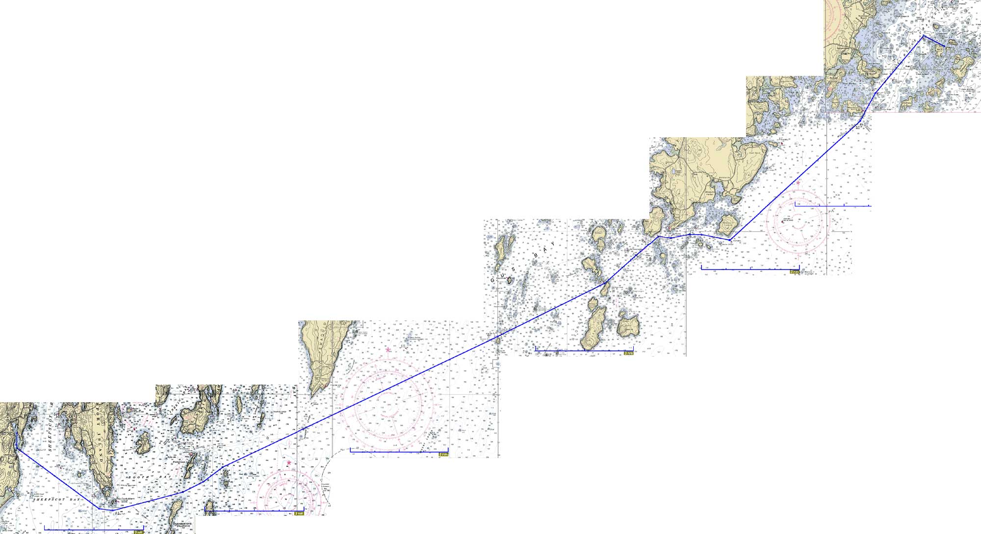
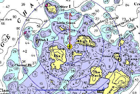
Sunday, July 25, 2004
Harmon Harbor - Dix Island/High Island (34.5 NM Plotted)
|
|

Route Chart
|
|
 Dasein and I departed in tandem at about 0820, with a loose commitment
to end up in the same place that evening, but no
guarantees. I was looking forward to knocking off some miles and
reaching Penobscot Bay today, so I set my sights on the harbor at Dix
and High Islands, off Muscle Ridge Channel at the gateway to the
bay. Again, a pleasant northerly wind greeted us after departure,
allowing for a brief sail before the wind became lighter and more
forward at Cape Newagan. And so it went for the next several
miles--attempts to sail, only to be foiled by deceptively strong wind
speeds that simply weren't strong enough to allow my self-imposed
minimum speed of 4 knots. Dasein and I departed in tandem at about 0820, with a loose commitment
to end up in the same place that evening, but no
guarantees. I was looking forward to knocking off some miles and
reaching Penobscot Bay today, so I set my sights on the harbor at Dix
and High Islands, off Muscle Ridge Channel at the gateway to the
bay. Again, a pleasant northerly wind greeted us after departure,
allowing for a brief sail before the wind became lighter and more
forward at Cape Newagan. And so it went for the next several
miles--attempts to sail, only to be foiled by deceptively strong wind
speeds that simply weren't strong enough to allow my self-imposed
minimum speed of 4 knots.
|
|
 After passing the
Hypoctites and White Islands near
Pemaquid neck, however, the wind became more northeasterly, which was
right on the nose-and also fairly light. Thus began the marathon
of powering into the teeth of the wind, though fortunately said wind was
under 10 knots for most of the day, though it piped up (while staying
right on the nose) during the inside passage past Port
Clyde--irritating, since there was no way to utilize the breeze, and I
was tired by this point and just wanted to get to my destination. After passing the
Hypoctites and White Islands near
Pemaquid neck, however, the wind became more northeasterly, which was
right on the nose-and also fairly light. Thus began the marathon
of powering into the teeth of the wind, though fortunately said wind was
under 10 knots for most of the day, though it piped up (while staying
right on the nose) during the inside passage past Port
Clyde--irritating, since there was no way to utilize the breeze, and I
was tired by this point and just wanted to get to my destination.
|
|
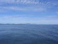
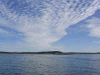
 The day remained anywhere
from cloudy to mostly sunny, with mild temperatures that dropped significantly
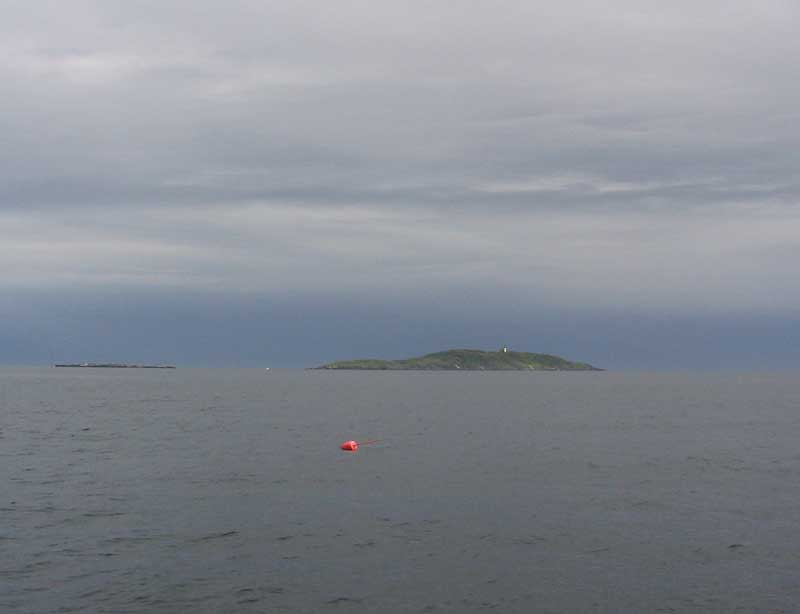
when the northeast wind picked up off the ocean. I passed Pemaquid
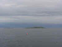
Ledge at 1025, and was abeam of Eastern Egg Rock (home of the Puffins--I
didn't see any) at 1145. The day remained anywhere
from cloudy to mostly sunny, with mild temperatures that dropped significantly
when the northeast wind picked up off the ocean. I passed Pemaquid
Ledge at 1025, and was abeam of Eastern Egg Rock (home of the Puffins--I
didn't see any) at 1145.
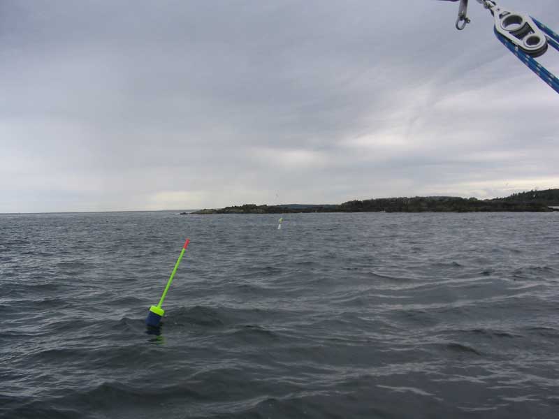
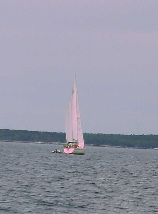
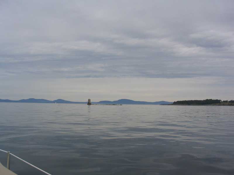
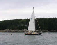
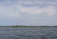
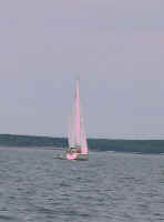
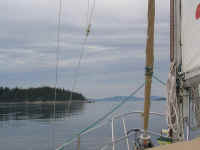
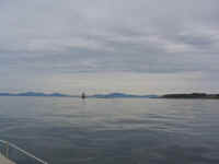
I passed by this sailboat,
which exhibited the oddest sail trim: she was sailing at about
70-80° to the wind, and her genoa was undertrimmed and flapping badly,
while her mainsail was strapped in tight--and not only that, but the
traveler was pulled all the way to windward. This image is a
lesson in "what not to do when sailing". No embarrassment
intended.
|
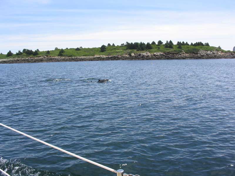
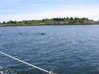 I passed busy Port Clyde after traversing
Davis Straight--where Dolphins frolicked in my wake-- and continued past Mosquito Island, where I faced the
choice of heading in a somewhat shorter distance (about 4 additional
miles) to Tenants Harbor, or whether to grit my teeth and continue on an
additional 9.8 miles to Muscle Ridge Channel and my intended
destination: Dix and High Islands. It was about 1400, so I
decided to just continue on. I passed busy Port Clyde after traversing
Davis Straight--where Dolphins frolicked in my wake-- and continued past Mosquito Island, where I faced the
choice of heading in a somewhat shorter distance (about 4 additional
miles) to Tenants Harbor, or whether to grit my teeth and continue on an
additional 9.8 miles to Muscle Ridge Channel and my intended
destination: Dix and High Islands. It was about 1400, so I
decided to just continue on.
|
 Because Glissando
powers about a half knot or more faster than Dasein at cruising
RPM, I had left them behind once the full motor began, off White
Islands. However, they had been in sight most of the day, though
dropping further behind. I hadn't intended to steam off to quite
such an extent, and hoped that I hadn't seemed rude. I tried
hailing them on the VHF after I passed Mosquito Island, but to no
avail. I was therefore unsurprised to receive a call from them
just as I was approaching my final anchoring spot in the Dix/High Island
harbor, with the news that they had stopped in Tenants Harbor and had
just arrived. Because Glissando
powers about a half knot or more faster than Dasein at cruising
RPM, I had left them behind once the full motor began, off White
Islands. However, they had been in sight most of the day, though
dropping further behind. I hadn't intended to steam off to quite
such an extent, and hoped that I hadn't seemed rude. I tried
hailing them on the VHF after I passed Mosquito Island, but to no
avail. I was therefore unsurprised to receive a call from them
just as I was approaching my final anchoring spot in the Dix/High Island
harbor, with the news that they had stopped in Tenants Harbor and had
just arrived.
We decided to see about hooking up sometime later in
the week; our immediate plans differed in that I had a week to bob
around a relatively small portion of Penobscot Bay by myself, before
picking up Heidi in Bucks harbor the following Monday, while the
Sanborns intended to continue east to Mt. Desert and the like, before
heading back south and west a bit later in the week for their
unfortunate return home 10 days hence.
|
|
|
|
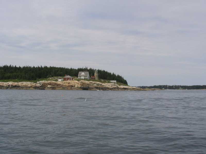
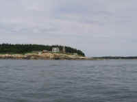
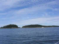
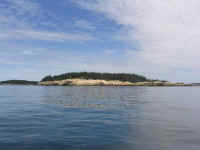
 The harbor was full of day
boats, there on a Sunday afternoon to enjoy nearby Birch Island and High
Island, with its abandoned quarry. As a result, several spots
where I might have considered anchoring were taken, so I motored slowly
around, watching the chart and my chart plotter, till I found a good
spot in and amongst the many lobster pots, and well ahead of an anchored
Pearson 30. I dropped the hook in 23 feet of water a little before
low tide, and set it with 90' of scope. It was 1540. The harbor was full of day
boats, there on a Sunday afternoon to enjoy nearby Birch Island and High
Island, with its abandoned quarry. As a result, several spots
where I might have considered anchoring were taken, so I motored slowly
around, watching the chart and my chart plotter, till I found a good
spot in and amongst the many lobster pots, and well ahead of an anchored
Pearson 30. I dropped the hook in 23 feet of water a little before
low tide, and set it with 90' of scope. It was 1540.
|
|
 Ravenous, I quickly made a
sandwich and settled down to watch the goings on. I was tired, but
it felt great: I was at the threshold of Penobscot Bay, my
favorite! From my spot, I had excellent views of the bay, the
surrounding islands, and, in the distance, the Camden Hills. I
felt terrific about my progress; with the "delivery" portion
of the trip over with, I looked forward to a week of relaxation and
gunkholing as I slowly made my way up the bay to Bucks Harbor, where I
planned to meet Heidi the following Monday, August 2. Ravenous, I quickly made a
sandwich and settled down to watch the goings on. I was tired, but
it felt great: I was at the threshold of Penobscot Bay, my
favorite! From my spot, I had excellent views of the bay, the
surrounding islands, and, in the distance, the Camden Hills. I
felt terrific about my progress; with the "delivery" portion
of the trip over with, I looked forward to a week of relaxation and
gunkholing as I slowly made my way up the bay to Bucks Harbor, where I
planned to meet Heidi the following Monday, August 2.
|
|
 Later, as I relaxed in the
cockpit, the owner of the nearby P-30 rowed over for a chat, spurred by,
as usual, his interest in the Triton. There have been few places
indeed where someone has not made the effort to say hello and offer up
their own Triton-based stories or experiences--one of the many pleasures
of owning a Triton. Later, as I relaxed in the
cockpit, the owner of the nearby P-30 rowed over for a chat, spurred by,
as usual, his interest in the Triton. There have been few places
indeed where someone has not made the effort to say hello and offer up
their own Triton-based stories or experiences--one of the many pleasures
of owning a Triton.
The night was still, with
chilly temperatures and overcast skies with light winds.
|
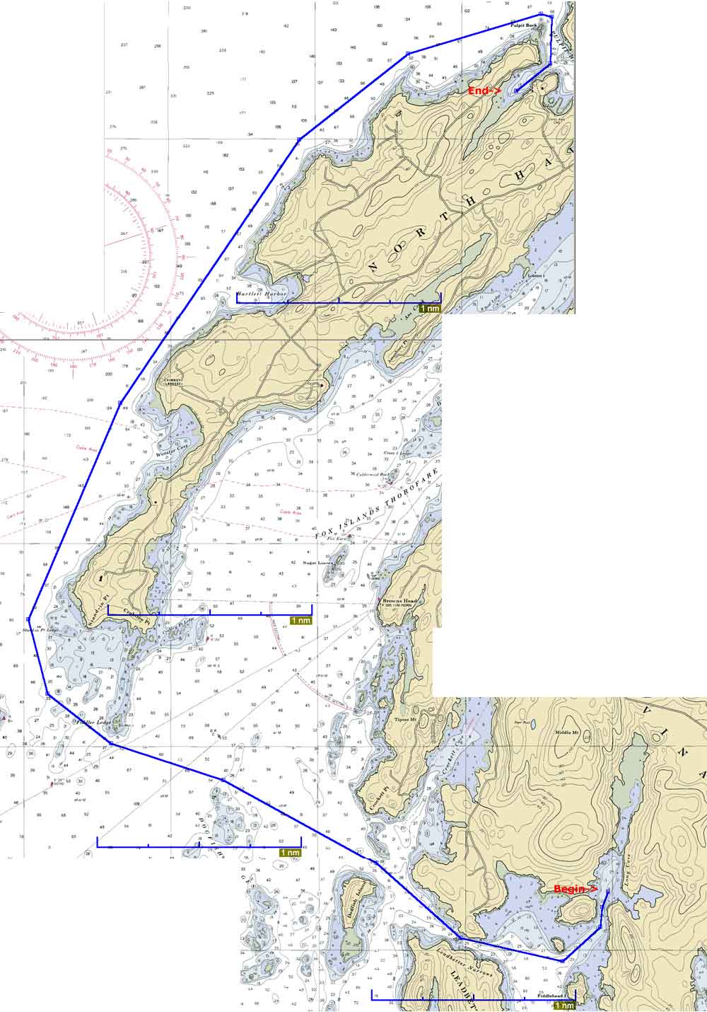
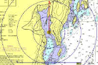
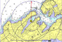
Monday, July 26, 2004
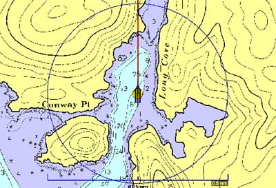
Dix Island/High Island - Vinalhaven Long Cove (10.8NM Plotted)
|
|
Route Chart
|
|
The early morning became quite rolly in the anchorage, mostly, I
determined, from the many lobster boat wakes both far and near:
when the wind and seas were as calm as they were this morning, wakes
tend to carry an extremely long way.
After lying in the rack for a while
bracing myself against the increasing rolls--it seemed that the boat
tended to get in these vicious cycles and self-perpetuated the rolling
motion: the more she rocked, the more she rocked--I got up late
(for me) at about 0645, and had a relaxing morning aboard, reading and
reveling in the thought that I had only a short trip planned for today.
A little before 1000, I prepared to get
underway. There was no wind, and the forecast was calling for
light and variable the entire day, so I figured I might as well get
going. Weighing anchor went smoothly, and the CQR was clean save
for some kelp and weed on the tip. I officially departed at 1010.
 Once the anchor was stowed, I raised the
main--despite no wind--and motored out through a passage between High
and Little Green Islands, before eventually turning nearly due east for
the 5.5 mile trip across the bay to Vinalhaven. The wind remained
calm, and the sun broke through the high clouds, making for a pleasant
passage. Once the anchor was stowed, I raised the
main--despite no wind--and motored out through a passage between High
and Little Green Islands, before eventually turning nearly due east for
the 5.5 mile trip across the bay to Vinalhaven. The wind remained
calm, and the sun broke through the high clouds, making for a pleasant
passage.
|
Hurricane
Sound Gallery
|
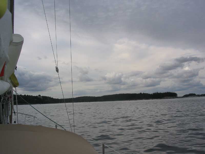
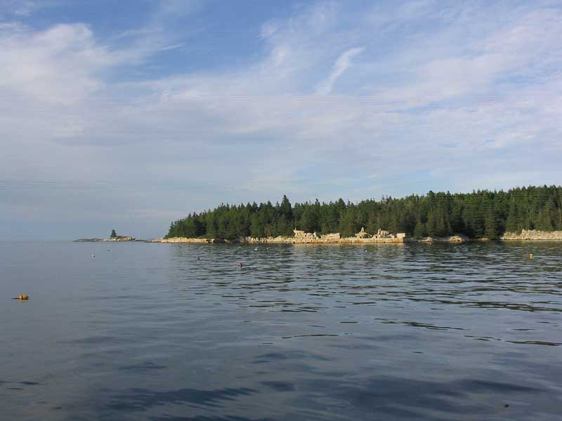
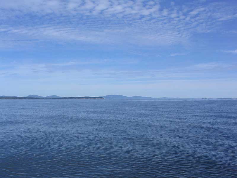
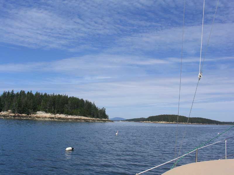
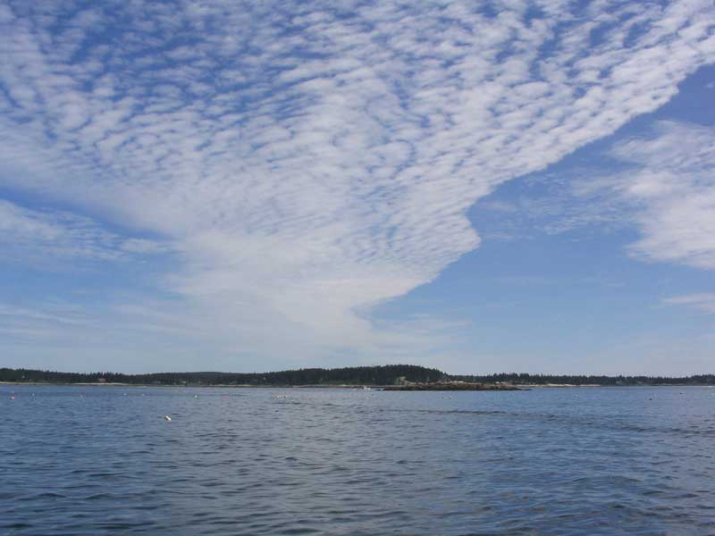
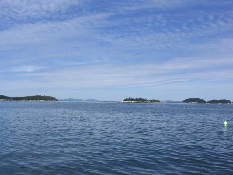
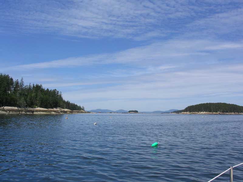
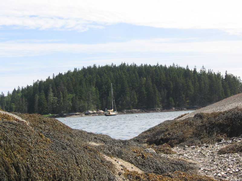
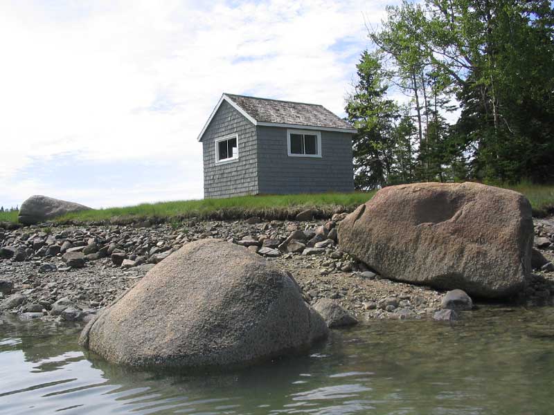
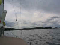
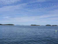
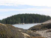
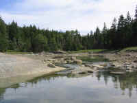
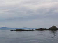
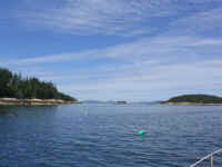 My planned route for the day took me, by
choice, through Hurricane Sound, passing south of the White Islands and
then up the sound to Long Cove. Hurricane Sound happens to be, in
my estimation, one of the most devastatingly beautiful passages on the
coast--the type that almost brings tears to one's eye from the pleasure
of it all. Two years ago, we had discovered this area, and I was
anxious to return. These pictures (above and to the right) don't
do it justice, but there you have it. As it happened, the weather became mostly sunny
as I arrived, making the passage even more beautiful. I loved it,
but all too soon I had arrived just south of Long Cove, where I lowered
the main and prepared to enter the harbor. My planned route for the day took me, by
choice, through Hurricane Sound, passing south of the White Islands and
then up the sound to Long Cove. Hurricane Sound happens to be, in
my estimation, one of the most devastatingly beautiful passages on the
coast--the type that almost brings tears to one's eye from the pleasure
of it all. Two years ago, we had discovered this area, and I was
anxious to return. These pictures (above and to the right) don't
do it justice, but there you have it. As it happened, the weather became mostly sunny
as I arrived, making the passage even more beautiful. I loved it,
but all too soon I had arrived just south of Long Cove, where I lowered
the main and prepared to enter the harbor.
|
|
|
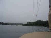
 Long Cove was
just as I remembered it, and this time I decided to pick up one of the
half dozen or so moorings that populate the cove. It seems that if
these "squatter", or destination, moorings are to be here, and
in other coves along the coast, then so be it: I, and seemingly
everyone else, will feel free to pick them up for the night (in fair
weather, at least). While I may be against the concept of these
types of moorings, I decided two years ago, after much angst over the
subject, that I should just feel free to pick them up when
convenient--perhaps only on weeknights, though, as these moorings are
more likely to be populated by their owners on the weekends.
Though who really knows? Long Cove was
just as I remembered it, and this time I decided to pick up one of the
half dozen or so moorings that populate the cove. It seems that if
these "squatter", or destination, moorings are to be here, and
in other coves along the coast, then so be it: I, and seemingly
everyone else, will feel free to pick them up for the night (in fair
weather, at least). While I may be against the concept of these
types of moorings, I decided two years ago, after much angst over the
subject, that I should just feel free to pick them up when
convenient--perhaps only on weeknights, though, as these moorings are
more likely to be populated by their owners on the weekends.
Though who really knows? |
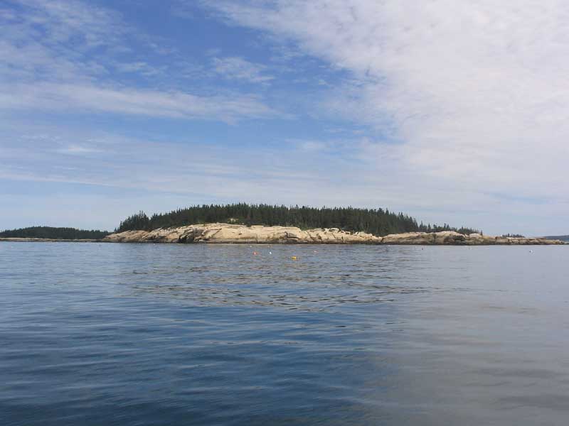
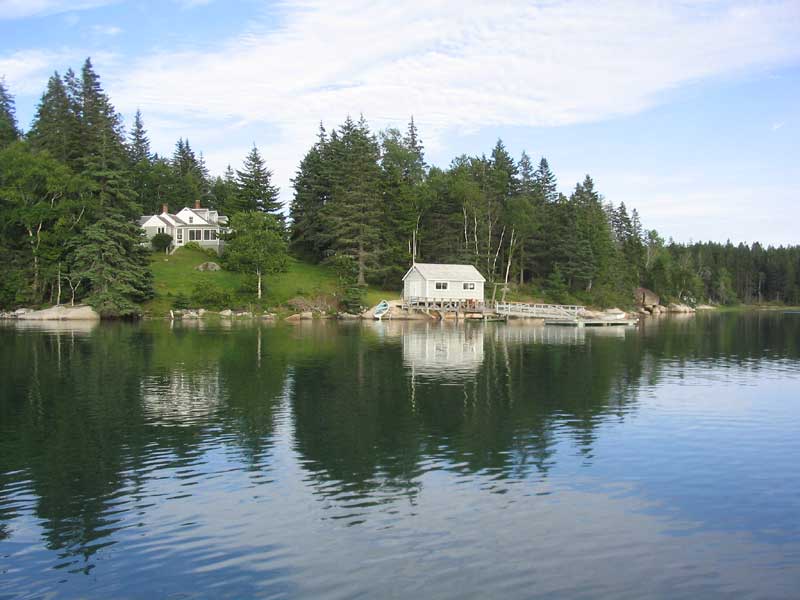
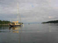
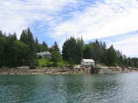
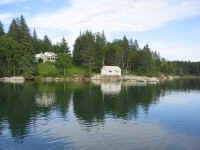 I picked up a mooring far off to the
eastern side of the cove, right in front of the property I might most
like to own anywhere on the coast. (Low and high tide views, left) Perched on the edge of the cove, surrounded by granite, the property contains the entire point,
with frontage on Long Cove, as well as a sort of "secret" back
cove (tidal). The house is a smallish cape on a bluff, surrounded
by trees and appearing as if it belonged, with several outbuildings
scattered about, and a dock and boathouse right on the cove. And
in the several times I have had the pleasure of being in Long Cove, I
have yet to see the house occupied: perhaps the need a
caretaker. Arrival: 1240. I picked up a mooring far off to the
eastern side of the cove, right in front of the property I might most
like to own anywhere on the coast. (Low and high tide views, left) Perched on the edge of the cove, surrounded by granite, the property contains the entire point,
with frontage on Long Cove, as well as a sort of "secret" back
cove (tidal). The house is a smallish cape on a bluff, surrounded
by trees and appearing as if it belonged, with several outbuildings
scattered about, and a dock and boathouse right on the cove. And
in the several times I have had the pleasure of being in Long Cove, I
have yet to see the house occupied: perhaps the need a
caretaker. Arrival: 1240. |
 After some lunch, I spent the afternoon
relaxing on board, punctuated with a pleasant row about the cove.
Several other boats trickled in, some of which also picked up the
moorings. Who knows what the right plan of attack is? I
noticed a change in the cruising guide for Long Cove as well: the
previous edition indicated that the moorings were private, and were not
to be picked up without permission. Our newest edition of the
cruising guide, purchased last year, now states that (and I paraphrase)
cruisers often enjoy the moorings in the cove, but are stunned into
shock when the mooring's owner appears to collect his exorbitant rental
fee. Fortunately, no one appeared to attempt to eke a charge out
of me. I don't like dealing with jerks, and little things like
this even possibility tend to really start to diminish the cruising
experience somehow. Once again, I longed for a simpler, friendlier
time, when everyone wasn't out to screw everybody else. What do
these people expect when the fill up the cove with moorings, anyhow? After some lunch, I spent the afternoon
relaxing on board, punctuated with a pleasant row about the cove.
Several other boats trickled in, some of which also picked up the
moorings. Who knows what the right plan of attack is? I
noticed a change in the cruising guide for Long Cove as well: the
previous edition indicated that the moorings were private, and were not
to be picked up without permission. Our newest edition of the
cruising guide, purchased last year, now states that (and I paraphrase)
cruisers often enjoy the moorings in the cove, but are stunned into
shock when the mooring's owner appears to collect his exorbitant rental
fee. Fortunately, no one appeared to attempt to eke a charge out
of me. I don't like dealing with jerks, and little things like
this even possibility tend to really start to diminish the cruising
experience somehow. Once again, I longed for a simpler, friendlier
time, when everyone wasn't out to screw everybody else. What do
these people expect when the fill up the cove with moorings, anyhow?
|
 I bet if mooring owners left an
"honor system" payment cup with a reasonable charge indicated,
they'd be surprised how many honest boaters actually paid the fee with
no question. Maybe someday I'll own waterfront property somewhere
(yeah, right) and will be pleased to provide a couple free moorings for
transient boaters, the way it should be. A bit of hospitality goes
a long way. I bet if mooring owners left an
"honor system" payment cup with a reasonable charge indicated,
they'd be surprised how many honest boaters actually paid the fee with
no question. Maybe someday I'll own waterfront property somewhere
(yeah, right) and will be pleased to provide a couple free moorings for
transient boaters, the way it should be. A bit of hospitality goes
a long way.
|
 Anyway, I apologize for my rant, but this
mooring issue is one that is becoming more and more of a problem on the
coast, and something must be done about it before it goes too far, if it
hasn't already. Waterfront municipalities take note: this is
an issue to deal with! Anyway, I apologize for my rant, but this
mooring issue is one that is becoming more and more of a problem on the
coast, and something must be done about it before it goes too far, if it
hasn't already. Waterfront municipalities take note: this is
an issue to deal with! |
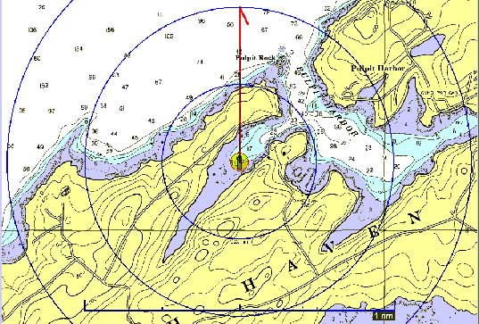
Tuesday, July 27, 2004
Vinalhaven Long Cove - Pulpit Harbor/Cabot Cove (8.93NM Plotted) |
|

Route Chart
|
| The evening and
night were incredibly quiet and still; the boats seemed as if glued to a
mirror. The slightest sound carried forever, and I felt
self-conscious about making too much noise while going about my normal
activities. It was the sort of quiet and stillness that I crave on
a daily basis at home, and which is sadly lacking on the road on which I
live. Boo hoo.
I had earlier considered laying over for
a day in Long Cove, but I had arrived early enough yesterday that I
already felt like I had been there for a long time, and besides:
the weather forecast for Wednesday was sounding iffy, maybe, and I
didn't want to end up stuck in the same place for even more days should
the fog some in or some such. So I decided to strike out for the
epic journey to Cabot Cove at Pulpit Harbor, fewer than nine miles away
by rhumb line. I could have easily traveled further, but with six
days until I had to pick up Heidi in Bucks Harbor (a very easy day's
journey from anywhere in Penobscot Bay), I decided to bop into a few
harbors along the way.
Again, the morning was completely still
and quiet, with no wind whatsoever and none forecast. This is just
so often the case when cruising, it seems. Well, better no wind
than an uncomfortable amount, I always say, and at 0950 I raised the
main and dropped the mooring. (I always motor with the main up: it
steadies the boat, makes the boat much more visible to other boats, and,
should the wind come up during the day, I'm ready to sail by just
unrolling the genoa.)
 I departed the cove and headed through
Leadbetter Narrows, a beautiful, narrow (duh) passage leading to the
entrance of Fox Islands Thorofare. I had some minorly anxious
moments when, heading towards the buoy in the narrows through a passage
I had made several times a couple years ago, the depthsounder indicated
shockingly low depths, which were not indicated on the chart. I
figured it had to be an error in the sounder, so I turned it off and
back on again to reset, after which it worked just fine. I departed the cove and headed through
Leadbetter Narrows, a beautiful, narrow (duh) passage leading to the
entrance of Fox Islands Thorofare. I had some minorly anxious
moments when, heading towards the buoy in the narrows through a passage
I had made several times a couple years ago, the depthsounder indicated
shockingly low depths, which were not indicated on the chart. I
figured it had to be an error in the sounder, so I turned it off and
back on again to reset, after which it worked just fine.
|
 My trip to Pulpit Harbor was completely
uneventful, with absolutely no wind, no seas, and only some minor
undulations from long-standing boat wakes. Everything was
platinum: sky, and sea. The Camden Hills, across the
bay to the west, were beautiful, if lacking in definition under the gray
skies. What a beautiful place, though! I love Penobscot
Bay. My trip to Pulpit Harbor was completely
uneventful, with absolutely no wind, no seas, and only some minor
undulations from long-standing boat wakes. Everything was
platinum: sky, and sea. The Camden Hills, across the
bay to the west, were beautiful, if lacking in definition under the gray
skies. What a beautiful place, though! I love Penobscot
Bay. |
 I arrived at Cabot Cove to find a
powerboat anchored in just about the spot I would have picked, so I
spent some time motoring about inside of the powerboat to see if I dared
anchor there. It was nearly low tide, and I had hoped to get as
far up the cove as possible, which usually works well to prevent others
from anchoring too closely. Further up from the powerboat, there
was enough water--barely--but I felt that to anchor there would have
placed me too close to the existing boat, and there might not have been
room enough to swing if the wind came up from the north, pushing be
further up the cove into the mud banks. Instead, I chose what
ended up being a good location east of the powerboat, and a little
further out: and just in time, too, as a trio of sailboats traveling
together were just turning the corner into the cove, so I hurried to
stake out my spot and drop the anchor, which I did without incident in
about 10 feet of water just before low tide. Arrival: 1210. I arrived at Cabot Cove to find a
powerboat anchored in just about the spot I would have picked, so I
spent some time motoring about inside of the powerboat to see if I dared
anchor there. It was nearly low tide, and I had hoped to get as
far up the cove as possible, which usually works well to prevent others
from anchoring too closely. Further up from the powerboat, there
was enough water--barely--but I felt that to anchor there would have
placed me too close to the existing boat, and there might not have been
room enough to swing if the wind came up from the north, pushing be
further up the cove into the mud banks. Instead, I chose what
ended up being a good location east of the powerboat, and a little
further out: and just in time, too, as a trio of sailboats traveling
together were just turning the corner into the cove, so I hurried to
stake out my spot and drop the anchor, which I did without incident in
about 10 feet of water just before low tide. Arrival: 1210. |
|
|
| The powerboat
left later in the afternoon, but I was happy with where I ended up
nonetheless.
Again, the afternoon and evening were
incredibly quiet and still, and I can recall few days where there has
been so little (read: absolutely none) evidence of any wind.
Silly things: it's important, when
cooking pasta in salt (ocean) water, to NOT salt the water the way I do
at home!
|
Wednesday, July 28, 2004
Cabot Cove |
 It began to rain
lightly at about 0400, and by 0500 it was raining quite hard and
steadily, which lasted for an hour or so. The boat needed a
washdown, so I was grateful. Amazingly, NOAA had even begun
calling for this rain, showers, and fog during the forecasts I listened
to yesterday, so to that extent I was unsurprised. After all, I
had headed here specifically yesterday so that I wouldn't end up stuck
in Long Cove (as nice as it is and all) with a rain or fog delay for a
day or more. The way this month has been, I would be unsurprised
to have a couple days of undesirable weather. Long Cove is
beautiful, and I enjoy it there, but there is nothing to do, and nowhere
to even think about going ashore; at least here at Cabot Cove, I could,
if I wanted, dinghy over to the Pulpit Harbor landing in the main
harbor, and walk around on shore, or even visit a nearby store listed in
the cruising guide. Mainly, I was thankful for the option of
having something to do if I became stir crazy on board--unlikely after
only one day, but quite possible if one day's bad weather
stretched to two, or even more. Nothing is guaranteed this summer,
that's for sure. It began to rain
lightly at about 0400, and by 0500 it was raining quite hard and
steadily, which lasted for an hour or so. The boat needed a
washdown, so I was grateful. Amazingly, NOAA had even begun
calling for this rain, showers, and fog during the forecasts I listened
to yesterday, so to that extent I was unsurprised. After all, I
had headed here specifically yesterday so that I wouldn't end up stuck
in Long Cove (as nice as it is and all) with a rain or fog delay for a
day or more. The way this month has been, I would be unsurprised
to have a couple days of undesirable weather. Long Cove is
beautiful, and I enjoy it there, but there is nothing to do, and nowhere
to even think about going ashore; at least here at Cabot Cove, I could,
if I wanted, dinghy over to the Pulpit Harbor landing in the main
harbor, and walk around on shore, or even visit a nearby store listed in
the cruising guide. Mainly, I was thankful for the option of
having something to do if I became stir crazy on board--unlikely after
only one day, but quite possible if one day's bad weather
stretched to two, or even more. Nothing is guaranteed this summer,
that's for sure.
|
 In any event, I quickly decided to stay
the day, and lounged nearly fully awake in the vee berth listening to
the rain until finally getting up at about 0620 (having been basically
awake since 0400). I don't mind rain/fog days (within reason, of
course), as long as I feel comfortable with where the boat is, and with
the overall "schedule": this is why I build in so much
unscheduled potential in any cruise, so that I am rarely, if ever,
forced out into conditions I would prefer not to be stuck in. In any event, I quickly decided to stay
the day, and lounged nearly fully awake in the vee berth listening to
the rain until finally getting up at about 0620 (having been basically
awake since 0400). I don't mind rain/fog days (within reason, of
course), as long as I feel comfortable with where the boat is, and with
the overall "schedule": this is why I build in so much
unscheduled potential in any cruise, so that I am rarely, if ever,
forced out into conditions I would prefer not to be stuck in.
In the mid morning, I decided to cook up
some corn muffins. Imagine my dismay at discovering that we had no
muffin tin aboard! I had dim memories of throwing out the rusty
old one after our 2002 cruise, but was surprised to find that apparently
I had not replaced it. I made Johnny Cake (cornbread) instead,
which was just fine.
|
 The
day passed uneventfully. It remained foggy, though it brightened
overhead. I even put the outboard motor on the dinghy for the
first time in a cruising situation--we bought the outboard last year,
but never cruised substantially--and buzzed around the harbor a bit to
check out the boats in the main part of Pulpit Harbor (including my
dream B-40 MK III yawl...my heart was a flutter). The fog outside
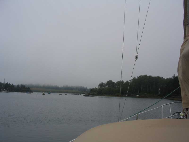
didn't look horrible--perhaps 1/2 mile to one mile visibility.
Tame, by Maine standards. In the afternoon, the sky became bright
enough as to threaten sunshine, though it never broke through. I
read a lot, and caught up on my logs and photos. I also
adjusted the stuffing box, checked the oil, and cleaned the cabin
(spurred on after some careless person stacked the dishes on the settee
while working on the engine, after which they crashed to the sole,
breaking a bowl into tiny bits). The
day passed uneventfully. It remained foggy, though it brightened
overhead. I even put the outboard motor on the dinghy for the
first time in a cruising situation--we bought the outboard last year,
but never cruised substantially--and buzzed around the harbor a bit to
check out the boats in the main part of Pulpit Harbor (including my
dream B-40 MK III yawl...my heart was a flutter). The fog outside
didn't look horrible--perhaps 1/2 mile to one mile visibility.
Tame, by Maine standards. In the afternoon, the sky became bright
enough as to threaten sunshine, though it never broke through. I
read a lot, and caught up on my logs and photos. I also
adjusted the stuffing box, checked the oil, and cleaned the cabin
(spurred on after some careless person stacked the dishes on the settee
while working on the engine, after which they crashed to the sole,
breaking a bowl into tiny bits). |
 Ha!
I had a feeling this might happen. Earlier, I wrote the paragraph
above, in which I stated that the sun never broke through (as if the
whole day were written sometime afterwards). Well, late in the
afternoon, the sun did indeed break through...just a little, and only
for a brief time. As I wrote the above, I actually considered that
maybe I would "jinx" the sun into making an appearance with my
taunt. It worked! Ha!
I had a feeling this might happen. Earlier, I wrote the paragraph
above, in which I stated that the sun never broke through (as if the
whole day were written sometime afterwards). Well, late in the
afternoon, the sun did indeed break through...just a little, and only
for a brief time. As I wrote the above, I actually considered that
maybe I would "jinx" the sun into making an appearance with my
taunt. It worked!
Please click here to
continue the log. --->
|
|