|
Cruising Log: 7/1/04 - 7/6/04
(Page 2)
|
7/3/04
 Saturday
morning dawned crisp, clear, bright, and gorgeous, the thick, humid,
hazy weather having finally departed on the heels of a cold front
overnight. There was no rush to leave in the morning, as our
planned day's run up to the Cross River was about 8.5 miles
total. In addition, we needed to catch the tide properly to make
our entrance, as a narrow part of the Cross River, called Oven Mouth,
can feature currents as high as 6 knots--currents we wanted to be in our
favor. Therefore, we relaxed on the guest mooring for the morning,
finally departing at about 1030 for our rigorous trek up the river. Saturday
morning dawned crisp, clear, bright, and gorgeous, the thick, humid,
hazy weather having finally departed on the heels of a cold front
overnight. There was no rush to leave in the morning, as our
planned day's run up to the Cross River was about 8.5 miles
total. In addition, we needed to catch the tide properly to make
our entrance, as a narrow part of the Cross River, called Oven Mouth,
can feature currents as high as 6 knots--currents we wanted to be in our
favor. Therefore, we relaxed on the guest mooring for the morning,
finally departing at about 1030 for our rigorous trek up the river. |
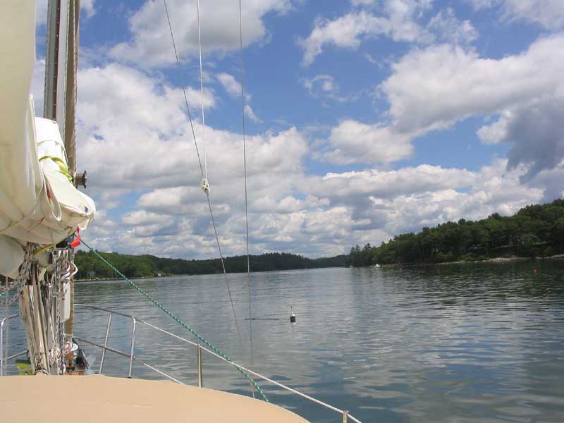
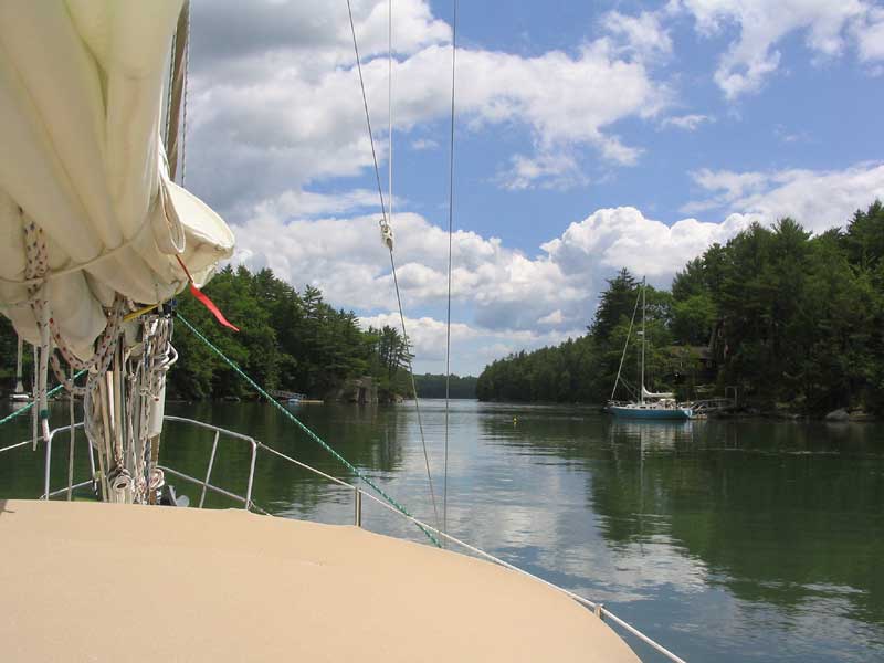
 There
was a pleasant breeze coming down the Sheepscot as we departed, and for
a time I thought we'd have a nice sail up the river for a couple
hours. Unfortunately, that was not to be, as the wind petered out
as we headed upriver, eventually forcing us to motor once more.
Still, we very much enjoyed our travels deep into the Sheepscot, which
is very scenic and lined with beautiful "old school"
homes--the sort of classy, island-type homes that belong in such a
setting, rather than the classless, gaudy,
who-needs-a-house-that-big-ever McMansions that are increasingly showing
up as people with bad taste and too much money buy up every scrap of
waterfront land, hoisting our property taxes and forcing 3rd and 4th
generation landowners to sell their property in the face of unaffordable
tax bills. There
was a pleasant breeze coming down the Sheepscot as we departed, and for
a time I thought we'd have a nice sail up the river for a couple
hours. Unfortunately, that was not to be, as the wind petered out
as we headed upriver, eventually forcing us to motor once more.
Still, we very much enjoyed our travels deep into the Sheepscot, which
is very scenic and lined with beautiful "old school"
homes--the sort of classy, island-type homes that belong in such a
setting, rather than the classless, gaudy,
who-needs-a-house-that-big-ever McMansions that are increasingly showing
up as people with bad taste and too much money buy up every scrap of
waterfront land, hoisting our property taxes and forcing 3rd and 4th
generation landowners to sell their property in the face of unaffordable
tax bills. |
 But
I digress. We really liked the Sheepscot, and found any number of
lovely, nearly-attainable homes that we'd be happy to live in, were we
"forced" to. With all that nice deep frontage and places
for a fleet of boats...let's move! But
I digress. We really liked the Sheepscot, and found any number of
lovely, nearly-attainable homes that we'd be happy to live in, were we
"forced" to. With all that nice deep frontage and places
for a fleet of boats...let's move! |
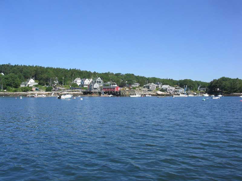
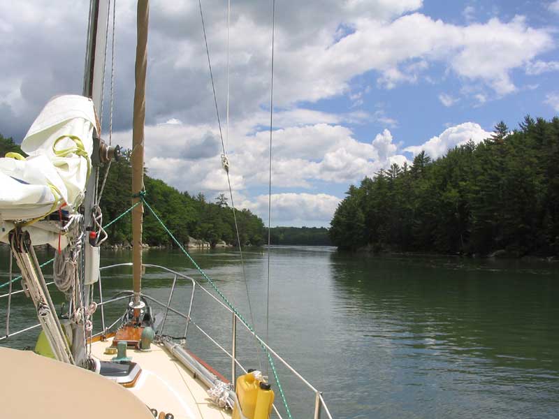
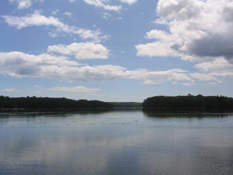
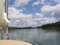
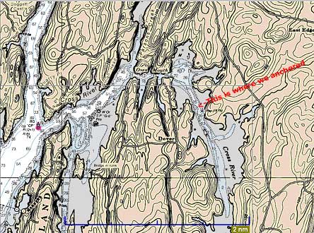 Soon
enough, we arrived off the mouth of the Cross River (left center of
chartlet). To our port, the Sheepscot wound off narrowly towards
Wiscasset, still a few miles upriver--a journey for some other time,
perhaps. Lowering the main, we found our way up the channel,
enjoying the scenery along the way. The river starts off quite
wide, then narrows dramatically through the Oven Mouth (top center of
the chartlet), after which it broadens greatly into a large basin and
winding tributary. The basin is surprisingly deep--up to 72
feet--and looking at the chart it is clear to see why the currents can
be so strong, given how much water must rush through the tiny entrance
four times each day with the 11-foot tides. Soon
enough, we arrived off the mouth of the Cross River (left center of
chartlet). To our port, the Sheepscot wound off narrowly towards
Wiscasset, still a few miles upriver--a journey for some other time,
perhaps. Lowering the main, we found our way up the channel,
enjoying the scenery along the way. The river starts off quite
wide, then narrows dramatically through the Oven Mouth (top center of
the chartlet), after which it broadens greatly into a large basin and
winding tributary. The basin is surprisingly deep--up to 72
feet--and looking at the chart it is clear to see why the currents can
be so strong, given how much water must rush through the tiny entrance
four times each day with the 11-foot tides. |
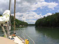
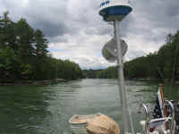
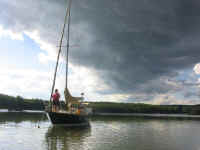
 Approaching
the western end of Oven Mouth, we could see our way down the narrow
channel--cool! I had vague memories from 20+ years earlier, but it
was beautiful to see. What an entrance! As we proceeded,
with steep rocky shores seemingly near enough to touch on each side, I
watched the GPS to monitor the current. By the time we reached the
eastern end--the narrowest part--near the basin, we were rushing along
with more than three knots of favorable current, even though we were
very near the time of supposed slack water. Approaching
the western end of Oven Mouth, we could see our way down the narrow
channel--cool! I had vague memories from 20+ years earlier, but it
was beautiful to see. What an entrance! As we proceeded,
with steep rocky shores seemingly near enough to touch on each side, I
watched the GPS to monitor the current. By the time we reached the
eastern end--the narrowest part--near the basin, we were rushing along
with more than three knots of favorable current, even though we were
very near the time of supposed slack water. |
|
|
|
|
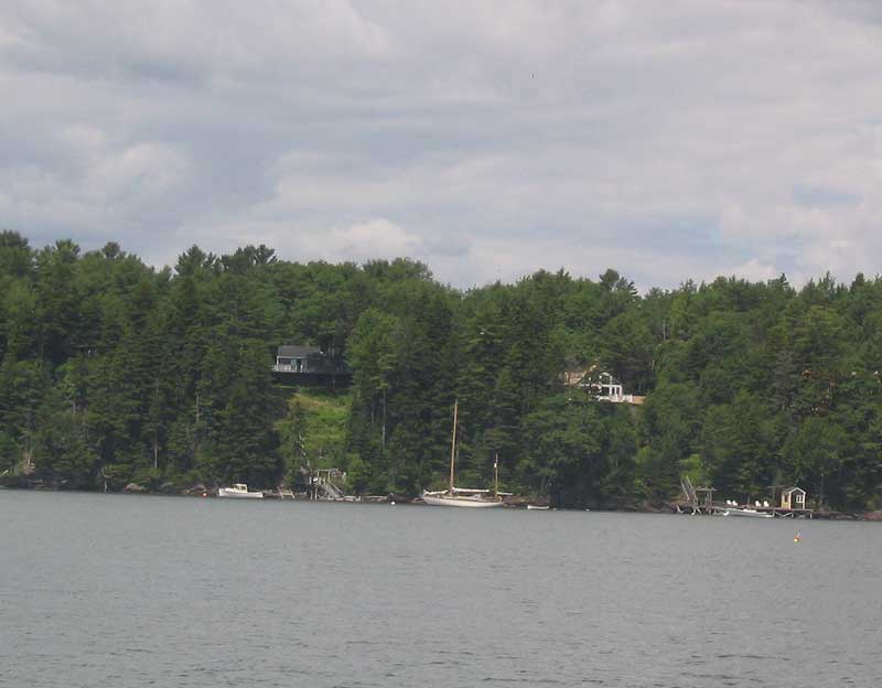
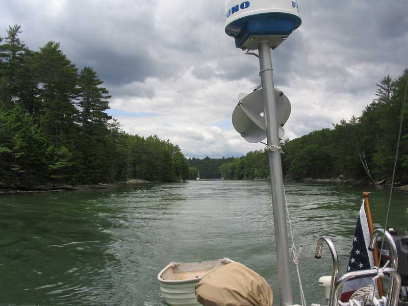
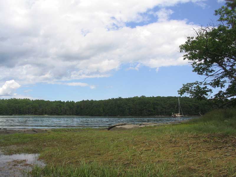
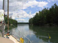
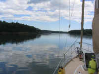
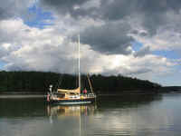
 We
burst into the basin at the end of Oven Mouth, after which the current
became negligible. There was one boat anchored at the northern
end of the basin, which is where we might have chosen to go; instead,
not wanting to be one of those "crowder" people--you know the
ones, who always seem to choose to anchor wherever anyone else is,
rather than use some initiative and find a different spot--we decided to
head up the channel further, finally choosing to anchor near where I
marked on the chartlet above. We set the hook in about 30' at high
water. We
burst into the basin at the end of Oven Mouth, after which the current
became negligible. There was one boat anchored at the northern
end of the basin, which is where we might have chosen to go; instead,
not wanting to be one of those "crowder" people--you know the
ones, who always seem to choose to anchor wherever anyone else is,
rather than use some initiative and find a different spot--we decided to
head up the channel further, finally choosing to anchor near where I
marked on the chartlet above. We set the hook in about 30' at high
water. |
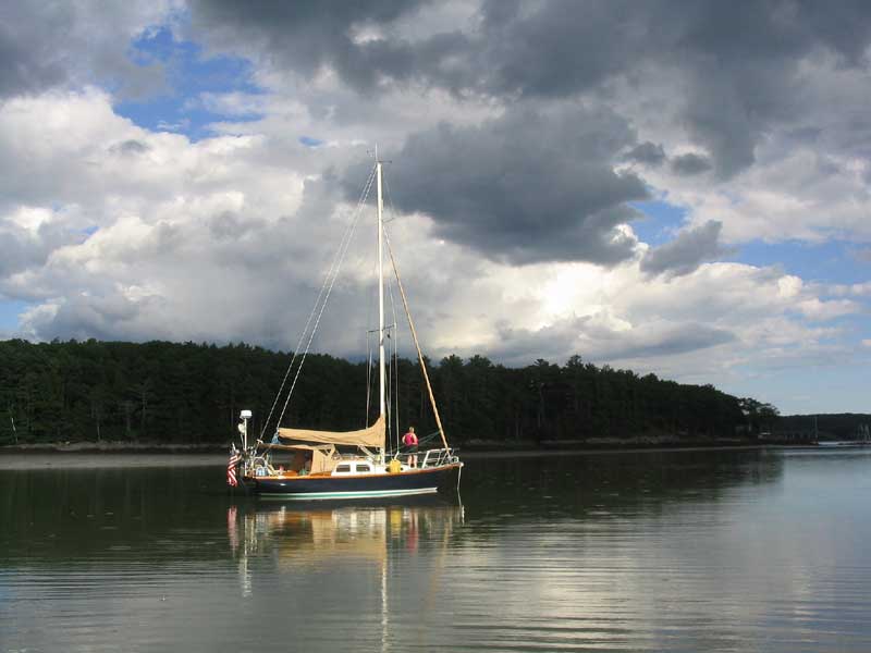
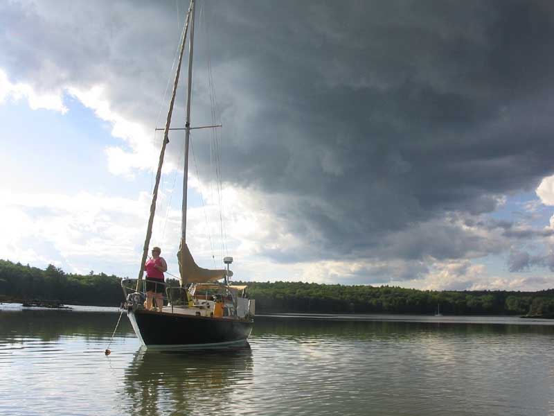
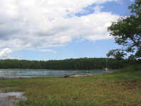
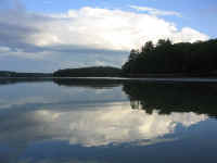
 The
afternoon passed pleasantly, with little to report. There were interesting
and dramatic cloud formations through the afternoon, which became
particularly interesting as the afternoon wore into evening; still, we
had only a very brief and half-hearted rain shower despite it all.
A regular parade of small powerboats passed us in the little channel
during the afternoon, sightseers and fishermen alike; this was an
unexpected consequence of choosing to anchor where we did. I had
not expected boat traffic, with the river a dead end and all.
Nonetheless, most of the boats proceeded appropriately slowly, with
only random jerks once or twice who thought they were cool by
throwing large wakes. But then this is the case wherever you go,
whatever you do. Ideally, I would choose to anchor elsewhere the
next time, though, just to avoid the issue entirely. The
afternoon passed pleasantly, with little to report. There were interesting
and dramatic cloud formations through the afternoon, which became
particularly interesting as the afternoon wore into evening; still, we
had only a very brief and half-hearted rain shower despite it all.
A regular parade of small powerboats passed us in the little channel
during the afternoon, sightseers and fishermen alike; this was an
unexpected consequence of choosing to anchor where we did. I had
not expected boat traffic, with the river a dead end and all.
Nonetheless, most of the boats proceeded appropriately slowly, with
only random jerks once or twice who thought they were cool by
throwing large wakes. But then this is the case wherever you go,
whatever you do. Ideally, I would choose to anchor elsewhere the
next time, though, just to avoid the issue entirely. |
|
|
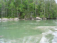
 Otherwise,
we were nearly alone. Two other sailboats came in during the
afternoon, both of whom chose to anchor at the northern end of the
basin. The powerboat that had been there when we came in left
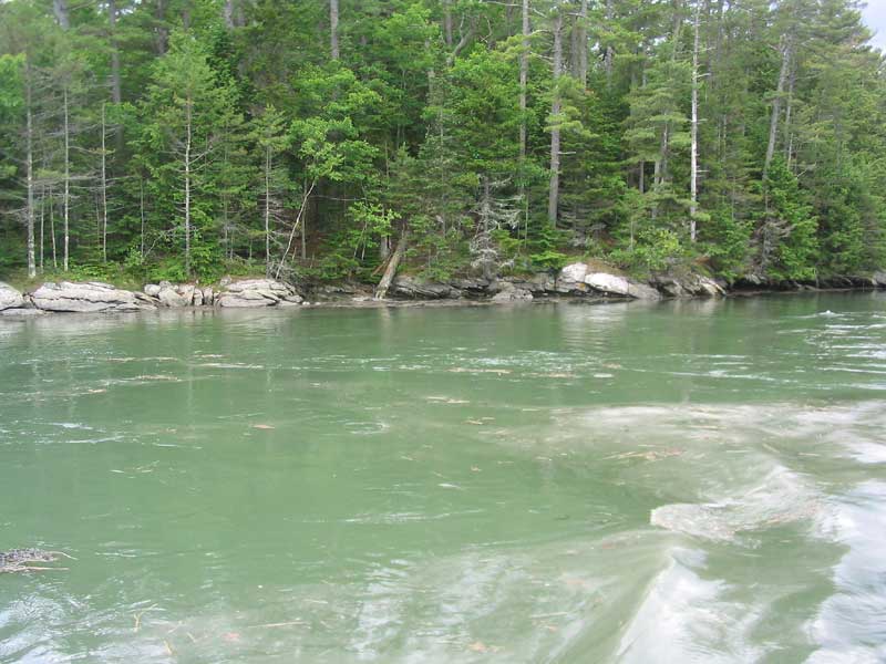
later in the afternoon. As the tide dropped, the scenery changed
dramatically, exposing mud banks along both sides. As we neared
low tide, I noticed some kelp in the water to our stern, and, rowing
over, found that it marked a rock formation below the water. The
chart showed a reported rock, but its position was nowhere near
correct: the rock is actually much closer to that point that juts
out above where we anchored, as seen on the chartlet above. While
we were interestingly close to these rocks at low, we were in 18-20 feet
of water, and I felt fine where we were. The dark clouds coupled
with the late day sun in the west made for some interesting photo
opportunities. Otherwise,
we were nearly alone. Two other sailboats came in during the
afternoon, both of whom chose to anchor at the northern end of the
basin. The powerboat that had been there when we came in left
later in the afternoon. As the tide dropped, the scenery changed
dramatically, exposing mud banks along both sides. As we neared
low tide, I noticed some kelp in the water to our stern, and, rowing
over, found that it marked a rock formation below the water. The
chart showed a reported rock, but its position was nowhere near
correct: the rock is actually much closer to that point that juts
out above where we anchored, as seen on the chartlet above. While
we were interestingly close to these rocks at low, we were in 18-20 feet
of water, and I felt fine where we were. The dark clouds coupled
with the late day sun in the west made for some interesting photo
opportunities. |
|
|
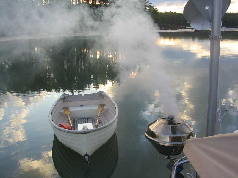
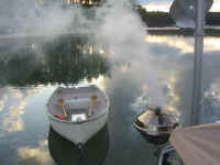 We
enjoyed ground lamb burgers for dinner, cooked on the grill. These
always create copious amounts of smoke--all the better to keep away the
noseeums, which had plagued us through the late afternoon as the tide
went out. Since there was no breeze all day, we found that a small
12-volt fan to stir the air in the cockpit made a big difference. We
enjoyed ground lamb burgers for dinner, cooked on the grill. These
always create copious amounts of smoke--all the better to keep away the
noseeums, which had plagued us through the late afternoon as the tide
went out. Since there was no breeze all day, we found that a small
12-volt fan to stir the air in the cockpit made a big difference. |
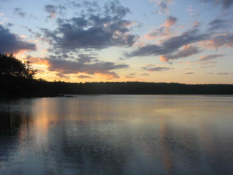
 As
the sun set, the mosquitoes descended in force, causing us to retreat
below far earlier than we might like. Time for some mosquito
netting around the dodger and awning, I think. Heidi? As
the sun set, the mosquitoes descended in force, causing us to retreat
below far earlier than we might like. Time for some mosquito
netting around the dodger and awning, I think. Heidi?
Yup, it's time for more sunset pictures. |
|
Continue
with the log> |
|