|
Cruising Log:
7/1/04 - 7/6/04 (Page 3)
|
7/4/04
 Sunday was a lay day--or we hoped it would be. Few things are more
relaxing than a day aboard when you have no plans. However, all
weekend we had been listening to the weather, and the forecast for
Monday--the day we planned to return home--was calling for snotty
southerly winds during the day, which, given the particular route we
needed to take home, could translate to sloppy, tall seas and 30 miles
of wind on the nose. Since we, like all sane people, choose to
avoid masochistic travels like this, we were forced with trying to make
a decision about whether to head home today and play it safe, or hope
that we could make it tomorrow. To get home before it became truly
dark, we'd have to leave no later than 1400 for the 35 mile trip home.
Sunday was a lay day--or we hoped it would be. Few things are more
relaxing than a day aboard when you have no plans. However, all
weekend we had been listening to the weather, and the forecast for
Monday--the day we planned to return home--was calling for snotty
southerly winds during the day, which, given the particular route we
needed to take home, could translate to sloppy, tall seas and 30 miles
of wind on the nose. Since we, like all sane people, choose to
avoid masochistic travels like this, we were forced with trying to make
a decision about whether to head home today and play it safe, or hope
that we could make it tomorrow. To get home before it became truly
dark, we'd have to leave no later than 1400 for the 35 mile trip home.
|
 After listening to an updated forecast
late Sunday morning, we finally decided that we could stay, as the
forecast winds were not supposed to become nasty till later Monday
afternoon, along with unsettled weather and possible patchy fog. I
decided that we'd simply leave early Monday morning--0500--and be home
before the worst arrived. I should have known better. After listening to an updated forecast
late Sunday morning, we finally decided that we could stay, as the
forecast winds were not supposed to become nasty till later Monday
afternoon, along with unsettled weather and possible patchy fog. I
decided that we'd simply leave early Monday morning--0500--and be home
before the worst arrived. I should have known better.
|
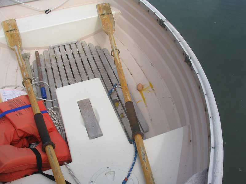
 Decision
made, the relaxation began in earnest. While I was making
breakfast during the morning, I discovered that one of the eggs had
broken in the carton--or cracked, at least. I picked the egg up
and, without giving it any thought, threw it through the hatch to go
overboard. As I did so, I happened to glance out--and noticed in
horror that the dinghy, rather than trailing behind, had drifted around
to the side! "Nice shot", said Heidi as the egg scored a
bullseye on the dinghy, splattering the oars and interior with
yolk. Decision
made, the relaxation began in earnest. While I was making
breakfast during the morning, I discovered that one of the eggs had
broken in the carton--or cracked, at least. I picked the egg up
and, without giving it any thought, threw it through the hatch to go
overboard. As I did so, I happened to glance out--and noticed in
horror that the dinghy, rather than trailing behind, had drifted around
to the side! "Nice shot", said Heidi as the egg scored a
bullseye on the dinghy, splattering the oars and interior with
yolk.
|
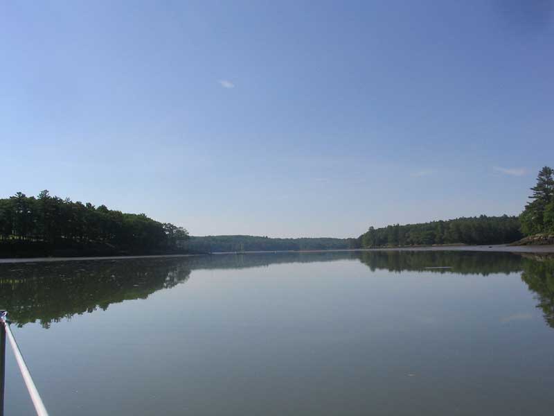
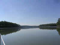
The river was quiet through
the entire morning, with a reduced number of passers-by during the
afternoon. I guess everyone was busy with their 4th of July
picnics and activities. We read, and I rigged and sailed the
dinghy for a while. By evening, we were the only boat in the
place, the other two sailboats having departed earlier for ports
unknown. Unbelievable! We pondered whether the world had
actually come to an end the day before, and if we were the sole
survivors (you children of the '80s: remember Asia? Where
are they now...) It was an early night, given our plans for a
start bright and early the next morning.
|
7/5/04
I was up at 0430, with Heidi soon after (grudgingly). As soon as
the coffee was made (a requirement for me), we prepared to depart.
The day was overcast, with evidence of fog--though it was hard to tell
up in our secret little hole in the wall. All we could do was head
out and hope for the best. The NOAA forecast was still calling for
the winds later, but they were supposed to be OK in the morning.
Again, NOAA called for "patchy fog". What do you think
of when you hear "patchy fog"? Nothing serious,
right? Ha! |
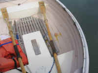
Given the quality of the mud--deep, silty, and looking as if it might
swallow you like quicksand were you unfortunate enough to step in
it--that I had observed along the river banks at low tide, I was not
looking forward to weighing anchor, as I worried that it would be packed
with mud and make for messy cleanup. Needless to say, I was
thrilled when the chain came up almost perfectly clean, and only a small
amount of mud on the anchor. All it took was one sluice with
a bucket and the cleanup was done.
Securing the anchor, we turned towards
the basin and Oven Mouth beyond. Conveniently, the tide was
ebbing, and would be ebbing for several hours to come: perfect,
not only for traversing Oven Mouth, but also to assist us with a push
all the way out the Sheepscot. Conversely, the tide would be
coming in as we neared home, and would help us again. It seemed too good
to be true.
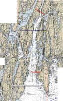
As we got close to the eastern side of
Oven Mouth, we could clearly see the water stacked u p on our side,
surging forward to try and run out the narrow channel. It was
really interesting to see the sort of concave surface of the water, with
it running higher at the banks than in the center. I braced myself
for a wild ride.
We blasted through the narrow channel on
the edge of control; the GPS showed a speed over ground of 10.5 knots
during one quick, furtive glance I managed to give it. Otherwise,
I was busy keeping the boat pointed straight through, fearing (whether
or not it would or could ever happen) that the slightest miscalculation
might dash us against the shoreline that seemed perilously close.
Wheeeeeeeeee! After covering a half mile in, like, 2 seconds, the
current finally eased as the channel widened, slowing to a mere two
knots. What an adrenaline rush! Who needs caffeine? |
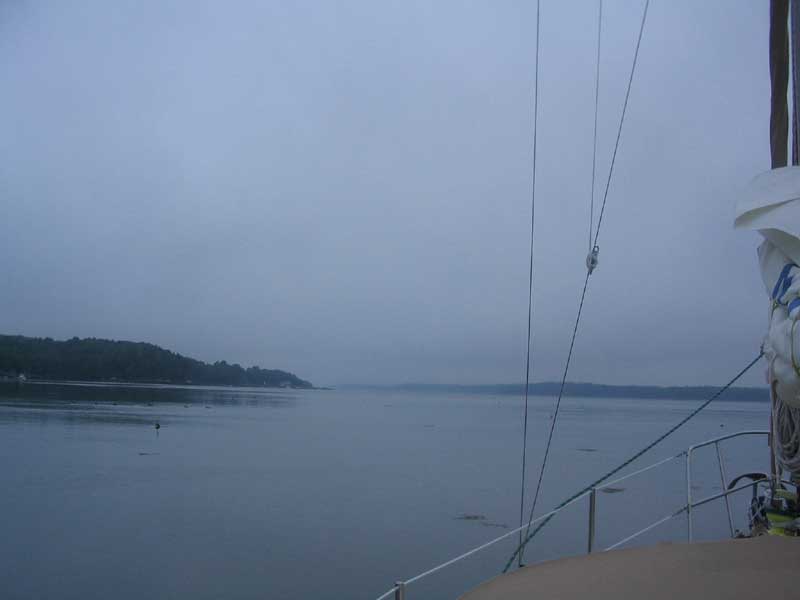
 Outside,
back in the Sheepscot, I raised the main, choosing a single reef since
there were already signs that some wind was beginning--and fairly fresh,
too. Freshness of wind at 0530 tends to be indicative of more to
come, so I decided it would be easier to just tuck the reef in now, in
case. It's easier to shake it out later. With the tide at
our back, we had an easy--if uneventful--passage back down the river
towards Five Islands. The Sheepscot River is extremely broad at
its mouth, and in fact is called "Sheepscot Bay" in that
area. Therefore, the passage, other than the few miles closest to
Cross River, is like being in the bay or ocean, rather than purely river-like. Outside,
back in the Sheepscot, I raised the main, choosing a single reef since
there were already signs that some wind was beginning--and fairly fresh,
too. Freshness of wind at 0530 tends to be indicative of more to
come, so I decided it would be easier to just tuck the reef in now, in
case. It's easier to shake it out later. With the tide at
our back, we had an easy--if uneventful--passage back down the river
towards Five Islands. The Sheepscot River is extremely broad at
its mouth, and in fact is called "Sheepscot Bay" in that
area. Therefore, the passage, other than the few miles closest to
Cross River, is like being in the bay or ocean, rather than purely river-like.
(My patchwork chart isn't perfect, so
please forgive me! Look for better attempts in the future.) |
|
|
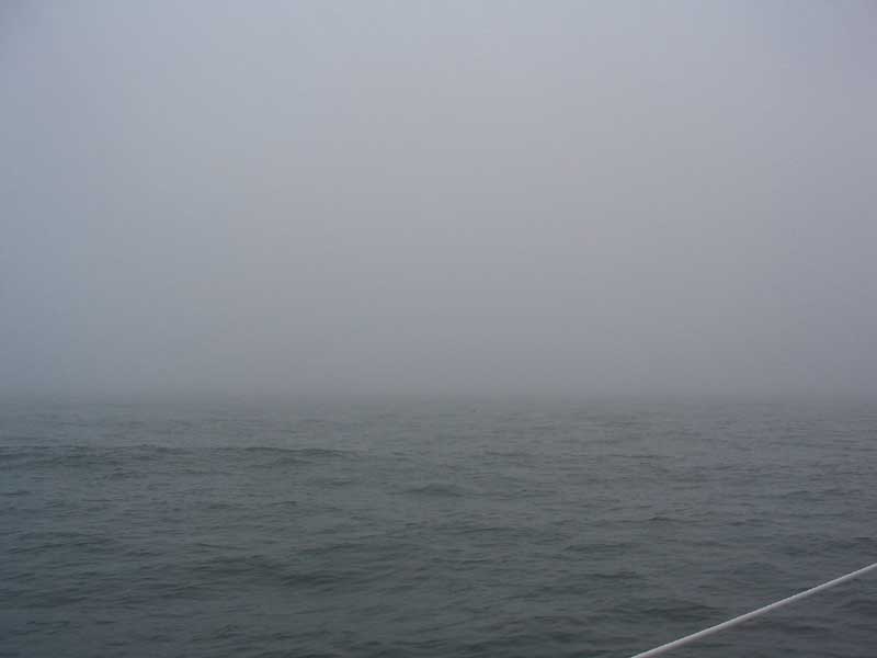
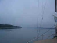
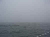 After about an hour and a half, we were nearly downriver as far as Five Islands.
It was at almost this exact moment that, out of the blue, the wind
picked up straight off the ocean and, almost as quickly, brought with it
some of the thickest, densest, wettest fog I have the displeasure of
remembering. It was obvious we weren't going to continue in that,
so, fortuitously, we continued the 2 minutes to Five Islands, where we
entered the harbor easily and picked up the same mooring as two days
before. It was 0730. From the mooring, I couldn't even see
the green can at the harbor entrance, only a few boatlengths away.
After about an hour and a half, we were nearly downriver as far as Five Islands.
It was at almost this exact moment that, out of the blue, the wind
picked up straight off the ocean and, almost as quickly, brought with it
some of the thickest, densest, wettest fog I have the displeasure of
remembering. It was obvious we weren't going to continue in that,
so, fortuitously, we continued the 2 minutes to Five Islands, where we
entered the harbor easily and picked up the same mooring as two days
before. It was 0730. From the mooring, I couldn't even see
the green can at the harbor entrance, only a few boatlengths away. |
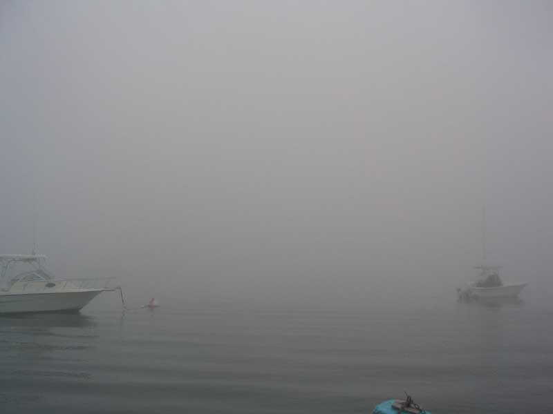
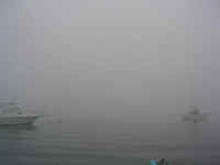 The fog remained thick all morning, but seemed to retreat a bit by about
1100. I rowed the dinghy around to see if the fog was gone
for real, or not. I could see a pretty good distance outside, so I
rowed back to the boat and consulted with Heidi--I was almost thinking
we could make a break for it. She thought we should stay, and,
sure enough, about 30 minutes later the fog was back, as thick as
before. Lovely! It looked like we would not be getting the
boat home today.
The fog remained thick all morning, but seemed to retreat a bit by about
1100. I rowed the dinghy around to see if the fog was gone
for real, or not. I could see a pretty good distance outside, so I
rowed back to the boat and consulted with Heidi--I was almost thinking
we could make a break for it. She thought we should stay, and,
sure enough, about 30 minutes later the fog was back, as thick as
before. Lovely! It looked like we would not be getting the
boat home today.
Since Heidi had to be at work Tuesday
morning, we made arrangements to get her home from Five Islands--it's
only an hour's drive from home. My mom was nice enough to drive up
and pick her up, arriving at about 1600. I stayed behind so that I
could bring the boat home on Tuesday, assuming the weather
cleared. It was kind of strange on board that night:
although I daysail and work on the boat alone all the time, this was the
first night I had spent aboard alone. It was a wonderfully cozy
night, though, with the fog and rain off and on. I caught up on my
reading and watched the seas roll by the harbor entrance whenever the
fog retreated for a few minutes; although the harbor was nearly a mill
pond, there was obviously wind blowing outside and kicking up the seas,
which were further exacerbated by running in the river against the tide. |
|
Continue with the log>
|
|