HOME  :: WHAT'S NEW :: PROJECTS :: SAILING :: MAINTENANCE :: RESOURCES  
  SAILING LOGS :: EQUIPMENT AND STORAGE :: MISCELLANY  


Cruising Log for Week 7:  August 25 - August 31, 2002

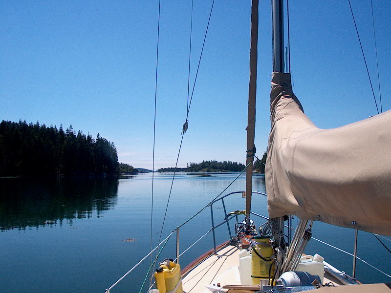
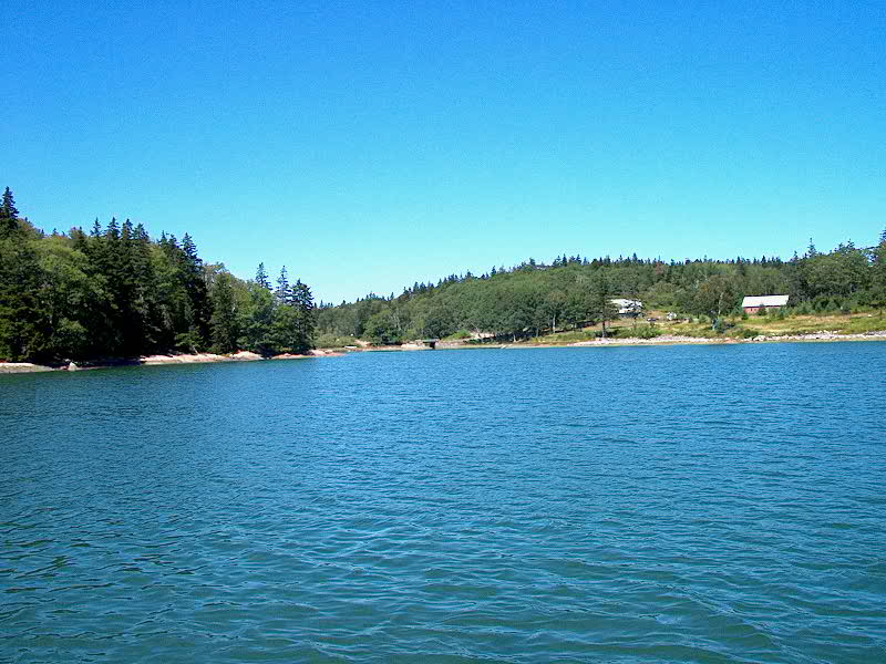
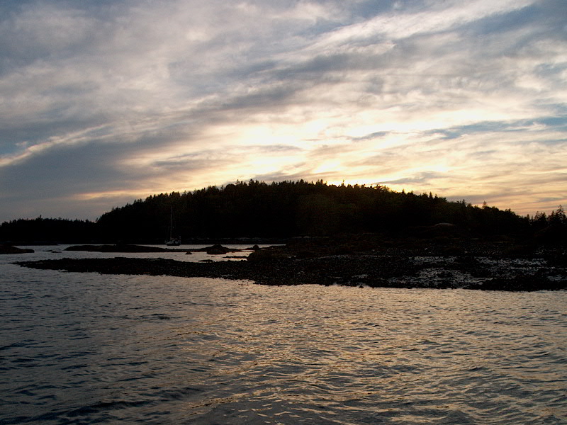
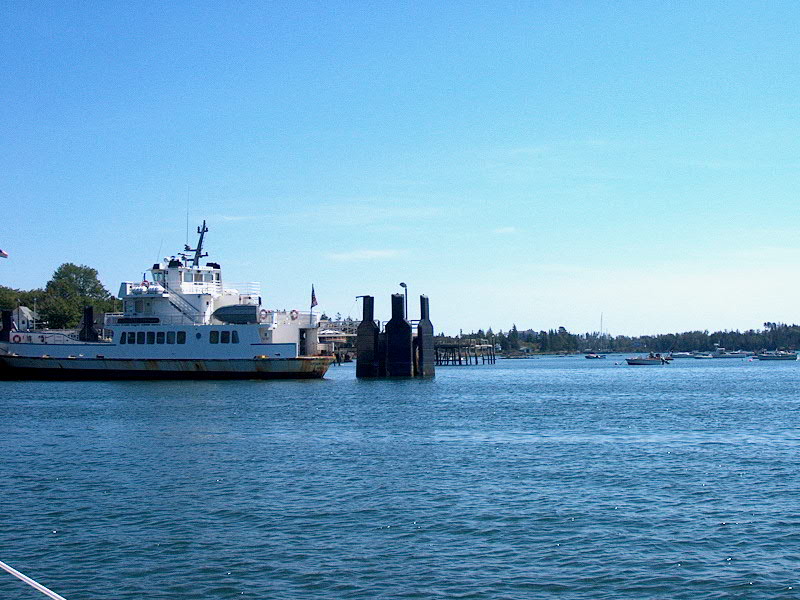
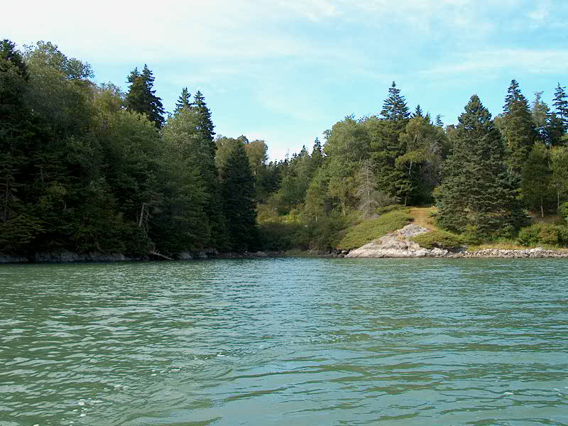
Sunday 8/25:  Long Cove  Harbor Detail Chart

The swift current at the narrows of Long Cove a couple hours after low tideWe awoke to some rain, which was essentially a pleasant change of pace--we've had virtually no rain during the cruise, and it was sort of nice and cozy to have it falling this morning.  I slept in a bit (till a little after 7) and Heidi slept in longer.  I enjoyed a quiet morning in the cabin reading and occasionally getting up to see what was going on topside, if anything.  Around 0930, with the rain taking a break, I rowed up to the head of the cove, where the falls I had heard last night were running again as the tide came in, slewing around the large ledge extending from one shore and around a couple smaller ledges in the remaining channel.  The current was running several knots through here, and I could see a The water  piles up to the left and surges around to the right. difference in the water height from inside to outside of nearly 6", as the incoming tide built up against the ledge before rushing around the corner.  I watched it for quite some time, interested and fascinated.  The huge yacht made its departure at around 1000, leaving the cove once again quiet and looking more like itself.


Cruise 8-22-26 046.jpg (152579 bytes)We decided to wait and see what the weather did before making any decisions on whether to leave or not, and by the time it cleared at around 1130 we were pretty ensconced in our day, so we decided to stay in the cove.  Plus, the wind forecast for tomorrow sounded like--perish the thought--the winds might be favorable for a sail through the thorofare, instead of yet another boring motor like I knew it would be today, so we figured we might as well stay.  It turned into an absolutely splendid day, bright and sunny with light wind that grew slightly stronger in the afternoon before dying overnight once again.  I rowed around the cove again, checking out every nook and cranny.

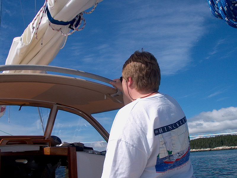
It was a crystal clear night, and I had to get up around 0400 for some important business.  Then I happened to check outside through the companionway--it was beautiful!  The moon, which is several days past full, was high in the sky, the cove was like a millpond with nary a ripple, and all the boats were highlighted by the stark moonlight and reflected perfectly in the cove.  Well worth the effort to get up!

Monday 8/26:  Long Cove - Winter Harbor (Rhumb Line Distance:  10.9 nm)  PDF Route Chart  Harbor Detail Chart

Does it get any better?Another beautiful day.  I can't believe how lucky we've been with the weather!  I also can't believe that in just over a week or so we'll be home.  Barf.  I hate to see this come to an end, though, as I've written before, it has seemed like it's been winding down--but only because we have a semi-firm end date in sight, not because either of us is bored or ready to move on.  Nope, not me.  We just have to figure out how to bring our dogs and I think we could go right back out and do this all over again.  I know I could.  And want to.  I don't know what I'm going to do when this is over.  (By the time you read this, we'll already be home, leading sad, pathetic shoreside lives once again.)  As I write this, I'm once again stunned by the simple beauty of our location for the day--Winter Harbor, on the eastern shore of Vinalhaven, just south of the east entrance to the Fox Islands Thorofare.  But I'm getting ahead of myself.

We pulled up the anchor at 0930--it was covered with kelp--and motored out of the cove into a beautiful, calm morning.  Heidi wanted to motor over and check out the nearby entrance to The Basin--a notorious tidal lake with a treacherous, obstructed, current-wreaked The daunting entrance to The Basin, Vinalhavenentrance that seems more or less impassible for mere mortals.  We motored around Fiddlehead Island and in towards the narrow entrance to The Basin.  It was just a little past low tide, so the rock that obscures most of the very narrow channel was visible.  There was no doubt that this was a pretty advanced place to navigate.  We got as close as we dared, which was basically the larger pool in the channel just outside the twin headlands, and turned around, having satisfied ourselves as to the difficulty of the entrance.  One of our boat neighbors in Long Cove last night had a 9' Whaler with a 4hp outboard, and had motored into The Basin yesterday around high tide, and we overheard him telling his friend that he almost couldn't make it back out against the current, making bare headway through the narrowest part of the channel.

Heading west through Leadbetter NarrowsAfterwards, we had a pleasant motor back through Hurricane Sound (gorgeous) and Leadbetter Narrows with the tide in our favor--at a lazy engine speed we were still tearing through at 6 knots over the ground.  It was a gorgeous day, and we motored into and through the Fox Islands Thorofare, NOAA having dropped the ball on wind again, as per usual.  Sheesh.

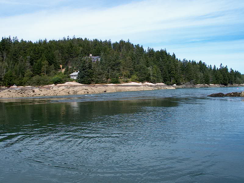
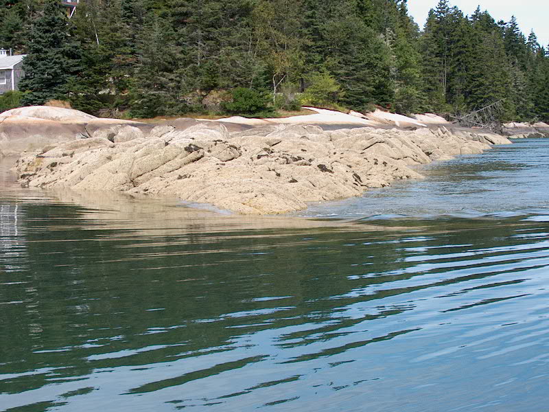
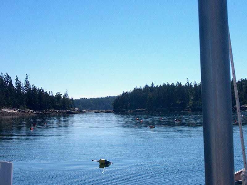
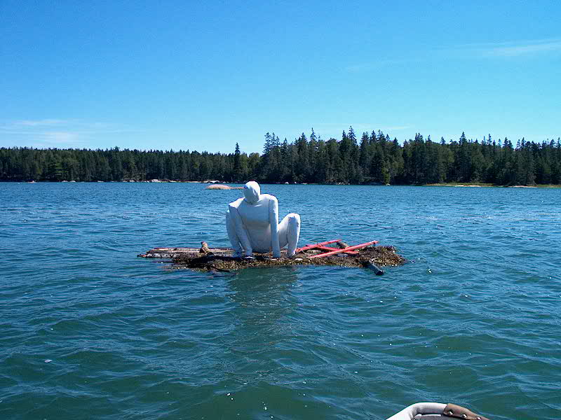
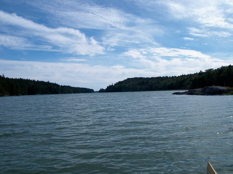
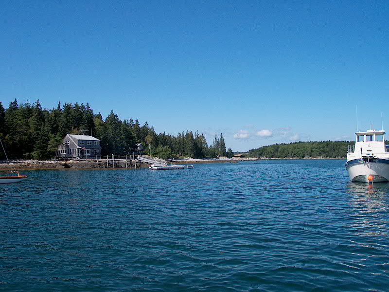
We arrived outside Winter Harbor near noontime, and proceeded in the long, narrow split in the rocks.  There are many opportunities for anchoring spots, and I had been studying the chart trying to figure out where we would want to be.  The problem with looking at charts is that you really can't tell much about what is the most scenic place in the harbor, or what the geography is like, so it was all a surprise to us.

Starboard Rock--Winter HarborAs we entered, Seal Bay off to port looked interesting, and we made a note to check that out on our next cruise up this way.  As with Long Cove the other day, we were pleasantly surprised and impressed with the beauty of Winter Harbor--lots of granite and spruce (can you tell that's my favorite type?).  There were no other boats in the harbor as of yet, so we pretty much had our pick of where we might want to go.  We passed by one of the likely spots--behind a little rock island across from the sheer cliffs of Starboard Rock, about halfway down--and decided to keep going and at least check out the upper pools beyond, which looked interesting on the chart, although I had really not figured we would go so far up.  We threaded past a number of rocks, mostly submerged since it was nearly high tide, to the basin at the mouth (so to speak) of the Mill Mill River, seen from our chosen anchoring spotRiver, which bisects Calderwood Neck and connects Seal Bay, off the thorofare, with Winter Harbor (though the river is completely tidal and dries out at low).  We liked it up here, so eventually we dropped the hook in the spot I had indicated on the chart, in 15' of water an hour or two before high.  There should be about 7-9' of water here at low, perfect.  There are advantages to our shallow draft!  

I could already tell that I was going to rue not having a dinghy outboard in here.  There are all these tributaries and channels all over the place that beg to be explored, but would not be possible under oar power alone.  A kayak would be great here also--I think we will have at least one inflatable kayak on board for our next cruise.  I love the rigid dinghy, and enjoy rowing most of the time, but there's no denying the utility and convenience of an outboard for instances like this.  I have occasionally looked longingly at some of the really nice Avons with big outboards...but I would miss the rowability of the FAKE as well.  I guess what I want is BOTH dinghies.  Soon, we're going to need a utility barge to follow us around wherever we go, carrying such things as kayaks, different dinghies, a dining table, spares, supplies...

The weird man-thing on the raft behind the boatJust behind the boat, there was some really odd, sort of creepy sculpture thing on a little float--a white apparition in the general shape of a man squatting down, doing God knows what.  It seems to random, and so weird, and just a bit unsettling.  Someone around here must fancy themselves a new-wave artiste or something. 

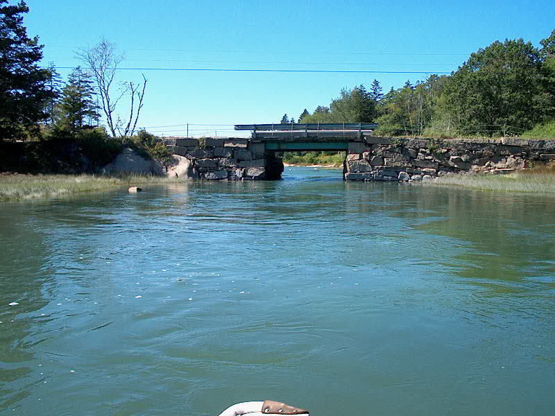
After lunch, I rowed up Mill River to the nearby bridge--it was high tide--only to find that I couldn't row through, since the span was not wide enough for me to use the oars.  There was already to pretty swift current running through against me.  Not to be I shot through the bridge with the current on my taildenied a view of the upper part of the river, I shipped the oars and pulled myself through the opening by grasping the granite foundation blocks and forcing my way through.  I rowed a bit of the way up inside, then prepared for the sluice-like ride back through the bridge with the current.  Wheeeee!  I shipped the oars just before I reached the opening and shot through.  Then, I rowed around (against the wind, which was not pretty brisk from the southwest) across and above Penobscot Island over to the far reaches of Seal Bay on the other side, including a brief stop on the island for a stretch, wade, photo opportunity, and explore, then back down past the creepy sculpture-thing The basin outside Mill River in Winter Habor, from Penobscot Islandto another tributary below, and finally struggled my way back to the boat, forcing the dinghy into the wind and waves and current.  There is much more to explore here.  

Near cocktail time, we were regaled from the nearby house on the shore with incredibly loud music by Kid Rock, laced with obscenities and indecipherable lyrics that demonstrated absolutely no level of musical talent whatsoever.  Fortunately, when the CD ended, the shoreside listener must have decided he'd had enough, and there was no more loud music to be heard.  Given the loudness of the music as heard on our boat, 1/4 mile away from the house, I can only imagine how loud it must have been in the living room or rec room or wherever.  Yikes.

Winter Harbor...or the surface of the moon?Later in the evening, near low tide, I rowed back out to check out the channel.  The landscape was markedly different, almost lunar in appearance given the dim evening light.  Creepy raft guy was hard aground, and most of the nearby tributaries and coves were drained completely dry, with huge granite boulders sticking up in seemingly random places.  We grilled our bargain pork tenderloin that we purchased in Castine for dinner--an even better deal than we had thought when purchasing it, for $5.99, since, upon opening the sealed plastic package I discovered that there were two whole, huge, beautiful tenderloins in there when I had only thought there was one.  A pleasant surprise.  I cooked both of them, leaving one for leftovers later.

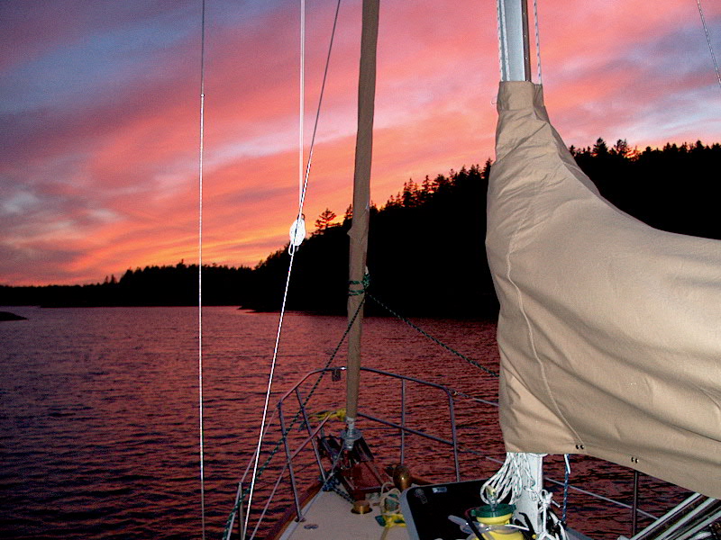
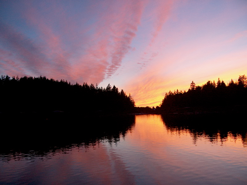
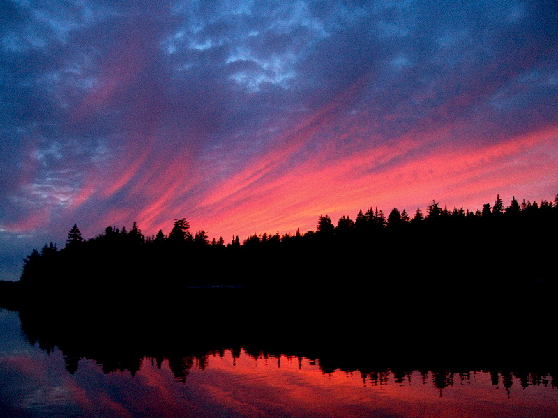
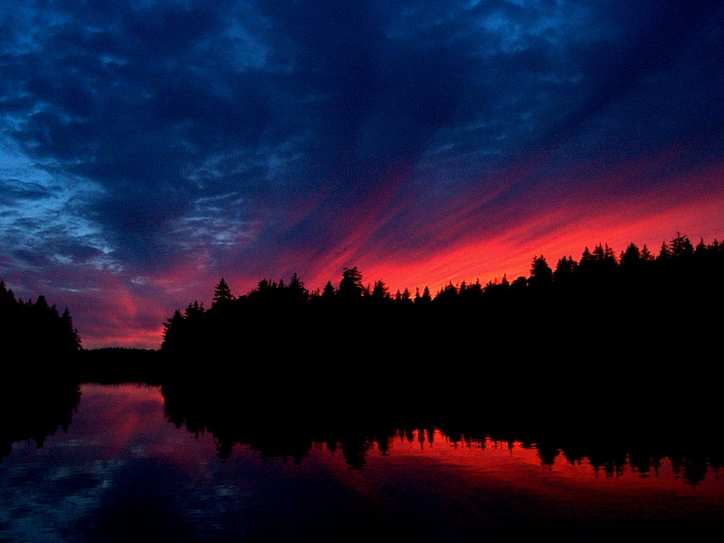
There was a very nice sunset, so of course I took pictures.  Here they are.

Cruise 8-27-28 016.jpg (187482 bytes)     Cruise 8-27-28 018.jpg (204978 bytes)

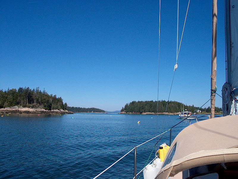
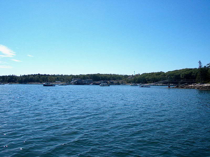
Tuesday 8/27:  Winter Harbor - Long Cove via Northhaven (Rhumb Line Distance:  10.9 nm)  PDF Route Chart  Harbor Detail Chart

Desperate provisioning day.

OK, so maybe it seems a little silly to go right back to long cove the day after we left in the first place.  Suffice it to say we had our reasons, and talked over any number of options before finally settling on the plan for today.  There are often substantial factors at work in any given day's cruising plan.

Our quandary started with our growingly desperate need for ice and fresh food.  I hate provisioning, because it usually means that we have to go to some larger, developed port, which we normally avoid like the plague--we enjoy the more out of the way places.  At this point, our provisioning options seemed to be limited to Rockland (who wants to go there), Rockport (a little better choice, but with a wide open harbor to the prevailing wind and swells and, from the sound of it, only an upscale gourmet store that might or might not have the basic provisions we needed), or Camden (no way--leave that for the cruisers from away; barf).  Stonington, on Deer Isle, was a remote possibility, but it was the wrong direction.

I was unexcited about going to Rockland, which seemed our best choice, and was talked out of trying for Rockport by Heidi, for a couple reasons--mainly whether the store would be adequate, not to mention fairly priced.  Plus, NOAA was calling for stiff northeasterly winds for Wednesday, so we were looking for a pleasant port in which to stay an extra day to wait out the predicted winds--Rockport or Rockland, with their basic need for mooring rental as the only option, were less than desirable for this.

Finally, we decided that we could live without a fine selection of fresh food--we have tons of nonperishable food on board, plus eggs, cheese, and assorted other stuff--and that block ice was our priority.  This revelation allowed us to choose to head to nearby Northhaven, on the way to everywhere, for supplies.  We had been forewarned about the lack of a real store and the ridiculous expense of the block ice here ($3.50 each!), but decided that it was nonetheless preferable for  us, the lazies, rather than heading to Rockland or some such.  After all, we're only a week or so from being home (yuck yuck yuck yuck--hate the thought of that, back to boring, unsatisfying shoreside life) and we could certainly live without.  Our plans for the upcoming few days include heading generally south through Muscle Ridge Channel, but the harbor north of Dix Island, where I hoped to stop, wasn't necessarily my favorite choice in case the winds really did grow strong from the northeast.

So, given all these considerations, we decided to head back to Long Cove, which is well protected from the northeast, plus we really liked it there anyway.  It's our new little safe haven, I suppose, and very convenient and easy to get to.  So, we departed Winter Harbor at around 0850, pulling the anchor up from 8' of water.  (It sure is nicer to have nearly all the chain on deck before having to pull up the weighty anchor!)  We threaded our way carefully through the tide-drained channel (plenty of water) and eventually exited the harbor into a pleasant northerly breeze.  In Fox Islands Thorofare, we set the genoa alone and enjoyed a nice sail  into the center of Northhaven, Stop Ahead where we picked up a mooring and rowed ashore for our provisioning.  We hoped to get some basic stuff like milk and butter and bread,  as well as hopefully some hamburger or some such.  Northhaven is attractive from the water and definitely has a ritzy summer-resident feel about the town once ashore, with lots of Volvos with Connecticut plates and a  general aura of wealth.   Some wise guy put a road sign on one of the red nuns out in the channel near the town.

Well, the store on the island was even more of a joke than we had feared, and had virtually nothing in stock except for lots of nonperishable stuff.  Fair enough, I guess, but still disappointing.  We ended up with milk and butter, but could only find a bag of bagels and English muffins for bread.  We did find a large steak that looked pretty good, and some pencil-thin asparagus.  On the way back to the boat, we picked up some of that block gold--I mean ice--but I suppose even the expensive ice is cheaper than a mooring at Rockport or Rockland.  At least we were forewarned and it didn't come as a surprise.  Heading back to the boat, we were stopped by a man asking about the Triton, and it turned out that he used to own #660, now known as Gracie, moored near our own mooring in Falmouth.  He had sold her 17 years before.

The Absolut ferry dockWe decided that the pier fenders at the ferry landing should be featured in an Absolut vodka ad.

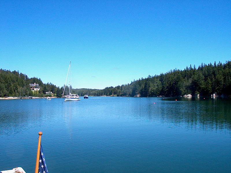
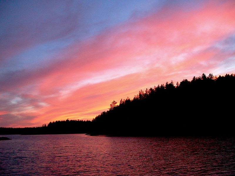
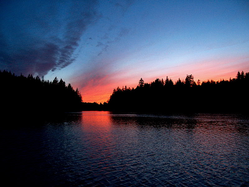
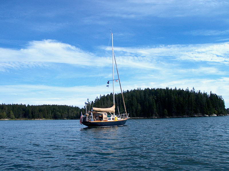
It had turned into a very nice sunny day, and we raised the main at the mooring and headed west through the thorofare, under sail alone after clearing the mooring field.  We had a very pleasant sail through the thorofare and into Leadbetter Narrows (where we were overtaken close aboard by the schooner Lewis R. French under full sail) and beyond, lowering sail only when we reached the entrance to Long Cove.   What a pleasure...it's been a while since we were able to sail.   We anchored near to the spot we had been before, but a bit farther out to better clear the moorings and also to prevent any huge yachts from anchoring like the one before!

It was another good sunset evening...although it sure is getting early!  (About 1920...)

A golden sunset began...     A few minutes later it looked like the sky was on fire.

Wednesday 8/28:  Long Cove  Harbor Detail Chart

Glissando sailed circles around her anchor as the wind and tide fought.We stayed here for the day, supposedly to hide from predicted high winds.  (They never arrived; the wind was light most of the day and then a weak seabreeze filled in late afternoon.  NOAA is dropping the ball left and right.)  We certainly could have ended up going somewhere, but I didn't really wish to accelerate our journey home.  I won't say we were bored today, but we both felt a little listless and loose-endy, and were looking forward to covering some new ground again soon--even though doing so means taking us closer to home and the end of the cruise.  Boo.

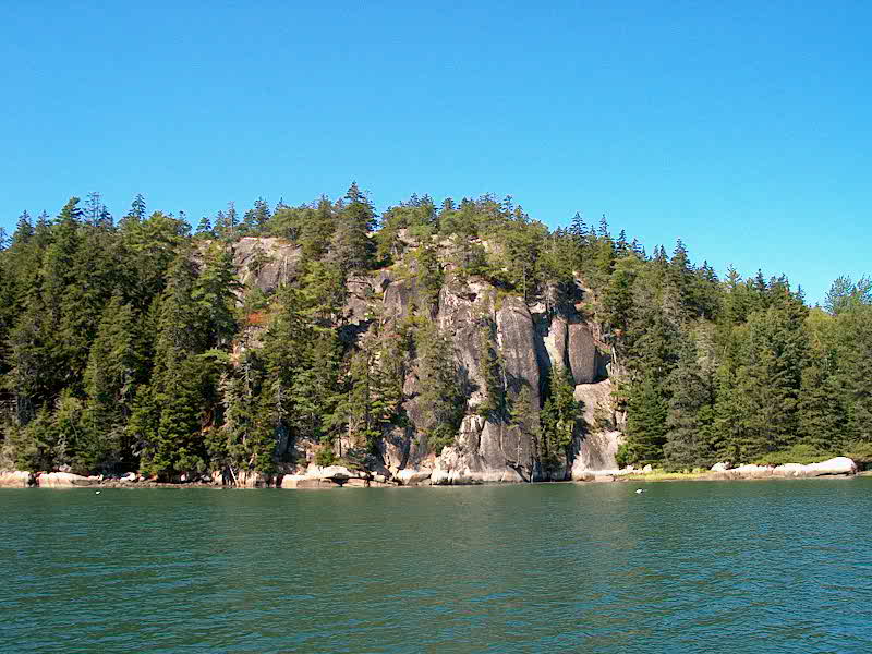
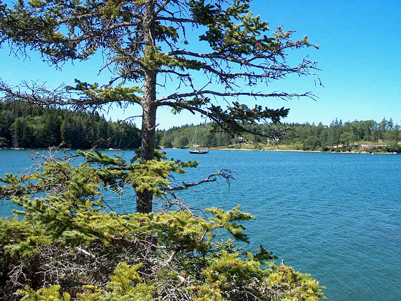
I rowed up the full length of Long Cove at high tide, all the way to the headwaters, which feature marshy land and mud rather than the severe granite of the outer cove.  This part of the cove is pretty tidal except for a narrow channel through the middle.  

The headwaters of Long Cove, 1/2 mile up from the ledge     Looking our from the inner part of the cove towards the anchorage outside, beyond the narrows     Glissando at anchor in Long Cove

For a while, it looked like we might have the cove to ourselves for the night, but eventually three other boats came in.  Another beautiful sunset regaled us.

Cruise 8-29-30 016.jpg (227361 bytes)     Cruise 8-29-30 017.jpg (205732 bytes)

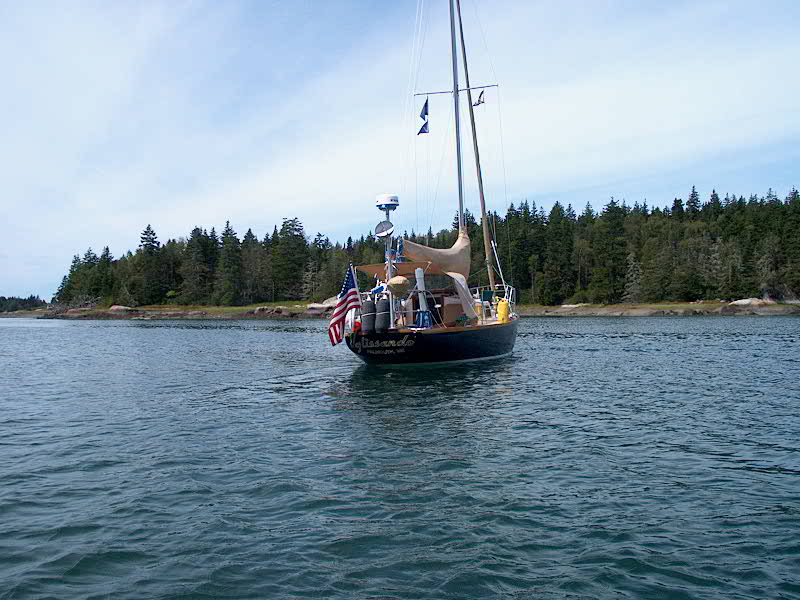
Thursday 8/29:  Long Cove - Dix/High Island (Rhumb Line Distance:  10.5 nm)  PDF Route Chart  Harbor Detail Chart

I was looking forward to getting going today.  I awoke early, freezing in the bunk for some reason, and got up a little after 0600. It was a calm, cool, grayish morning, but not really bad at all.  At 0800, I woke Heidi, and we departed by 0830.  Heidi started the engine (she has only done it once or twice), which I though showed great interest and initiative.  Unfortunately, when she advanced the throttle she didn't push in the neutral/throttle only button completely, so the boat was in gear, unbeknownst to either of us.  I was showing her the route for the day on the chart when I happened to look up and notice that the 46' Grand Banks we had been near to was suddenly quite far away, and at that time I became aware that we were motoring over our anchor at about three knots!  Yikes!  No harm done, fortunately, and we sheepishly pulled up the anchor (it was well stuck and covered again in kelp) and departed.  We rode the outgoing tide through the now-familiar Leadbetter Narrows, then turned southwest towards the outer islands of Muscle Ridge Channel 5 miles distant, threading our way between the numerous ledges at the southern end of Fox Island Thorofare.

Oily-calm waters on Penobscot Bay during our crossingAfter an uneventful journey across the open bay, experiencing our first ocean swells in quite some time (I didn't miss 'em), we motored just south of Fisherman and Marblehead Islands and around into the harbor between Dix, Birch, and High Islands.  We dropped the hook at around 1100 in 17' of water, a couple hours past low tide.


The granite wharf and spoil-lined shores of High IslandHigh Island was once quarried, so we rowed ashore and hiked around the island a bit, over to the large granite pier on the west end and in towards the old quarry in the center, which is filled with green algae-tinged water.  We had the anchorage and the island to ourselves.  Unfortunately, the  batteries dies in my camera, so I didn't get any more pictures of the island.  

Back on the boat, I enjoyed a private sunshower (felt like a new man) and after lunch we passed a relaxing afternoon, dodging periodic rain showers.  The rain grew more steady into the evening, and it rained a good portion of the night, although the winds fortunately remained quite calm.  The rain did a great job cleaning off the decks, which were getting pretty salty and generally dirty.  Later, two other boats came in for the night.

Friday 8/30:  Dix/High Island - Long Cove/Tenants Harbor (Rhumb Line Distance:  7.71 nm)  PDF Route Chart  Harbor Detail Chart

Interesting clouds as it cleared on Friday morningNo, this is a different Long Cove!  With strong northeast winds predicted for late tonight and early Saturday, we wanted a nice, cozy place to hole up for a while.  The northern end of Long Cove, just to the east of Tenants Harbor, looked to be a good place for this--plus, it's a nice place anyway.  There's an abandoned quarry nearby, which is always interesting to visit.


Heidi at the helm as we motor through Muscle Ridge ChannelWe departed the harbor at around 1030 and motored the whole way to Long Cove in calm winds.  We threaded our way into Long Cove all the way up to Spectacle Island, which seemed to offer the best protection from the northeast, and were circling looking for a good spot to anchor when we were hailed from shore by a man who indicated that we could pick up a nearby mooring.  Great!  Thank you! It was nice to not have to anchor for a change, and the mooring looked heavy and sturdy for the upcoming (supposedly) winds.  We spent a pleasant afternoon on the mooring; the sky cleared just after lunch and it was warm and sunny.  However, the local lobstermen win the dubious award of "Rudest Local Fishermen Encountered During the Cruise"...most lobstermen have been courteous and friendly, in our experience.  But Long Cove The attractive home of our impromptu mooring hosts--thank you!seemed to be full of rednecks who liked to drive their big boats at top speed (with classy names like Whore-Ifier) back and forth, throwing up huge wakes, and one jerk in about a 20' outboard-powered lobster boat buzzed us close aboard on his way to and from the nearby lobster pound, passing about 5' away at full throttle on his way out.  Sigh.  All we can do is continue to be friendly and wave to all the fishermen we see during our travels and hope that some of their inherent dislike of "yachties" might be dispelled.

Looking towards the lobster pound and quarry in Long CoveThe wind died in the evening and it was nice and calm for much of the night.  Right before midnight, the promised northeast wind picked up quite strongly, and an annoying roll was set up in the cove from waves bouncing off the outer islands, apparently--the roll was 90 degrees to the wind and seemed to come in groups of three.  It wasn't horrible, but was just enough to make things a bit unsettled overnight.


Saturday 8/31:  Long Cove/Tenants Harbor  Harbor Detail Chart

The promised northeast wind actually came up overnight, at about 2330 (NOAA had been saying after midnight, so they called this one pretty well).  It blew hard for the rest of the night and well into the morning, kicking up a pretty good sea offshore.  When I got up in the morning, the ocean horizon--which I could see thought the gap between the islands--looked like the Himalayas, rough and jagged.  We decided to hang tight and see what developed during the morning.  I watched several boats leave, pitching against the waves from the overnight wind.

By noontime, the wind had started to die, but was still gusting fairly strongly.  Given the lateness of hour, and the fact that, on Labor Day weekend our chosen next destination--Harbor Island in Muscongus Bay, about three hours distant--would probably fill up fast with boats as the early afternoon wore on, we decided to stay where we were on our secure mooring.  So we passed an uneventful, bright and sunny (but sort of chilly out of the sun) afternoon on board, accomplishing very little of virtue.  We talked a lot about our plans for the upcoming several days and our homecoming.  The night was calm, but the roll was still severe and I was looking forward to being somewhere else tomorrow.

Please click here to continue to the log for week 8.


Glissando, Pearson  Triton #381
www.triton381.com 

We recommend viewing this site with your screen resolution set to 1024 x 768 or larger.  Problems?  Email the webmaster.

©1999-2014 by Timothy C. Lackey.  All rights reserved.  No duplication of any portion of this website allowed without express permission.  Permission may be obtained by emailing the webmaster.