|
|
|||||||||||||
| HOME | :: | WHAT'S NEW | :: | PROJECTS | :: | SAILING | :: | MAINTENANCE | :: | RESOURCES | |||
| SAILING LOGS :: EQUIPMENT AND STORAGE :: MISCELLANY | |||||||||||||
|
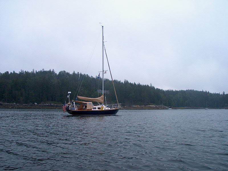
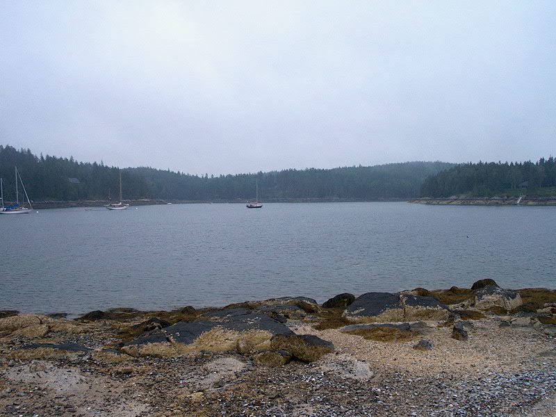
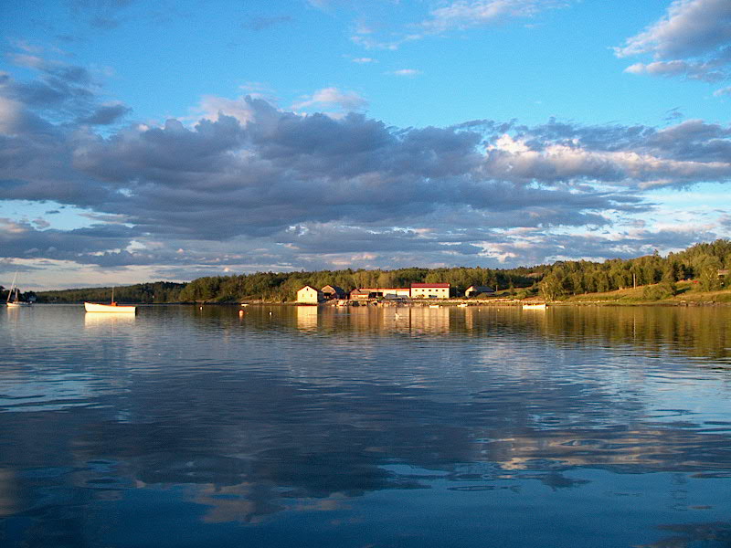
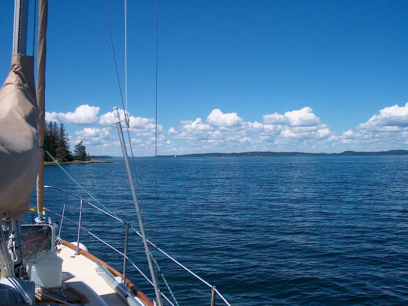
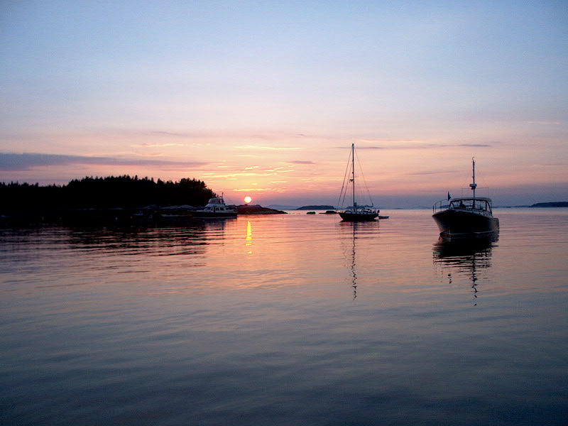
Sunday 8/4: Buckle Island - Sawyer Cove (Rhumb Line Distance: 8.78 nm) PDF Route Chart Harbor Detail Chart The day dawned very foggy--when I first got up, I couldn't even see the boats that were anchored nearest to us (and they weren't that far away at all...). Eventually, I could make out their shadows nearby, but it was a rather disconcerting effect to feel so disoriented. We had a short day planned (which, thankfully, most of our days are now--short, that is), so a slight fog delay was no issue. After a relaxing early morning, the fog finally began to clear out by 0930 or 1000. My favorite boat--that of the loud obnoxious wife, poor henpecked husband, and extensive bow thruster use--departed first, at about 0830, right in the thick'o'fog. Pretty scary, when you think about it. I wanted to go over and rip the bow thruster control out of wifie's hands and scream to her, "LEARN HOW TO MANEUVER YOUR STUPID BOAT WITHOUT THIS THING!!!". I've never seen any boat use a thruster so frequently, especially for no reason. Here they were, in the middle of a wide-open harbor, not even docking, and this annoying woman is cranking the thing left and right, telling her husband every step to take and "fixing" all his errors and screw-ups. I'm sure we weren't the only ones glad to see (or, more accurately, hear) them depart.
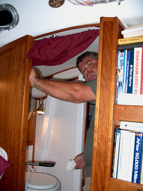
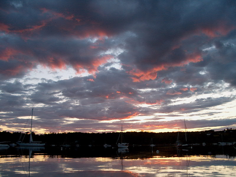
The sun was hot, the wind calm, and the sea temperature, according to our thermometer, was a balmy 64 degrees. We relaxed through the afternoon, and I rigged up the dinghy for a very pleasant sail. Once again, we have found yet another place that we like very much. No one seems to come up here; apparently it is too far off the beaten path. Fine for me...we have the time! Late in the afternoon, we were joined by one other boat in the cove--and older wooden yawl. I went for a swim--briefly, but it wasn't too bad--and enjoyed a warm sun shower afterwards from our under-utilized Sun Shower. I was doing a final turn about the deck, as is my wont, when Heidi informed me that (ahem) the toilet was clogged. This had never happened with our Lavac, although it is a fairly common instance with most marine heads. I suppose we were lucky. However, lucky was the furthest thing from my mind as I struggled to clear the head for the next hour and a half. What a foul task...and to top it off, the mosquitoes were thick as the sun set, forcing us below the whole time, behind screens. My first thought was that the pump must be clogged, so I removed the easy-off cover. Nope...all OK, except for the...well, you can imagine what was inside the pump. Next, I moved on to the hose running from the bowl to the pump, thinking that a clog must be lodged there. This is where the job sped past "disgusting" and continued on towards...well, what's a stronger word than "disgusting"? How about "unspeakably foul"? If you've ever had the misfortune to be in a similar position yourself, I'm sure you understand completely.
See,
to check the hose for clogging, it had to be removed for inspection.
First, I did the "easy" end--the top, where it connects to the
pump. Since I had already opened the pump, most of the
"effluent" (what a charming word to describe something beyond
description) had previously drained out, so it wasn't too bad. Nope, no
clog visible there. Inwardly sighing deeply, I reattached the top end and
moved onto the bottom end--the one that attaches to the bottom of the toilet
bowl. Stay with me now...keep those visuals coming. Removing this
end, choking back the foulness, I finally discovered the cause of the
problem. I also discovered that I should have just tried to clear it from inside
the bowl, rather At this point, once I had cleaned up and cooled off, I calmly instructed Heidi in the proper flushing technique--what came to be known as AFT: Aggressive Flushing Technique. No wimpy flushes that might allow anything to suddenly clog...no, with AFT, the bowl was guaranteed to be cleared in the first couple strokes, avoiding a relapse of the problem. (And we had no further problems for the remainder of the cruise.) Monday 8/5: Sawyer Cove Harbor Detail Chart
I spoke with my brother on the phone and we indicated that he would be in Searsport on Friday evening, and would we want to consider meeting him there that night? Heidi and I talked it over and decided that it would be fun to go, so that changed our plans for the coming week a bit. We had been heading to Blue Hill in order to now only see and enjoy beautiful Blue Hill Bay (another reason why it made no sense to make the run in reduced visibility--we wanted to see the sights!), but also for a significant provisioning stop. With our new schedule, of sorts, bringing us to Searsport with access to cars and real stores, we decided we could happily avoid the trip to Blue Hill if need be. It did, however, completely change our rough plans for the coming week--we had intended to stay in Blue Hill Bay for a couple days, then head down to Merchant Row, the string of granite and spruce-clad islands south of Deer Isle. However, now we decided that instead we would head to Searsport, and easy trip given the time we had available, and then head to Merchant Row afterwards, in the week ensuing until our New England Triton rendezvous in Castine/Islesboro on the weekend starting August 16.
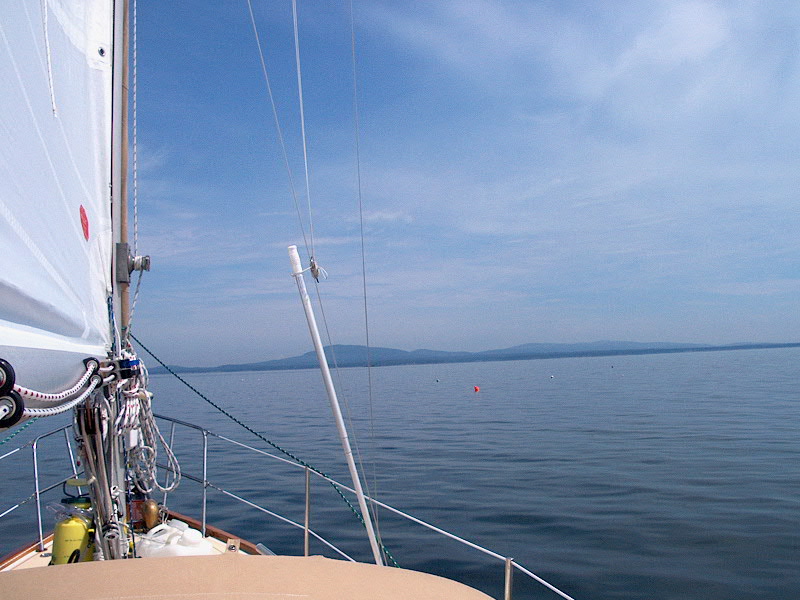
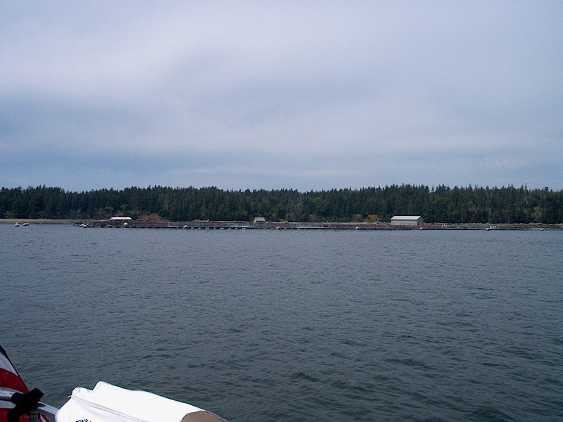
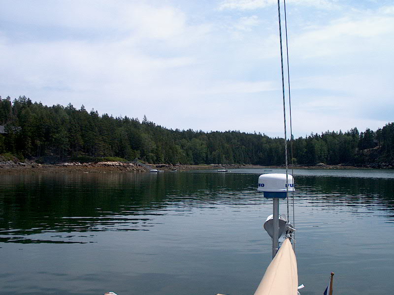
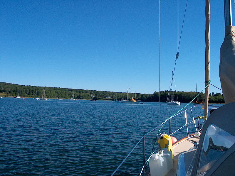
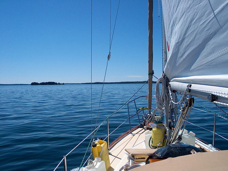
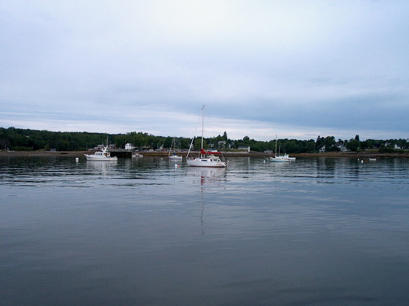
Tuesday 8/6: Sawyer Cove - Benjamin River (Rhumb Line Distance: 17.7 nm) PDF Route Chart Harbor Detail Chart Some days, you just wish you'd stayed in bed. We got a pretty early start this morning, pulling up the anchor and leaving Sawyer Cove at 0745. We had a relatively (for us) long day planned, plus I wanted to take advantage of the currently light winds and avoid the forecast heavier 15-20 knot northwesterlies later in the day, which I though would be uncomfortable once we got out of Blue Hill Bay and headed almost directly northwest into Eggemoggin Reach towards our destination. I hoped to go slightly out of our way through Bartlett Narrows and around Bartlett Island for a little fun, but decided to shorten our course and go directly south based on the forecast. We'll have to return another time for Bartlett Narrows. The day started off badly. I was very tired, having slept poorly overnight, with the exception of (of course) right before my alarm jolted me awake at 0600. Never fails. I got going slowly and brewed strong coffee. The anchor came up without a problem, and, as usual, I reached over the side with my long-handled brush to scrub some mud off the anchor chain before pulling it on deck. My hand slipped, and the brush went over the side, where I sort of stared at it briefly before securing the chain roughly around the mooring bit (the anchor was now free and dangling somewhere beneath the surface) and running aft for the boathook, requesting (in the most kind, calm manner, of course) Heidi, who was on the helm, to please steer closer to the brush, which was floating just beyond the reach of the boathook. At that moment, it sank. Not a happy start to the day. Disgruntled, I returned forward to stow the chain and pull the anchor up the rest of the way (it turned out to need no further scrubbing). One quick bucked of saltwater sluiced over the foredeck took care of any minor muddiness left over. With that out of the way, we departed the cove and started our course roughly southwest toward Moose Island. There were some steep, short seas left over from the northwest wind of the night just outside the cove, once we got past the shelter of Bartlett Island, so I decided to put the main up. It had seemed there was virtually no wind when we left, so I wasn't going to bother initially, but we were rolling uncomfortably. I raised the main and tucked in a single reef, preferring to have it in earlier than later given the forecast 15-20 knot winds, and as I finished cranking the halyard tight with the stupid original South coast/Merriman #1 winch with its poorly fitting handle that didn't lock into place, I managed to drop the nearly-irreplaceable handle overboard. "That was a bad thing to lose," I grouched to Heidi, who was still at the helm. I was very angry with myself. Then, I pulled in the reefing line and used the other winch handle (a normal type) to crank it with the boom-mounted winch. As I finished that job, I dropped that handle as well, and it splashed overboard! This was too much to take. I was so mad I could hardly see. Fortunately, this handle was the floating kind--they float with the handle just barely visible above the surface, by the way, in case you've never tested yours out--so I took the helm over (very kindly, of course) and steered the boat around so we could pick up the handle--which I managed to actually do. At this point, Heidi questioned out loud whether we should continue or not...I suppose we should have just quit for the day. Instead, we continued, as I was ready to leave this place behind. We motorsailed down Blue Hill Bay, with an ever-increasing northwest wind broad on the beam, making over 6 knots over the ground. At one point I tried using the genoa too, but it was too blanketed by the main and I was in "get there" mode and enjoying the fast passage. So we continued under main and motor. The waves were getting pretty big by the bottom end of the bay, near the entrance to Casco Passage, making for some tiring steering. The wind was definitely all of the forecast 15-20, and quite possibly even more at this point. The wind and seas relaxed once we reached the lee of Black Island and Casco Passage. I could see, though, that the strong wind would be directly on our nose once we steered our course towards and into Eggemoggin Reach, and debated for a time lowering the sail for the inevitable slog. Instead, it seemed to be helping us for a while, so I left it up. As we headed from the westernmost end of Casco Passage to Eggemoggin Reach a few miles away, our speed slowed significantly in the face of the very strong winds, which were gusting well into the 20s. Waves crashing over the bow were running to the leeward side of the deck and draining through the deck scupper there, which joins the main port cockpit scupper beneath the cockpit. I keep the overboard seacock for that side closed, since I had problems with the drain hose earlier and the hose attachment always leaked. This arrangement soon became untenable, as the continual flow of water through the sidedeck drain began upflooding into the cockpit, and our angle of heel was such that it wouldn't drain out the starboard cockpit drain. Soon, my left foot was buried to my ankle in seawater, so we headed up briefly so I could open the deck hatch (releasing a torrent of salt water into the bilge) and open the port seacock for the passage. Once I did this, there were no further problems. When we, after what seemed like an eternity, reached the somewhat-lee of Devil's Head, marking the eastern entrance to Eggemoggin Reach, I did lower the main, since it was definitely going to be a nasty, into-the-tooth of the wind slog up the reach and the sail would just be annoying. Plus, I harbored secret fears about the possibility of an airbound engine. The reasons for this are as follows. The fuel tank beneath the cockpit is unbaffled, and the pickup is far to one side (in this case the windward side). I make all attempts to keep the fuel level above 1/2 at all times, to minimize the opportunity for any air to enter the fuel system should the fuel slosh away from the pickup momentarily. When we left the cove this morning, I had noted that the fuel gauge read 3/4--fine enough, so I left it. Before long, though, I noticed it hanging more around the 1/2 mark, making me increasingly nervous. It would have been unpleasant for the engine to choose this day, with the 30-knot gusts, to crap out. Note that this has never happened, and my fears may well be unfounded. But with the wide, shallow, unbaffled tank with its sloshing contents, it seems (I've been thinking this issue over for months and months) that the possibility of this sort of event does exist. So, given my own poor performance earlier in the morning, and the stupidity of the decision not to add 5 gallons of fuel before we left, was putting me increasingly on edge as the day progressed, as were the steadily increasing, and nagging, winds. Out speed dropped to 3.5 - 4.5 knots as we slogged into the wind and seas, dragging out the day for what seemed like forever. The reach was clogged with boats, most of which were enjoying a rollicking reach as they headed east. Few boats slogged into the headwind passing west, except for a huge Post powerboat (Davida, from Cape Elizabeth) that rock'n'rolled by us out of nowhere, and close aboard, throwing up a massive wake in the process. Thanks, jerks. Just what we needed. Oh, and to add to my self-inflicted misery, I had failed to secure the oars in the dinghy, cavalierly telling Heidi that all would be fine today, so I was nervous about losing one or both through my own poor decision. All this discomfort self-imposed upon us because of a rough schedule, something we had been avoiding throughout the cruise. Had the lousy, inaccurate NOAA forecasts (I've grown to despise Betty, my name for the fake female voice that has replaced Sven on the current channel) been better, I never would have left today. The winds were nearly double what had been predicted, and I never would have left given a 30-knot forecast. (Later in the day, when we were comfortably ensconced in our destination, I noted that the forecast was now saying exactly that--15-25 knot winds with gusts over 30. Where was that forecast this morning?) Anyway, here we were, stuck in a nasty headwind. The actual wind and seas bothered me far less than our slow progress and my active imagination creating all sorts of scenarios where the engine would fade and die. I worked out plan after plan of how to deal with this possibility as we continued up the reach, and was sure I heard the engine falter a few times. (It didn't, but you know how the mind can sometimes play tricks.) I was in a foul mood, and the passage took forever. I had thought the wind and seas would be less inside the reach, but they were not--it seemed that the wind continued to increase the whole time. Also, each mark we would pass on our route would seem to be closer to our destination, but each time it would be another mile or two to the next one, which takes an agonizingly long time at 3.5 knots. The nasty winds slammed us the entire way, right up into the narrow channel leading to Benjamin River, and never slackened a bit. I was so happy to arrive, once we finally got past the long bar that crosses most of the entrance to the river. Relieved, we picked up a mooring courtesy of Benjamin River Marine, at 1145. What a miserable, for me, trip; it didn't bother Heidi nearly as much. But my own fears about the worst-case scenarios involving the engine just nagged at my mind the whole time. Stupid, I know. At least I would have been prepared for it, had it happened. Adding to my displeasure, both yesterday and today, and further forcing our trip into less than desirable weather was the fact that we were nearly out of ice, down to small remnants of a couple blocks, and our fresh water situation was also close, as I had used the last 10 gallons of reserve in the deck jugs to fill the empty tank a few days ago. I wanted ice, and full tanks--I don't like not having my reserves. The need for ice caused me to hurry up and leave the boat only a few minutes after our arrival at the mooring. In Benjamin River, there is a general store (in Sedgewick) that is over 1.7 miles away by road from the town dock. However, you can row up to the back of it if you follow the tidal Benjamin River in the dinghy--we had done this when we stopped here a couple years ago while on our chartered boat for our honeymoon. The tide was past high and falling, and the river dries out at low, so I figured I'd better get moving or I'd be upset the whole day if I didn't get my ice. Exhausted though I was, I hopped into the dinghy for the lengthy row to the store, fighting my way against the wind and, as I got to the corner, the very strong outflowing tide. Fun. As I rowed, I could see that I did have some time to escape before the tide stranded me, but hardly a lot. So I kept up the pace and rowed finally into the very muddy shore behind the store, tied up the dinghy, waded carefully through the ankle-deep muck, cleaned my feet on some slimy rockweed, and walked up the short field to the store, where I bought ice and a few minor supplies. The trip was short and sweet, and I got the last of the ice in their cooler...phew. Laden with the four bags of ice, eggs, and milk, I hurried down to the dinghy--less than 10 minutes had elapsed since I tied up. I dragged the dink through the mud till it floated, and rowed back out. No problem. Ice again. I spent m much of the afternoon watering the boat--I rowed to Benjamin River Marine with my 6 jugs to fill them, then back to the boat, where I poured the contents of five of the jugs (12.5 gallons total) into the forward water tank, filling it to the top. With the sixth jug, I rinsed off as much of the very salt-encrusted decks and varnish and wiped things down with a wet towel to remove the bulk of the dried salt from the dodger and varnish. It's amazing how far 2.5 gallons of water can go. Then, I returned to shore to fill the six just once again, and stored them on deck for reserve. I also got rid of four bags of trash, including the very nasty one from Sunday night. BRM is a pleasant, low-key place. They were busy putting the masts in a beautiful Herreshoff Rosinante that was going in the water soon.
Wednesday 8/7: Benjamin River Harbor Detail Chart We awoke to another windy northwest day; by 0900 the wind had nearly reached the ferocity of yesterday. Since we were in no big hurry--we still had three days to make it to Searsport, an easy proposition--we decided to wait it out, at least for the morning, and see what developed.
Thursday 8/8: Benjamin River - Pickering Island (Rhumb Line Distance: 8.63 nm) PDF Route Chart Harbor Detail Chart
Friday 8/9: Pickering Island - Searsport (Rhumb Line Distance: 13.5 nm) PDF Route Chart Harbor Detail Chart Today was to be a chore day and social day in Searsport. Ordinarily, we would not head for Searsport as a choice for destination, as it is really not a suitable harbor for overnight stays on board. It is very wide open to the prevailing winds, with virtually no protection. However, we had a connection here and a method to our madness. My brother's friend's family lives in Searsport, right on the water near the town dock, and had extended an invitation to us to please stop by for a visit, chores, shopping, laundry, etc. After speaking with my brother earlier in the week, we decided to go ahead and try to meet him today. Our journey was uneventful and took place under power in a flat calm--we left early so that we would have plenty of time in port to take care of provisioning, laundry, and chores. (I needed a new brush to replace the one I dropped earlier in the week, too.) We arrived in Searsport at around 1100 and contacted the harbormaster, Wayne Hamilton (founder of Hamilton Marine, my favorite supplier) to find out where our previously arranged mooring was. Then, we shortly headed ashore with bags of dirty laundry--just what every host wants to be greeted with! But they couldn't have been nicer and more helpful, offering us their laundry machines, shower, food, and trips about town for groceries, diesel fuel, and a new brush at the Searsport home base of Hamilton Marine. Heidi stayed at the house working on the laundry while I rode around and took care of much of the rest of the list, and packed the new groceries and such away on the boat. Later, with the laundry done, we returned to the boat with bags of clean clothes so that we could change clothes for dinner. The southerly breeze that had come up a couple hours after we arrived had been blowing quite strongly during the afternoon; Searsport is very wide open to the south, with virtually no protection at all. Therefore, the chop in the harbor was quite brisk, such that it seemed like we covered as much distance up and down, bouncing in the waves, as we did towards the boat itself! All changed into (yuck) shore clothes, we returned for a very nice evening of cocktails and then dinner out, where a great time was had by all. We stayed up later than any night of the cruise, I think, and returned to the boat around 2300 to be greeted by a fairly brisk westerly breeze-which fortunately did not create too much chop, being off the land, and eventually died anyway. Saturday 8/10: Searsport - Merchant Harbor (Rhumb Line Distance: 24.6 nm) PDF Route Chart Harbor Detail Chart
Click here to continue to the log for week 5.
|
|||||||||||||
|
|||||||||||||